Stuckenbusch
|
Stuckenbusch district of Recklinghausen |
|
|---|---|
| Coordinates | 51 ° 35 '33 " N , 7 ° 10' 43" E |
| height | (Confluence with Hansering in Stuckenbuschstrasse) 61.1 m above sea level. NHN |
| surface | 2.800 km² |
| Residents | 2389 (Sep 30, 2015) (14/18) |
| Population density | 853 inhabitants / km² |
| Post Code | 45659 |
| Source: | |
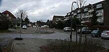
Stuckenbusch is a district south of the center of Recklinghausen .
The originally rural Stuckenbusch is today mainly characterized by residential areas, most of which arose after 1960.
The neo-Romanesque St. Francis Church is located on Friedrich-Ebert-Strasse, to which a former Franciscan monastery building with a monastery garden is attached. The monastery existed from 1901 to 1969. Since the departure of the Franciscans, it has been used by rented apartments and rooms for the parish. The church, painted in the Byzantine style in the 1980s, houses a replica of the cross of San Damiano (Assisi) , in front of which, according to legend, St. Francis is said to have experienced his calling . The late romantic Speith organ (1908) with 27 registers should also be mentioned.
Individual evidence
- ↑ Quarterly Statistical Report III 2015 ( Memento of the original from March 30, 2016 in the Internet Archive ) Info: The archive link was inserted automatically and has not yet been checked. Please check the original and archive link according to the instructions and then remove this notice. , City of Recklinghausen (PDF; 9.9 MB)
- ↑ Geodata portal of the city of Recklinghausen ( Memento of the original from July 19, 2011 in the Internet Archive ) Info: The archive link was inserted automatically and has not yet been checked. Please check the original and archive link according to the instructions and then remove this notice.
- ↑ Topographical Information Management, Cologne District Government, Department GEObasis NRW ( Notes )

