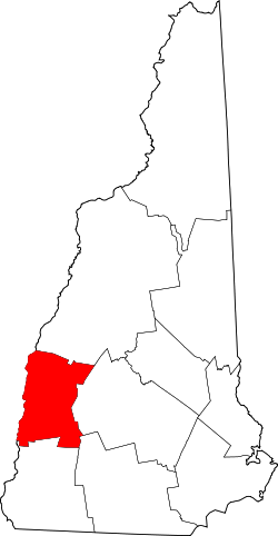
Sullivan County, New Hampshire
| administration | |
|---|---|
| US state : | New Hampshire |
| Administrative headquarters : | Newport |
| Foundation : | 1827 |
| Made up from: | Cheshire County |
| Demographics | |
| Residents : | 43,742 (2010) |
| Population density : | 31.4 inhabitants / km 2 |
| geography | |
| Total area : | 1429 km² |
| Water surface : | 38 km² |
| map | |
| Website : www.sullivancountynh.gov | |

Sullivan County is a county in the US state of New Hampshire . The county seat is Newport .
history
Sullivan County was formed in 1827 in Newport from the northern part of Cheshire County. It was named after John Sullivan , a general in the US Army during the Revolutionary War.
In Sullivan County there is a national historical park , the Saint-Gaudens National Historical Park . Another place in the county has National Historic Landmark status , the Salmon P. Chase Birthplace . A total of 67 buildings and sites in the county are listed on the National Register of Historic Places (as of February 14, 2018).
Population development
| year | 1980 | 1990 | 2000 | 2010 |
|---|---|---|---|---|
| Residents | 36.097 | 38,592 | 40,458 | 43,742 |
geography
The county covers an area of 1,429 square kilometers; 38 square kilometers of this is water.
- Neighbor counties
- Grafton County , north
- Merrimack County , East
- Hillsborough County , Southeast
- Cheshire County , south
- Windham County, Vermont, Southwest
- Windsor County, Vermont, west
cities and communes
Sullivan County is divided into one city and 14 towns ; both terms are translated into German as city . The information behind the place names are the population figures from the 2010 census.
- City
- Claremont , 13,355
- Towns
|
|
|
Web links
Individual evidence
- ↑ GNIS-ID: 873183. Retrieved on February 22, 2011 (English).
- ↑ Listing of National Historic Landmarks by State: New Hampshire . National Park Service , accessed February 14, 2018.
- ↑ Search mask database in the National Register Information System. National Park Service , accessed February 14, 2018.
Coordinates: 43 ° 20 ′ N , 72 ° 15 ′ W
