Supraśl (river)
| Supraśl | ||
|
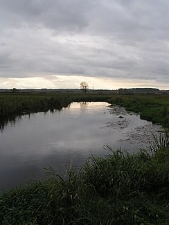
The Supraśl at Studzianki |
||
| Data | ||
| River system | Vistula | |
| Drain over | Narew → Vistula → Baltic Sea | |
| source | in the swamps northwest of Topolany 53 ° 3 ′ 0 ″ N , 23 ° 27 ′ 0 ″ E |
|
| muzzle | at Złotoria in the Narew coordinates: 53 ° 11 ′ 0 ″ N , 22 ° 57 ′ 0 ″ E 53 ° 11 ′ 0 ″ N , 22 ° 57 ′ 0 ″ E
|
|
| length | 93.8 km | |
| Catchment area | 1,844.4 km² | |
| Drain |
MQ |
9.86 m³ / s |
| Left tributaries | Kamionka, Płoska , Pilnica, Biała | |
| Right tributaries | Słoja, Sokołda , Czarna | |
| Small towns | Michałowo , Supraśl , Wasilków | |
| Communities | Gródek | |
|
The Supraśl at Supraśl |
||
The Supraśl is a right tributary of the Narew in north-eastern Poland .
geography
The river rises in the marshes northwest of Topolany, flows first to the east, then to the north and from Gródek in a predominantly westward direction to its confluence with the Narew near Złotoria after a run of around 93.8 km. Its catchment area is given as around 1844.4 km². The Supraśl is used to supply drinking water to the city of Białystok , not far to the south .
Web links
Commons : Supraśl - collection of images, videos and audio files


