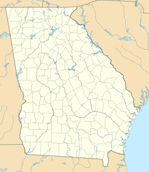
Richard B. Russell dam
| Richard B. Russell dam | ||
|---|---|---|
| location | ||
|
|
||
| Coordinates | 34 ° 1 '33 " N , 82 ° 35' 57" W | |
| country |
|
|
| place | Elbert County , Georgia and Abbeville County , South Carolina | |
| Waters | Savannah River | |
| Height upstream | 144.8 m | |
| power plant | ||
| owner | United States Army Corps of Engineers (USACE) | |
| operator | USACE | |
| construction time | 1974 to 1985 | |
| Start of operation | 1985 | |
| technology | ||
| Bottleneck performance | 600 megawatts | |
| Average height of fall |
44 m | |
| Turbines | 8 turbines, 4 of which are pump turbines | |
| Others | ||
The dam Richard B. Russell ( English Richard B. Russell Dam ) is a dam with hydroelectric power station in the USA . It dams the Savannah River , which at this point forms the border between Elbert County , Georgia and Abbeville County , South Carolina , to a reservoir ( Richard B. Russell Lake or Lake Russell ). The dam was named after former Georgia Senator Richard B. Russell .
The dam is used to generate electricity. Its construction was approved by the US Congress through the Flood Control Act of 1966 . Construction of the dam began in 1974. It was completed in 1983. The dam is owned by the United States Army Corps of Engineers (USACE) and is also operated by the USACE.
Barrier structure
The barrier structure consists of a concrete gravity dam with a height of 64 m (210 ft ) and earth embankments that connect on both sides. The length of the dam is 574 m (1884 ft). The volume of the dam is 841,000 m³ (1.1 million cubic yards ); the volume of the earth embankments is 2.56 million m³ (3.35 million cubic yards). The flood relief with 10 segment weirs is on the left side of the dam .
Reservoir
At the normal storage target of 144.8 m (475 ft) above sea level , the reservoir extends over an area of around 107.8 km² (26,650 acres ). Damming started in October 1983. The normal stowage target of 475 ft was reached in December 1984.
power plant
The power plant is located at the foot of the dam on the right side of the dam. It went into operation in January 1985. The installed capacity with 8 turbines is a total of 600 MW . The power plant serves to cover peak loads .
Originally 4 turbines with a maximum output of 75 MW each were installed. By 1992, 4 additional pump turbines with a maximum output of 75 MW each were put into operation. Each pump turbine can pump a maximum of 203.8 m³ / s (7200 cft / s) back into the reservoir. The average height of fall for normal turbines is 43.9 m (144 ft) and for pump turbines 45 m (148 ft). In the switchgear , the generator voltage is increased from 13.8 kV to 230 kV using power transformers.
Others
The electricity generated is sold by the Southeastern Power Administration .
See also
Web links
- Richard B. Russell Dam and Lake. United States Army Corps of Engineers (USACE), accessed March 9, 2019 .
Individual evidence
- ^ It's not just a Senate office building that was named for Richard B. Russell. CNN , August 27, 2018, accessed March 9, 2019 .
- ^ A b c Background Materials on the Richard B. Russell Dam. www.sjrdotmdl.org, accessed on March 9, 2019 .
- ↑ a b c d e Hydropower. United States Army Corps of Engineers (USACE), accessed March 9, 2019 .

