
Schömbach dam
| Schömbach dam | |||||||||
|---|---|---|---|---|---|---|---|---|---|
 |
|||||||||
|
|||||||||
|
|||||||||
| Coordinates | 50 ° 59 '28 " N , 12 ° 34' 13" E | ||||||||
| Data on the structure | |||||||||
| Construction time: | 1967-1972 | ||||||||
| Height above valley floor: | 16.6 m | ||||||||
| Height above foundation level : | 17.7 m | ||||||||
| Height of the structure crown: | 201.32 m | ||||||||
| Building volume: | 450 000 m³ | ||||||||
| Crown length: | 749 m | ||||||||
| Crown width: | 4 m | ||||||||
| Slope slope on the air side : | 1: 2.25 | ||||||||
| Slope slope on the water side : | 1: 2.50 | ||||||||
| Data on the reservoir | |||||||||
| Altitude (at congestion destination ) | 199.15 m | ||||||||
| Water surface | 1.75 km² | ||||||||
| Storage space | 7.71 million m³ | ||||||||
| Total storage space : | 9.99 million m³ | ||||||||
| Catchment area | 106.7 km² | ||||||||
| Design flood : | 100 m³ / s | ||||||||


The Schömbach dam is a dam that lies on the border between Saxony and Thuringia . It was originally built as a flood retention basin and later converted into a dam.
description
The dam was built from 1967 to 1972 to protect against flooding , as the open-cast mining meant that natural retention areas (flood areas) were no longer available.
The dam got its name from the village of Schömbach to the east of it , from which some farms had to be abandoned for the construction of the dam. The dammed waters are the Wiera and Leuba . The flow of the dam feeds the Wyhra . The dam is used for the supply of industrial water for agriculture , for raising the low water level , for flood protection , fishing and bird protection .
The dam has an "ordinary" flood protection area of 6.21 million m³, which is part of the storage space of 7.71 million m³. In addition, there is an “extraordinary” flood protection area of 2.28 million m³, which together with the storage space of 7.71 million m³ results in a total storage space of 9.99 million m³.
Barrier structure
The barrier structure is a dam made of poured sand with an asphalt-concrete outer seal. The structure was built from 1967 to 1972 just south of Altmörbitz near Frohburg and repaired from 1993 to 1996.
Repair
After the dam had been in operation for around twenty years, the damage to the asphalt concrete seal became more and more apparent. As early as 1981 and 1989/1990 attempts were made to repair the cracks and blisters with the options available at the time, but they did not bring lasting success. Extensive repairs were therefore carried out from 1994 to 1996: an essential part was the thorough renewal of the upper sealing layers including the application of a wear layer (mastic). After the dam was completely empty, the breakwater on the dam crest was demolished. Part of the mud was temporarily uncovered along the entire length of the dam foot. the damaged bitumen layer was then milled off. The installation of the new asphalt concrete seal on the inclined dam area was carried out with a horizontally working bridge paver over 22 meters long. In addition, the concrete components of the inlet structure and the northern and eastern end walls of the flood relief were repaired.
The shut-off and control elements of the bottom outlet were also overhauled and partially renewed. In the course of the construction work, the appearance improved. A railing was erected on the embankment, fences and gates were renewed and the company buildings, which are equipped with the latest measurement, control and transmission technology, were given a new look.
Dammstrasse has been open to pedestrians since 1995. Interested visitors can find out more about the task and development of the Schömbach dam at the viewing pavilion. In the following year 1996 the concrete repair of the flood overflow ridge and the weft channel took place. The dam's drainage system was also modernized and the previously open, 350 m long seepage ditch provided with filters, piped, filled in and sown. The seepage water that accumulates is now specifically discharged and brought together in the newly built measuring house and monitored in terms of quantity. After the August floods in 2002, it became clear that a quicker preliminary relief of the dam can be useful to protect the downstream. For this reason, a protective system was installed in the flood overflow ridge in 2007/2008, which, if the lower reaches allow it, enables the dam to be blocked more quickly in the event of flooding.
In 2008 the wear layer (mastic) on the asphalt seal had to be renewed. This protects the seal from UV light and thus contributes significantly to extending its service life. In the course of this work, damaged areas in the asphalt concrete seal were also repaired. In order to ensure stable operation of the dam in the years to come, the steward staff must constantly carry out checks and functional tests of all system components. In this way, deviations can be recognized and impairment of the functionality of the dam can be avoided.
Freetime activities
The reservoir offers the opportunity for fishing and hiking. The dam is accessible, there is a lookout point at the west end of the dam. There is no hiking trail that goes around it directly along the reservoir. The nature reserve Leinawald is located directly to the west of the dam . The village of Langenleuba-Niederhain ( Altenburger Land district , Thuringia) is located on the south bank .
photos

The dam

Dam crest
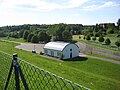
Buildings behind the dam

Flood channel behind the dam
Panoramic view of the dam


See also
Web links
Individual evidence
- ↑ Matthias Quaisser: Dam Schömbach. Retrieved May 7, 2018 .