Tambogrande
| Tambogrande | ||
|---|---|---|
|
|
||
| Coordinates | 4 ° 56 ′ S , 80 ° 20 ′ W | |
| Symbols | ||
|
||
| Basic data | ||
| Country | Peru | |
| Piura | ||
| province | Piura | |
| ISO 3166-2 | PE-PIU | |
| District | Tambogrande | |
| height | 69 m | |
| Residents | 24,073 (2017) | |
| Website | www.munitambogrande.gob.pe (Spanish) | |
| politics | ||
| mayor | Alfredo Rengifo Navarrete (2019-2022) |
|
| Political party | Solidaridad Nacional | |
Tambogrande is a city in the Piura Province in the Piura region of northwest Peru . In the 2017 census, the population was 24,073. 10 years earlier this was 20,194. The city is the administrative seat of the district of the same name .
Geographical location
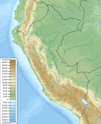
Tambogrande is located in the arid coastal plain of northwestern Peru on the northern bank of the Río Piura at an altitude of 69 m . The Quebrada Cameros flows along the eastern outskirts and flows into the Río Piura. The small town is 44 km northeast of the city center of the metropolis Piura . About 15 km further east rise the western foothills of the Peruvian Western Cordillera . Irrigated agriculture is practiced north of the city, while desert is predominant in the south. Main roads lead from Tambogrande to Piura, to the city of Chulucanas, 26 km southeast of the Río Piura, and to Sullana, 40 km to the west .
Individual evidence
- ↑ a b PERU: Region Piura - Provinces & Places . www.citypopulation.de. Retrieved January 19, 2020.

