Chulucanas
| Chulucanas | |
|---|---|
|
Coordinates: 5 ° 6 ′ S , 80 ° 10 ′ W
Chulucanas on the map of Peru
|
|
| Basic data | |
| Country | Peru |
| region | Piura |
| province | Morropón |
| Residents | 40,867 (2017) |
| City insignia | |
| Detailed data | |
| height | 92 m |
| Waters | Río Piura , Río Ñacara |
| Time zone | UTC -5 |
| City Presidency | Nelson Mío Reyes (2019-2022) |
| Website | |
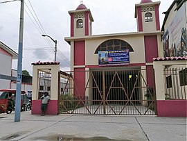
| Església de San Ramón de Chulucanas | |
Chulucanas is a city in Peru of about 40,000 inhabitants (40,867 in the 2017 census). In 2007 the population was 36,613. The city is the seat of the eponymous diocese .
geography
The city of Chulucanas is located in the northwest of the South American country in the Piura region and is the capital of the Morropón province . It is located in the Chulucanas district .
The 92 m above sea level. d. City at sea level is a good 100 km from the Pacific coast and a few kilometers from the western edge of the Peruvian western cordillera of the Andes . The Río Ñacara flows into the Río Piura at Chulucanas .
Individual evidence
- ↑ a b Peru: Region Piura - Provinces & Places . www.citypopulation.de. Accessed January 1, 2020.
- ↑ Instituto Nacional de Estadística e Informática (INEI): Directorio Nacional de Centros Poblados - Censos Nacionales 2017 . Lima 2018, vol. 4, p. 1545 ( online ).
Web links
Commons : Chulucanas - collection of images, videos and audio files


