
Taplejung
| Taplejung Nagarpalika ताप्लेजुङ्ग नगरपालिका Taplejung |
|||
|---|---|---|---|
|
|||
| Coordinates | 27 ° 21 '28 " N , 87 ° 40' 19" E | ||
| Basic data | |||
| Country | Nepal | ||
| Province No. 1 | |||
| District | Taplejung | ||
| ISO 3166-2 | NP-P1 | ||
| height | 1441 m | ||
| surface | 41.9 km² | ||
| Residents | 19,085 (2011) | ||
| density | 455.7 Ew. / km² | ||
| founding | May 18, 2014 | ||
| Website | www.taplejungmun.gov.np | ||
| 9 wards | |||
 |
|||

Taplejung ( Nepali ताप्लेजुङ्ग Taplejung ) is a city ( municipality ) in the far east of Nepal in the district of the same name .
The city was created in 2014 by merging the Village Development Committees Dokhu and Phungling . The urban area covers 41.88 km². Taplejung lies on a ridge at an altitude of 1441 m . The Tamor river valley runs 5 km to the west . Taplejung can be reached via a cul-de-sac from the Tamor valley. Suketar Airport is 3 km east of Taplejung .
Residents
At the 2011 census, the VDCs from which the city of Taplejung emerged had 19,085 inhabitants (9048 of whom were male) in 4,480 households.
gallery
Suketar Tower

Suketar airstrip

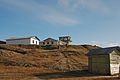
Suketar village


Individual evidence
- ↑ 72 new municipalities announced . My Republica.com. Retrieved June 10, 2014.
- ^ Government announces 72 new municipalities . The Kathmandu Post. Retrieved June 10, 2014.
- ↑ Municipal Association of Nepal (MuAN) ( Memento of the original from January 7, 2014 in the Internet Archive ) Info: The archive link was inserted automatically and has not yet been checked. Please check the original and archive link according to the instructions and then remove this notice.
- ↑ National Population and Housing Census 2011 (PDF; 2.1 MB) Central Bureau of Statistics. Archived from the original on July 31, 2013.