Tart-le-Haut
| Tart-le-Haut | ||
|---|---|---|

|
|
|
| local community | Tart | |
| region | Bourgogne-Franche-Comté | |
| Department | Côte-d'Or | |
| Arrondissement | Dijon | |
| Coordinates | 47 ° 12 ' N , 5 ° 12' E | |
| Post Code | 21110 | |
| Former INSEE code | 21623 | |
| Incorporation | 1st January 2019 | |
| status | Commune déléguée | |
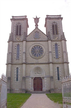
 Church of Tart-le-Haut |
||
Tart-le-Haut is a village and a former French commune with 1,386 inhabitants (at January 1, 2017) in the department of Côte-d'Or in the region Bourgogne Franche-Comté . It belonged to the Arrondissement of Dijon and the Canton of Genlis .
With effect from January 1, 2019, the former municipalities of Tart-le-Haut and Tart-l'Abbaye were merged to form the Commune nouvelle Tart and have the status of a Commune déléguée in the new municipality . The administrative headquarters are in Tart-le-Haut.
geography
Neighboring towns of Tart-le-Haut are Varanges in the north, Tart-le-Bas in the east, Tart-l'Abbaye in the southeast, Montot in the south, Brazey-en-Plaine in the southwest, Longecourt-en-Plaine and Échigey in the west, as well as Marliens in the west.
Population development
| year | 1962 | 1968 | 1975 | 1982 | 1990 | 1999 | 2011 |
| Residents | 201 | 215 | 205 | 405 | 702 | 811 | 1,377 |
