Taygetus
| Taygetus | ||
|---|---|---|
|
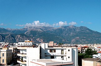
Taygetos Mountains seen from Sparta |
||
| Highest peak | Profitis Ilias ( 2407 m ) | |
| location | Laconia / Messenia , Greece | |
| part of | Peloponnese peninsula | |
|
|
||
| Coordinates | 36 ° 57 ′ N , 22 ° 21 ′ E | |
| rock | limestone | |
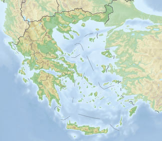
The Taygetos Mountains ( Greek Ταΰγετος ) is a mountain range on the Peloponnese peninsula in southern Greece . It lies in the Mani countryside and separates Laconia from Messinia . The highest peak is the pyramid-shaped Hagios Ilias (or Profitis Ilias ) with 2407 m, which is also the highest mountain in the Peloponnese.
The mountains consist mainly of limestone from the Tertiary and Upper Cretaceous periods , most of which are stored horizontally. However, it is traversed by a strip of crystalline shale in the longitudinal direction . This is much more overgrown because it offers better soil and water conditions.
The ruined city of Mistras, founded by Frankish princes at the time of the Crusades , is located on the northeastern edge of the Taygetos Mountains .
Two events from the Greek world of legends entwine around the Taygetos: Zeus and Leda are said to have begotten the Dioscuri . In addition, these mountains are said to have served as a place of death for weak children from Sparta : The fathers of children born with defects were obliged to plunge them into a crevice in the mountain range near today's Sparta.
The mountains got their name from the nymph Taygete , daughter of Atlas and the Oceanid Pleione .
The Taygetos Mountains are well developed for tourism today. Several hiking trails such as the European long-distance hiking trail E4 invite you to extensive tours.
View over Koroni and the Gulf of Messenia to the Taygetus
swell
- Greece: E4 - Peloponnese . Stein, Welver, ISBN 978-3-86686-221-0 .


