Tororo
| map | |
|---|---|

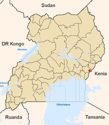
Location of Tororo within Uganda |
|
| Basic data | |
| District | Tororo |
| Geographical location | 0 ° 41 ′ N , 34 ° 11 ′ E |
| surface | ? |
| population | 47,729 (2005 estimate) |
| Population density | ? Inhabitants / km² |
| medium height | 1216 m |
| Precipitation | Average value 2005–2009: 625.01 mm / a |
| Time zone | UTC +3 |
| UN / LOCODE | UG TRY |
| Telephone code | (+256) 045 |
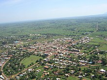
Tororo is a city in southeast Uganda near the border with Kenya with 47,729 inhabitants. It is the capital of the Tororo district of the same name .
Facilities
Tororo is the seat of the Catholic Archdiocese of Tororo . In 1984 the Benedictines of St. Ottilien founded a monastery in the town called Christ the King's Priory . The convent consisted of 19 monks in 2008 and 25 monks in 2010. The monastery maintains facilities such as vocational schools and training centers in the fields of metal processing, carpentry and building trade.
Attached to the Benedictine Missionary Monastery is a Benedictine Eye Hospital, which is sometimes looked after by the Lions charity.
climate
Despite the exposed location near Mount Elgon , Tororo has experienced repeated droughts since the weather records began in January 1957. In the period 1973 to July 1974, for example, only 61.99 mm of rain fell, while a two-month measurement in the nationwide drought year 1999 showed only 0 mm. The years 2000–2009, taking the years 2003 and 2004 together and excluding 2001, produced an annual rain average of 488.39 millimeters. In the comparison period 1973–1978, however, only 213.15 mm of rain fell. The destructive force of the flash flood of June 18, 1997 with 320.04 mm was not even rudimentarily reached again. The peak value on February 14, 2008 only resulted in a quantity of 114.05 mm of precipitation, which is an extraordinary event for a day in February in Uganda.
Infrastructure
Tororo is about 10 kilometers from the Kenyan border town of Malaba . The city has an airplane runway. It is also a junction of the Uganda Railway with rail lines from Mombasa on the Indian Ocean to Kampala and north towards Mbale and Pakwach . The place has trunk road connections via the A 104 to Webuye in Kenya and in the direction of Iganga and Mbale.
Population development
| year | Residents |
|---|---|
| 1911 census | |
| 1921 census | |
| 1931 census | |
| 1940 census | |
| 1959 census | 6,000 |
| 1969 census | |
| 1980 census | |
| 1991 census | 26,783 |
| 2002 census | 34,810 |
| 2005 estimate | 47,729 |
literature
- Johannes Neudegger OSB: The stolen mosque and other unbelievable things - experiences from Uganda , EOS-Klosterverlag, St. Ottilien 1993, ISBN 3-88096-720-2
Web links
Individual evidence
- ^ The monasteries of the Mission Benedictines of the Archabbey of St. Ottilien in Bavaria ( Memento from August 28, 2009 in the Internet Archive )

