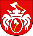
Trzcinica
| Trzcinica | ||
|---|---|---|

|
|
|
| Basic data | ||
| State : | Poland | |
| Voivodeship : | Greater Poland | |
| Powiat : | Kępno | |
| Geographic location : | 51 ° 10 ′ N , 18 ° 0 ′ E | |
| Residents : | see Gmina | |
| Postal code : | 63-620 | |
| Telephone code : | (+48) 62 | |
| License plate : | PKE | |
| Gmina | ||
| Gminatype: | Rural community | |
| Gmina structure: | 8 school offices | |
| Surface: | 75.14 km² | |
| Residents: | 4936 (Jun. 30, 2019) |
|
| Population density : | 66 inhabitants / km² | |
| Community number ( GUS ): | 3008072 | |
| Administration (as of 2006) | ||
| Community leader : | Grzegorz Paweł Hadzik | |
| Address: | ul.Jana Pawła II 47 63-620 Trzcinica |
|
| Website : | www.kotlin.com | |
Trzcinica [ tʂt͡ɕiˈnit͡sa ] ( German Strenze , 1939–1943 Sternbruch , 1943–1945 Strenze ) is a village and seat of the rural community of the same name in Poland . The place is located in the powiat Kępiński of the Greater Poland Voivodeship .
local community
The rural community ( gmina wiejska ) Trzcinica includes the following eight districts with a Schulzenamt ( solectwo ) :
- Aniołka Pierwsza
- Kuźnica Trzcińska
- Laski ( Strenze , 1943–1945 Hirscheck )
- Piotrówka
- Pomiany
- Smardze
- Trzcinica
- Wodziczna
Other localities in the municipality without the Schulzenamt are:
- Aniołka Druga
- Aniołka Parcele
- Börek
- Dzierżążnik
- Granice
- Ignacówka Druga
- Ignacówka Pierwsza
- Ignacówka Trzecia
- Jelenia Głowa
- Kwasielina
- Laski tartak
- Nowa Wieś
- Różyczka
- Siemionka
- Teklin
traffic
In the municipality were the Trzcinica and Laski-Smardze stations on the Namysłów – Kępno railway line .
Web links
- Order on change of place names in Reichsgau Wartheland in the ordinance sheet of the Reich governor in Warthegau from May 18, 1943 (PDF; 1.79 MB)
Individual evidence
- ↑ population. Size and Structure by Territorial Division. As of June 30, 2019. Główny Urząd Statystyczny (GUS) (PDF files; 0.99 MiB), accessed December 24, 2019 .
- ↑ a b Cf. web link "Order about change of place names in Reichsgau Wartheland" - Kempen district (Wartheland)
