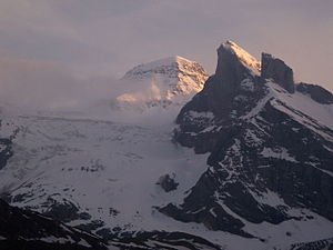
Tschingelhorn
| Tschingelhorn | ||
|---|---|---|
|
Tschingelhorn with Lauterbrunnen-Wetterhorn |
||
| height | 3562 m above sea level M. | |
| location | Canton border Bern / Wallis , Switzerland | |
| Mountains | Bernese Alps | |
| Dominance | 1.7 km → Breithorn | |
| Notch height | 393 m ↓ weather gap | |
| Coordinates | 631 453 / 147 573 | |
|
|
||
The Tschingelhorn is relatively unknown in relation to the triad of Eiger , Mönch and Jungfrau in its vicinity and at 3562 m above sea level. M. rather low summit in the Bernese Oberland (Switzerland). Nevertheless, due to its charming surroundings, it is part of the Jungfrau-Aletsch-Bietschhorn UNESCO World Heritage Site .
The normal route is a technically not very difficult, but physically quite demanding two-day tour. On the first day it leads from Stechelberg in the Lauterbrunnen valley over the Obersteinberg and the Tschingelfirn (crevasses - high-altitude tour equipment required) to the Mutthornhütte . On the second day, the route continues from the hut over the glacier and after crossing the Petersgrates through a moderately steep firn couloir and over the west ridge to the summit.
To the west is the Chly Tschingelhorn ( 3495 m above sea level ), from which you can traverse to the Tschingelhorn (III).
Web links
- Tschingelhorn on the ETHorama platform

