
Elterleinplatz
| Elterleinplatz | |
|---|---|
|
|
|
 Elterleinplatz to the east |
|
| Basic data | |
| place | Vienna |
| District | Hernals (17th), |
| Confluent streets | Hormayrgasse, Kalvarienberggasse, Jörgerstrasse, Hernalser Hauptstrasse , Kindermanngasse |
| Buildings | Alszauberbrunnen , Hernals District Office |
| use | |
| User groups |
Private transport Public transport 9 43 |
| Space design | Traffic areas , green areas , |

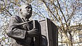
The Elterleinplatz is a place the center in part of the 17th Viennese municipal district Hernals . It has been named after Johann Georg Elterlein (1805–1882), an innkeeper who owned the entertainment venues Casino Unger and Elterleins Casino , since the decision of the Hernals community on June 26, 1882 . At the location of the former "Elterlein Casino" about 700 m east of Elterleinplatz there is now the U6 underground station (formerly the Stadtbahn station) Alser Straße . Elterlein was also mayor of Hernals (1869–1881) in the period before the suburb was incorporated into Vienna in 1892.
Buildings
In the past, Hernals Castle was located in the area of Elterleinplatz , which was a stronghold of Protestantism at the time of the Reformation and therefore played an important role for the majority of the Protestant citizens of the Catholic-ruled Vienna. Today Elterleinplatz is mainly known for the administrative building for the 17th district (1882/83, war damage) and the subsequent shopping center at ground level, in whose building there is not only apartments but also a municipal library and an adult education center. In the protected square ensemble there is also a school building (1860/1900) designed by the builder Ferdinand Fellner the Elder and the Hernals district museum in the monumental building (1911–13) of the former Hernals Spar-Cassa . The baroque / neo-baroque Kalvarienbergkirche and the municipal Jörgerbad are located in the immediate vicinity of the square.
traffic
As the junction of the Stadtbahn line 9 in north-south and line 43 in the east-west direction, Elterleinplatz has a certain importance. Due to the considerable volume of motorized individual traffic along Hernalser Hauptstrasse , part of an arterial road that leads across the Vienna Woods towards Tulln , Elterleinplatz, an indentation in Hernalser Hauptstrasse, is characterized by through traffic.
Metro station
In the course of the second part of the expansion project lined cross U2 / U5 to the planned under the Elterleinplatz a subway station U5 arise connects the Hernals with the city center (Town Hall, the Museum Quarter, Mariahilferstraße, Karlsplatz). The Elterleinplatz station is scheduled to open in 2027.
The U5 will come to an end for the time being at Elterleinplatz, although a further extension of the U5 to the suburb line is under discussion. In the direction of the city center, the Michelbeuern underground station will be the neighboring station of the Elterleinplatz underground station.
Todays situation
The place is considered rather unattractive due to the heavy traffic. Projects in recent years have made the square more attractive in terms of its appearance and functionality, but could only change this structural problem to a limited extent. The Elterleinplatz, here primarily the square-like area around the Alszauberbrunnen (1932/82), which is literally shielded from traffic , tends to be used by socially disadvantaged groups and schoolchildren to linger.

District Office Hernals, the former town hall of the municipality

The Alszauberbrunnen on Elterleinplatz
Alszauberbrunnen, detail

Alszauberbrunnen, detail

Bank building (1911–13) with district museum


Web links
Individual evidence
- ^ Elterleinplatz in the Vienna History Wiki of the City of Vienna
- ↑ station Elterleinplatz - U2xU5 - the new U2 and the new U5. City of Vienna and Wiener Linien, accessed on June 25, 2020 .
- ↑ Construction of the Vienna U2 / U5 is delayed by up to a year. Der Standard, November 9, 2018, accessed July 4, 2020 .
- ↑ Variant investigation - U2 and U5 subway expansion / U5 line routing. City of Vienna, accessed on February 19, 2020 .
Coordinates: 48 ° 13 ′ 5.9 ″ N , 16 ° 19 ′ 52.6 ″ E