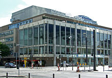
Willy-Brandt-Platz underground station
|
||||||||||||||||||||||||||||||||||||||||||||||||||||||||||
|
||||||||||||||||||||||||||||||||||||||||||||||||||||||||||
|
||||||||||||||||||||||||||||||||||||||||||||||||||||||||||
The Willy-Brandt-Platz subway station (until July 1, 1993 Theaterplatz ) is the station in the Frankfurt subway network that connects the A and B basic lines.
It was built in 1971 as a transfer hub and started operating in its current size from 1974. From here you can get to the U1, U2, U3 and U8 (A route) and U4 and U5 (B route) lines. Entrances to the underground station are located directly at Willy-Brandt-Platz , but also at Kaiserplatz, 200 meters away . It is divided into three levels. The name of the square commemorates the former Federal Chancellor Willy Brandt (1913–1992, Chancellor from 1969 to 1974), who died in 1992.
construction
Distribution level
The B-level is directly below the square and mainly has a distribution function. In the past, you could go straight to the BfG high-rise shopping center from here . It was the first and so far only direct link between a high-rise building and an underground station in Frankfurt. Due to poor sales and security concerns, it was used for other purposes after the European Central Bank moved into the high-rise. There remained a passage to an exit, which soon closed. Today the basement partly houses the Club Living XXL .
The so-called theater tunnel , a road tunnel that connects the station district and the old town , also runs on this level . The underground station and road tunnel were built together.
Platform levels
Below is the C-level with the two platforms of the A-lines in the direction of Südbahnhof and Heddernheim . This part of the station is located below Friedensstraße , a side street of the square. Another entrance is at Kaiserplatz. Another level lower, in the D-level are the tracks of the B-lines towards the main station and Bockenheim and Preungesheim .
The original plan for the train station provided for the crossing of the basic lines to be connected by track in order to enable direct journeys from the main station to the main station as well as from the Konstablerwache to Sachsenhausen . For cost reasons, it was decided in 1966 against a track connection and the two station structures were arranged one above the other.
architecture
The station was built using the cut-and-cover method. In February 1970, all surface traffic was stopped on what was then Theaterplatz in order to excavate the construction pit. From October of the same year, trams could cross the square again over a construction bridge. To rebuild this construction bridge, the tram traffic had to be stopped again between August and December 1971, after which the construction work had progressed so far that the traffic on the surface could pass again.
The station is designed to be simple and functional. The main materials are orange and turquoise painted sheet metal and exposed aggregate concrete in the D-level.
The station is to be comprehensively renewed in the coming years. The station is supposed to take up the elements of the neighboring buildings. Stylized Ionic columns, for example, are to show the proximity to the Hotel Frankfurter Hof on Kaiserplatz in the C-level and a specially developed lighting concept is to be implemented. As part of the modernization, the "Pillars of Eintracht ??" were designed between the tracks: Since January 2013, eleven "legendary" Eintracht Frankfurt players and a trainer, who were selected via internet voting, have been honored on the twelve supporting pillars.
| Frankfurt subway | ||
| Previous station | line | Next station |
|---|---|---|
|
Hauptwache ← Ginnheim |
|
Schweizer Platz Südbahnhof → |
|
Hauptwache ← Bad Homburg-Gonzenheim |
|
Schweizer Platz Südbahnhof → |
|
Hauptwache ← Oberursel-Hohemark |
|
Schweizer Platz Südbahnhof → |
|
Cathedral / Römer ← Enkheim / Seckbacher Ldstr. |
|
Central station Bockenheimer Warte → |
|
Cathedral / Römer ← Preungesheim |
|
Hauptbahnhof Hauptbahnhof → |
|
Hauptwache ← Riedberg |
|
Schweizer Platz Südbahnhof → |
literature
- Jens Krakies, Frank Nagel: Stadtbahn Frankfurt am Main: A Documentation . 2nd Edition. Frankfurt am Main 1989, ISBN 3-923907-03-6 .
Web links
References and comments
- ↑ Reference point: intersection Neue Mainzer Straße / Friedensstraße
- ↑ a b c d The depth refers to the floor or platform level
- ↑ Jens Krakies, Frank Nagel: rail Frankfurt: A documentary . 2nd Edition. Frankfurt am Main 1989, ISBN 3-923907-03-6 , pp. 118 .
- ↑ Jens Krakies, Frank Nagel: rail Frankfurt: A documentary . 2nd Edition. Frankfurt am Main 1989, ISBN 3-923907-03-6 , pp. 119 .
- ^ Pillars of Unity , Call for Elections, accessed on April 8, 2012
- ↑ Simon Heinrich: "Pillars of harmony" - reunion of the legends in the subway station. In: Frankfurter Allgemeine. January 23, 2013, accessed October 12, 2017 .
Coordinates: 50 ° 6 ′ 33 ″ N , 8 ° 40 ′ 29 ″ E


