Uda (Selenga)
|
Uda Уда |
||
|
Location of the Uda in the catchment area of the Selenga |
||
| Data | ||
| Water code | RU : 16030000412116300016177 | |
| location | Republic of Buryatia ( Russia ) | |
| River system | Yenisei | |
| Drain over | Selenga → Angara → Yenisei → Arctic Ocean | |
| source | east of Chita 52 ° 32 ′ 55 ″ N , 112 ° 11 ′ 33 ″ E |
|
| muzzle | near Ulan-Ude in the Selenga coordinates: 51 ° 49 '9 " N , 107 ° 34' 39" E 51 ° 49 '9 " N , 107 ° 34' 39" E
|
|
| length | 467 km | |
| Catchment area | 34,800 km² | |
| Discharge at the Chorinsk A Eo gauge : 7850 km² Location: 228 km above the mouth |
MQ 1942/1997 Mq 1942/1997 |
8.2 m³ / s 1 l / (s km²) |
| Discharge at the Ulan-Ude A Eo gauge : 34,700 km² Location: 5.1 km above the mouth |
MQ 1936/1997 Mq 1936/1997 |
67 m³ / s 1.9 l / (s km²) |
| Left tributaries | Chudun , Brianka | |
| Right tributaries | Kurba , Ona | |
| Big cities | Ulan-Ude | |
| Small towns | Chorinsk | |
|
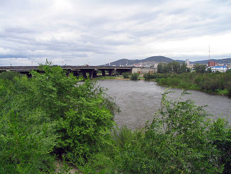
The Uda in Ulan-Ude |
||
The Uda ( Russian Уда ) is a 467 km long, right or eastern tributary of the Selenga in Russia , Asia .
The river Uda has its source in the mountainous and highland world of Buryatia east of the Chita in the Transbaikalia region . From its source , in the vicinity of which the mountains rise up to 1,592 m high, the Uda flows mainly in a westerly direction, including via Chorinsk to Ulan-Ude , where it flows into the Selenga River, which comes from the south-west .
Web links
Commons : Uda - collection of pictures, videos and audio files
Individual evidence
- ↑ a b Article Uda in the Great Soviet Encyclopedia (BSE) , 3rd edition 1969–1978 (Russian)
- ↑ a b Uda in the State Water Directory of the Russian Federation (Russian)
- ↑ Uda at the Chorinsk gauge - hydrographic data from R-ArcticNET
- ↑ Uda at the Ulan-Ude gauge - hydrographic data from R-ArcticNET

