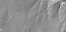
Uedemer Hochwald

The Uedemer Hochwald (also just called Hochwald ) is a forest area of around 9.5 km² on the Lower Rhine , which is almost entirely located in the municipality of Uedem in the Kleve district. Only very small fringes of the forest are in the neighboring communities of Sonsbeck and Xanten .
The high forest belongs to the Lower Rhine ridge , a terminal moraine wall of the Saale Ice Age . It is crossed by Landesstraße 5 between Uedem and Xanten- Marienbaum . In the eastern part of the forest there is a radar system for air surveillance that is visible from afar .
Protected areas and forest development
The great north-western part of the forest is in the Uedemer conservation area Balberger ridge with the forest areas Uedemer Hochwald and Tüschenwald . In the north and north-east there are small peripheral areas in the Xanten landscape protection area Niederung Körvesley / Marienbaumergraben . The south -eastern part of the high forest is designated as a nature reserve Uedemer Hochwald (approx. 424 hectares ), which is protected as FFH area DE-4304-301 Uedemer Hochwald with almost identical surface layout . In the nature reserve there are also the natural forest cells Hochwald I and Hochwald II (together approx. 41.4 hectares) with beech and sessile oak trees rich in old and dead wood . Due to the high proportion of dead wood and open structure, the nature reserve in particular is of great importance for various bird species such as small woodpeckers , black woodpeckers , stock doves and jackdaws as well as hawks , sparrowhawks , buzzards , wasp buzzards and tawny owls . Mountain newts , common toads and common frogs spawn in ponds and ponds . In addition to fallow deer, there are extensive stocks of red fox and hare .
Until the beginning of the 17th century , the high forest was a pure deciduous forest area , which was connected to the Reichswald near Kleve via small forests and heather areas ; the Tüschenwald connects to the south . Through various reforestation measures up until the 19th century , pine stands took up a large proportion of the area. The older deciduous forests of the high forest that have survived to this day are all in the nature reserve area. On January 18 and 19, 2007, the hurricane "Kyrill" hit the Uedemer Hochwald very hard. Large wind breaks occurred particularly in the area northeast of Schmachtdarm (in the landscape protection area) .
history
In the western part of the high forest there is a burial ground (barrows) probably from the Hallstatt period .
During the Second World War , a large part of the forest area was destroyed or at least cleared. In the Hochwaldschneise, the "Hau", which separates the Hochwald from the Tüschenwald in the south, heavy fighting took place between the advancing Allied troops (Canadians under Lieutenant General Guy Simonds ) and from February 27 to March 4, 1945 as part of Operation Blockbuster of the German Wehrmacht. The operation served to win the battle in the Reichswald .
In November 2012, the remains of Roman forts and training camps were found in the forest by a Dutch archaeologist.
Web links
Individual evidence
- ↑ Topographical Information Management, Cologne District Government, Department GEObasis NRW ( Notes )
- ↑ Nature reserve "KLE-020 Uedemer Hochwald" in the specialist information system of the State Office for Nature, Environment and Consumer Protection in North Rhine-Westphalia
- ↑ Natura 2000 area DE-4304-301 in the specialist information system of the State Office for Nature, Environment and Consumer Protection in North Rhine-Westphalia
- ↑ cf. NWZ 12: Hochwald I and NWZ 65: Hochwald II
- ↑ a b c cf. Nature conservation in the Kleve district: NSG Uedemer Hochwald
- ↑ cf. Nature conservation in the Kleve district: burial mounds
- ^ "The Hochwald Gap" at Canadianheroes.org
- ↑ receipt? see talk page
- ↑ cf. Anja Settnik: Uedemer Hochwald could become a world cultural heritage. In: rp-online.de . November 10, 2015, accessed October 10, 2016 .
Coordinates: 51 ° 40 ′ 27 ″ N , 6 ° 21 ′ 49 ″ E


