Ugom
|
Ugom - Ögem Угом, Өгем |
||
| Data | ||
| location | Kazakhstan , Uzbekistan | |
| River system | Syr Darya | |
| Drain over | Chirchiq → Syr Darja → Aral Sea | |
| source | in the Ugom Mountains 42 ° 0 ′ 57 ″ N , 70 ° 19 ′ 47 ″ E |
|
| Source height | approx. 2760 m | |
| muzzle |
Chirchiq coordinates: 41 ° 37 '46 " N , 69 ° 56' 49" E 41 ° 37 '46 " N , 69 ° 56' 49" E |
|
| Mouth height | 748 m | |
| Height difference | approx. 2012 m | |
| Bottom slope | approx. 27 ‰ | |
| length | 74 km | |
| Catchment area | 869 km² | |
| Drain |
MQ |
20.9 m³ / s |
|
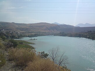
Mouth of the Ugom (left) into the Chirchiq |
||
|
Course of the Ugom (Russian Уга́м) |
||
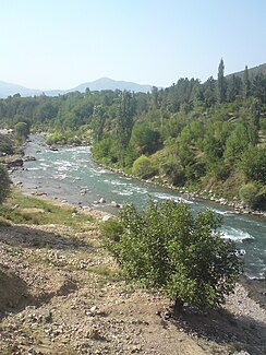
The Ugom ( Uzbek Угом ; Kazakh Өгем Ögem ; Russian Уга́м Ugam ) is a right tributary of the Chirchiq in Kazakhstan and Uzbekistan .
The Ugom rises on the western slope of the Ugom Mountains on the border between Kazakhstan and Uzbekistan. The Ugom flows initially in a westerly and later in a south-westerly direction along the western flank of the Ugom Mountains through the Qasyghurt district in the Turkistan region . Later he turns south and reaches Tashkent Province in Uzbekistan. The Qarschantau mountain range extends west of the river . The Ugom finally flows into the Chirchiq on the right-hand side below the Chorvoq hydropower plant.
The Ugom has a length of 74 km. It drains an area of 869 km². The mean discharge is 20.9 m³ / s.
Web links
Individual evidence
- ↑ a b c whitewater.ru


