Uhlja
| Uhlja | ||
| Угля | ||

|
|
|
| Basic data | ||
|---|---|---|
| Oblast : | Zakarpattia Oblast | |
| Rajon : | Tyachiv Raion | |
| Height : | 286 m | |
| Area : | 24.1 km² | |
| Residents : | 3,117 (2001) | |
| Population density : | 129 inhabitants per km² | |
| Postcodes : | 90514 | |
| Area code : | +380 3134 | |
| Geographic location : | 48 ° 9 ' N , 23 ° 38' E | |
| KOATUU : | 2124487601 | |
| Administrative structure : | 4 villages | |
| Address: | вул. Центральна буд. 32 90514 с.Угля |
|
| Website : | City council website | |
| Statistical information | ||
|
|
||
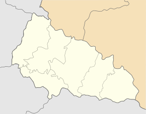
Uhlja ( Ukrainian Угля ; Russian Угля Uglja , Slovak Uhľa , Hungarian Uglya ) is a village in the Ukrainian Zakarpattia Oblast with about 3100 inhabitants (2001).
The village, first mentioned in writing in 1389, is the administrative center of the district council of the same name in the south of the Tyachiv district with a total of more than 6,000 inhabitants, to which the villages of Bobowe ( Бобове , ⊙ ) with about 200 inhabitants, Hrunyky ( Груники , ⊙ ) with about 1400 inhabitants and Mala Uholka ( Мала Уголька , ⊙ ) with about 1500 inhabitants.
The village lies in the historical region of Maramures in the Carpathians at an altitude of 286 m on the banks of Welyka Uholka ( Велика Уголька ), a 27 km long left tributary of the Tereblya , 29 km north of the Rajonzentrum Tyachiv and 139 km southeast of the Oblastzentrum Uzhhorod .
Web links
Local history Uhlja in the history of the cities and villages of the Ukrainian SSR (Ukrainian)
Individual evidence
- ↑ Local website on the official website of the Verkhovna Rada ; accessed on January 25, 2019 (Ukrainian)
- ↑ Uhlja on travelua.com.ua ; accessed on January 25, 2019 (Ukrainian)
- ^ Website of the district council on the official website of the Verkhovna Rada; accessed on January 25, 2019 (Ukrainian)


