
Vattis
| Vattis | |
|---|---|
 |
|
| State : |
|
| Canton : |
|
| Constituency : | Sarganserland |
| Political community : | Pfäfers |
| Postal code : | 7315 |
| Coordinates : | 752 511 / 197430 |
| Height : | 940 m above sea level M. |
| Residents: | 440 (2006) |
| Website: | www.vaettis.ch |
| map | |
 |
|
Vättis ( Rhaeto-Romanic ) is a municipality in the political municipality of Pfäfers in the southeastern corner of the canton of St. Gallen . It is located in the Sarganserland constituency .
geography
The village of Vättis is located above Bad Ragaz in the Tamina valley at the foot of the Calanda . The Calfeisental with the Gigerwaldsee extends west of Vättis . In addition to Vättis, the localities Pfäfers, Vadura , Valens and Vasön as well as the scattered settlement St. Margretenberg with Furggels belong to the political municipality of Pfäfers. The former Walser settlement of St. Martin is located in the Calfeisental .
The high valley is protected from the wind in the east (Calanda) and west by high mountains and therefore has little precipitation, with a healthy climate thanks to warm summers and cold winters. In the south, the valley opens up towards the Kunkelspass ( 1357 m above sea level ), the transition to the Bündner passes in the Vorder and Hinterheintal, which was probably already used by the Romans.
Vättner window
Between Gigerwald and Vättis - at the so-called Vättner window - the Aar massif is open. The window is the easternmost outcrop of the Aarmassiv, the alpine basement. It is a geological feature that explains the development of the Tamina valley and the Alps. At the entrance of the Chrüzbachtoble these oldest rocks of the Geopark Sardona can be viewed .
history
The teacher Theophil Nigg carried out archaeological excavations in the Drachenloch between 1917 and 1923. His son Toni Nigg continued his father's research and published his cave diaries. Nigg was also involved in designing the Dragon Hole Museum. In the highest prehistoric cave in Europe, the Drachenloch ( 2,427 m above sea level ), theophil Nigg found charcoal remains that refer to human life around 50,000 BC. Indicate. The finds can be viewed in the local museum.
Pre-Roman spear journeys, Roman coins and the special Romanesque village and field names indicate the historical significance of the Kunkel Pass. Medieval settlements in Vättis (then Vethin ) are documented in documents from the Pfäfers and Disentis monasteries.
Until the French Revolution, Vättis was under the prince Abbot von Pfäfers. The current church of St. Anian was built in 1695, the first parish church was mentioned as early as 1274. The St. Martin Chapel from 1346 testifies to the immigration of the Walsers in the Calfeisental. An inscription on the house wall of the place of negotiation - a former inn in Vättis - complains about the low severance payment that was negotiated when the Pfäfers monastery was dissolved in 1838.
In the 19th century, Vättis also benefited from the emerging tourism. The newly built spa hotels gave the mountain farming village a small boost. The air and whey health resort Vättis was advertised on a postcard at the beginning of the 20th century .
literature
- Collection of Swiss Legal Sources, XIV. Department: The Legal Sources of the Canton of St. Gallen, Part Three: The Landscapes and Country Cities, Volume 2: The Legal Sources of the Sarganserland by Sibylle Malamud and Pascale Sutter, Basel 2013 [1] .
population
The population in Vättis remained fairly constant in the 20th century - in contrast to the general emigration in the mountain areas. A kindergarten and a primary school from the 1st to the 6th grade are run in town for the children.
Economy and tourism
The inhabitants work in the craft, agriculture and service sectors. In addition to three village shops and two village inns, there are five farms (2006) and a private school. In the middle of the village is the Parnassia Offizin - a workshop for handicraft books and fonts. There are also the mountain restaurants Gigerwald and St. Martin (Calfeisental) as well as the Ringelspitz and Sardonahütte of the SAC.
There is a Postbus from Bad Ragaz to Vättis that runs several times a day and continues to the Gigerwald dam on summer weekends.
Attractions
- Drachenlochmuseum and local museum
gallery

Church of St. Anian with former parish hall (now a museum)
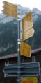
Hiking trails from Vättis: to the north (left), west (half right), south (right)

Vattis


Web links
- Website of the village of Vättis
- Daniel Speaker: Vättis. In: Historical Lexicon of Switzerland .
- Website of the Walser settlement St. Martin im Calfeisental
- Website about caving in the Drachenloch
Individual evidence
- ^ Mineralienatlas: Vättner window
- ↑ Stefan Hesske, David Imper: The geological window of Vättis . The oldest rocks of the UNESCO World Heritage Site of the Tectonic Arena Sardona in the Tamina Valley. Terra plana 3/2010
- ^ Famous local residents: Theophil and Toni Nigg. Retrieved August 5, 2020 .
- ↑ Unesco-Sardona: Dragon Hole Museum
- ↑ Dragon Hole Museum and Local Museum