Valkenburg (South Holland)
 flag |
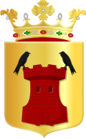
 coat of arms |
| province |
|
| local community |
|
|
Area - land - water |
5.75 km 2 4.98 km 2 0.77 km 2 |
| Residents | 5,585 (Jan 1, 2017) |
| Coordinates | 52 ° 11 ′ N , 4 ° 26 ′ E |
| Important traffic route |
|
| prefix | 071 |
| Postcodes | 2221, 2223, 2231, 2235, 2331, 2342 |
| Location of Valkenburg in the municipality of Katwijk | |
Valkenburg is a district of the municipality Katwijk in the Netherlands , province of South Holland . The place has 5,585 inhabitants (as of January 1, 2017) and an area of 5.75 km², of which 0.77 km² consists of water.
On January 1, 2006, Valkenburg and Rijnsburg were merged to form the new municipality of Katwijk.
Valkenburg goes back to the Roman fort Praetorium Agrippinae , of which numerous excavations have been made.
The headquarters of the fishing group Parlevliet & Van der Plas is located in Valkenburg . In the south of Valkenburg there used to be an important military airfield of the Royal Navy , the Vliegkamp Valkenburg . The steam train trains on Lake Valkenburg ( Stoomtrein Valkenburgse Meer ) depart from the narrow-gauge railway museum.
politics
Distribution of seats in the municipal council
| Political party | Seats | |||
|---|---|---|---|---|
| 1990 | 1994 | 1998 | 2002 | |
| CDA | 6th | 4th | 5 | 5 |
| VVD | 1 | 2 | 2 | 3 |
| PvdA | - | 2 | 2 | 2 |
| ChristenUnie | - | - | - | 1 |
| GPV / RPF | 2 | 3 | 2 | - |
| PvdA / PPR | 2 | - | - | - |
| total | 11 | 11 | 11 | 11 |
Web links
Individual evidence
- ↑ a b Kerncijfers wijken en buurten 2017 Centraal Bureau voor de Statistiek , accessed on June 2, 2018 (Dutch)
- ↑ Allocation of seats in the municipal council: 1990–2002 , accessed on June 2, 2018 (Dutch)
