
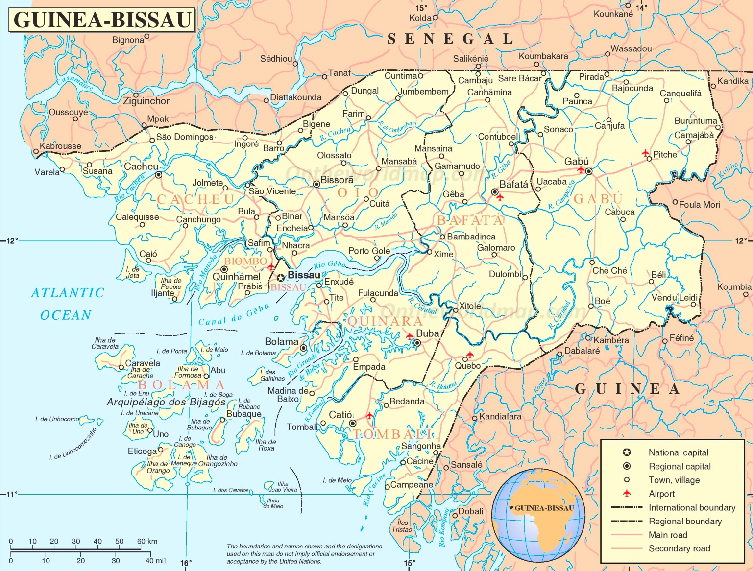
Varela (Guinea-Bissau)
| Varela | |||
|---|---|---|---|
|
|||
| Coordinates | 12 ° 17 ′ N , 16 ° 36 ′ W | ||
| Basic data | |||
| Country | Guinea-Bissau | ||
| Norte | |||
| region | Cacheu | ||
| ISO 3166-2 | GW-CA | ||
| Residents | 748 (2009) | ||

Varela , also Varela Iale or Varela-Ial , a town in the northwest corner is Guinea-Bissau with 597 inhabitants, predominantly the animistic ethnicity of Felupe belonging, with a Muslim minority.
The place is in the administrative sector of São Domingos in the Cacheu region .

history
There is one thesis among historians that the Portuguese navigator António Fernandes was the first European to go ashore here between 1445 and 1447, and not Nuno Tristão , who may have received his fatal injuries in the Gambia .
Attractions
.jpg)
Varela is best known for its white sandy beaches, particularly Para da Varela , which is considered the most beautiful sandy beach in the country outside the islands. Other beaches are:
- Praia dos Pescadores , an extension of Praia de Varela , from where fishermen traditionally put their boats into the water
- Praia de Niquin , 3 km from Praia de Varela , difficult to access beach with impressive surrounding nature
- Praia de Catão located 2 km from the road to São Domingos removed by mangrove separately and for its hippos known
- Praia de Edjim is 13 km from the road to São Domingos
The untouched nature with its rich flora and fauna and the calm atmosphere characterize Varela. The Italian-run Aparthotel Chez Hélène is the only accommodation option in the area so far, there are only a few improvised restaurants by local residents as a tourist infrastructure.
An unusually grown palm is revered as sacred by the local animist population. For a small gift or coin, you can ask for something there.
A small marine museum has been set up at the environmental station of the Portuguese non-governmental organization AD - Acção para o Desenvolvimento .
traffic
From São Domingos a non-asphalt road (mud track) leads to Varela, 53 km away, past the village of Susana , 12 km before Varela , which is the next largest town for Varela.
Varela has an airfield with the ICAO code GGVR, from where u. a. Excursions to Cap Skirring in nearby Senegal are possible.
Web links
- Entry Varelas on the Guinea-Bissau tourism site (Portuguese, English, French and Italian)
- Varela episode from a television series about Guinea-Bissau on the Portuguese television channel RTP , recorded on YouTube
- Impressions from Praia da Varela beach (2012) , private video on YouTube
Individual evidence
- ↑ Inhabitants by region, sector and town by gender, 2009 census (p. 142), PDF retrieval from the INE National Statistics Office of January 6, 2018
- ↑ a b c Joana benzinho, Marta Rosa: À Descoberta da Guiné-Bissau . , Afectos com Letras / EU, Pombal 2015, ISBN 978-989-20-6252-5 , p. 68.
- ↑ Joana Petrolho, Marta Rosa: À Descoberta da Guiné-Bissau. , Afectos com Letras / EU, Pombal 2015, ISBN 978-989-20-6252-5 , p. 11.
- ↑ a b Entry Varelas on the tourism website Guinea-Bissau (port.), Accessed on January 6, 2018
- ↑ Joana Petrolho, Marta Rosa: À Descoberta da Guiné-Bissau. , Afectos com Letras / EU, Pombal 2015, ISBN 978-989-20-6252-5 , p. 70.
- ↑ Road map of Guinea-Bissau at www.ontheworldmap.com, accessed on January 6, 2018