Vau de Bouche
|
Vau de Bouche Ruisseau du Moulin |
||
|
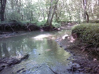
The river below Lucy-le-Bois |
||
| Data | ||
| Water code | FR : F3169000 | |
| location | France , Bourgogne-Franche-Comte region | |
| River system | His | |
| Drain over | Cure → Yonne → Seine → English Channel | |
| source | in the municipality of Sauvigny-le-Bois 47 ° 31 ′ 17 ″ N , 3 ° 57 ′ 51 ″ E |
|
| Source height | approx. 292 m | |
| muzzle | in the municipality of Voutenay-sur-Cure in the Cure coordinates: 47 ° 33 ′ 46 ″ N , 3 ° 46 ′ 31 ″ E 47 ° 33 ′ 46 ″ N , 3 ° 46 ′ 31 ″ E |
|
| Mouth height | approx. 128 m | |
| Height difference | approx. 164 m | |
| Bottom slope | approx. 7.8 ‰ | |
| length | approx. 21 km | |
The Vau de Bouche (in the central part also Ruisseau du Moulin ) is a river in France that runs in the Yonne department in the Bourgogne-Franche-Comté region . It rises in the northeastern municipality of Sauvigny-le-Bois and drains in the source area in a northeastern direction. Just before reaching the A6 motorway , the river turns north-west to west and flows into the Cure as a right tributary after around 21 kilometers in the municipal area of Voutenay-sur- Cure .
Places on the river
(Order in flow direction)
- Genouilly , parish of Provency
- Provency
- Étaule
- Thory
- Lucy-le-Bois
- Voutenay-sur-Cure
particularities
Between the towns of Lucy-le-Bois and Voutenay-sur-Cure, the river valley is interspersed with numerous grottos on the steep slopes , which leads to a variety of springs that flow into the river there.
Individual evidence
- ↑ Source height according to geoportail.gouv.fr
- ↑ mouth height according to geoportail.gouv.fr
- ↑ Vau de Bouche at SANDRE (French)
- ↑ Spéléo-Club de Chablis: Les grottes du Vau de Bouche. (PDF; 3.87MB) 2007, pp. 1–10 , accessed on March 27, 2020 (French).
