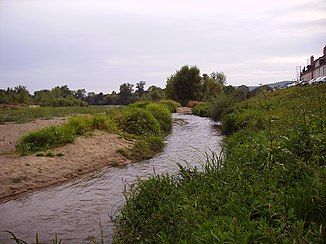
Vauvise
| Vauvise | ||
|
The Vauvise at Saint-Thibault-sur-Loire |
||
| Data | ||
| Water code | FR : K40-0310 | |
| location | France , Center-Val de Loire region | |
| River system | Loire | |
| Drain over | Loire → Atlantic Ocean | |
| source | in the municipal area of Nérondes 46 ° 59 ′ 47 ″ N , 2 ° 51 ′ 8 ″ E |
|
| Source height | 230 m | |
| muzzle | near Saint-Thibault , in the municipality of Saint-Satur in the Loire Coordinates: 47 ° 20 ′ 14 ″ N , 2 ° 52 ′ 1 ″ E 47 ° 20 ′ 14 ″ N , 2 ° 52 ′ 1 ″ E |
|
| Mouth height | 140 m | |
| Height difference | 90 m | |
| Bottom slope | 1.6 ‰ | |
| length | 58 km | |
The Vauvise is a river in France that runs in the Cher department in the Center-Val de Loire region . It has its source in the municipality of Nérondes and generally drains northwards. At Saint-Bouize the Vauvise reaches the Canal latéral à la Loire (German Loire Lateral Canal ), crosses it and after a total of 58 kilometers it flows into the Loire as a left tributary at Saint-Thibault , in the municipality of Saint-Satur .
Places on the river
- Nerondes
- Villequiers
- Jussy-le-Chaudrier
- Sancergues
- Saint-Martin-des-Champs
- Saint-Bouize
- Thauvenay
- Ménétréol-sous-Sancerre
- Saint-Satur
