Venø
| Venø | ||
|---|---|---|
| Venø Kirke, Church of Venø. | ||
| Waters | Limfjord | |
| Geographical location | 56 ° 33'15 " N , 8 ° 37'30" E | |
|
|
||
| length | 7.5 km | |
| width | 1.5 km | |
| surface | 6.46 km² | |
| Residents | 178 (January 1, 2020) 28 inhabitants / km² |
|
| main place | Venø By | |
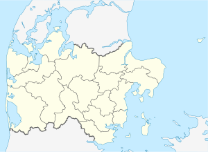
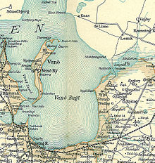
Venø (or Venö ) is an island in the Danish Limfjord north of Struer . It is about 7.5 km long, up to 1.5 km wide and has an area of about 6.46 km².
description
The island forms its own parish Venø Sogn , which until 1970 belonged to Harde Skodborg Herred in what was then Ringkøbing Amt , then to Struer Kommune in the expanded Ringkjøbing Amt , which became part of the "new" Struer Kommune in the course of the municipal reform on January 1, 2007 Region Midtjylland rose. The island has 178 inhabitants (January 1, 2020)
The only place on the island is Venø By .
On Venø there is an Efterskole and a campsite, there is a shop with a snack in the harbor and a restaurant (Kro). Agriculture is practiced on the island. The cultivation of their own potato variety and sheep breeding are known.
In the north of the island is one of spits enclosed, heart-shaped Strandsee (Nørskov Vig, also called Klovvig). The Danish name for such a morphological phenomenon is "Vinkelforland". Among the processing steps become a foreshore understood, the formation of the merging of two or more headlands back (spits), so that this time a bay to a lagoon or Bodden transform and finally completely cut off from the open sea. The resulting beach lake then gradually silts up. On Venø such Strandsee has already been done, but the silting has not yet occurred.
Although there are some areas in Denmark with such a Vinkelforland, the Vinkelforland of Venø represents a development phase that cannot be found anywhere else in Denmark. The area is therefore one of around 200 specially protected "Areas of National Geological Interest" (områder af national geologiskinterest) in Denmark. A large bird sanctuary has been established in the area.
The local church ( Venø Kirke ) is one of the smallest churches in Denmark.
Venø belongs to the Association of Danish Small Islands .
traffic
There is a small marina on the island . The ferry connection from Venø Færgefart to the mainland is the shortest car ferry route in Denmark with a length of 266 m. Venø By is connected by a bus service operated by Midttrafik (Venø bussen, no. 346) six times on weekdays and twice on Saturdays and Sundays directly to the train station in Struer .
literature
- Steen Andersen (Red.): Det mellemste Jylland (published in the Geologisk set series ) - 272 p., Numerous. Fig. And maps, Geografforlaget, Brenderup (DK) 1994 (1st edition of the 1st edition).
Individual evidence
- ↑ a b statistics banks -> Befolkning og valg -> BEF4: Folketal pr. January 1st demands på øer (Danish).
- ↑ Danmarks Statistics : Statistical Yearbook 2009 - Geography and climate, Table 3 Area and population. Regions and inhabited islands (English; PDF; 39 kB)
- ↑ VENØ BUSSEN. Struer - Bremdal - Venø. In: venoefaergefart.dk. Retrieved May 27, 2020 (Danish).
Web links
- official website (Danish)
- Venø Færgefart. In: venoefaergefart.dk. Retrieved May 27, 2020 (Danish).


