Vilicher Bach
|
Vilicher Bach Mühlenbach, Holtorfer Bach, Wielesbach, Geislarer Bach |
||
|
The Vilicher Bach in Holzlar, referred to here as Mühlenbach |
||
| Data | ||
| Water code | DE : 271972 | |
| location | North Rhine-Westphalia , Germany | |
| River system | Rhine | |
| Drain over | Rhine → North Sea | |
| source | In Holtorfer district Ungarten 50 ° 43 '42 " N , 7 ° 11' 25" O |
|
| Source height | approx. 160 m above sea level NHN | |
| muzzle | north of Beuel Coordinates: 50 ° 45 ′ 12 ″ N , 7 ° 6 ′ 22 ″ E 50 ° 45 ′ 12 ″ N , 7 ° 6 ′ 22 ″ E |
|
| Mouth height | 56 m above sea level NHN | |
| Height difference | approx. 104 m | |
| Bottom slope | approx. 12 ‰ | |
| length | 8.6 km | |
| Catchment area | 9.811 km² | |
| Left tributaries | Alaunbach | |
| Right tributaries | Wolfsbach , Steinbach , Mersbach | |
| Big cities | Bonn | |
|
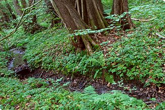
Mühlenbach near the source |
||
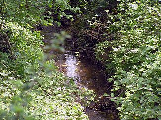
The Vilicher Bach is a right tributary of the Rhine in Bonn , Beuel district . Its total length is 8.6 kilometers and its catchment area is 9.8 square kilometers. Sections of the water are also referred to as Mühlenbach , Holtorfer Bach , Geislarer Bach and Wielesbach .
course
The Vilicher Bach arises from three source brooks in Holtorf , namely an unnamed one from Niederholtorf , the Wielesbach from Ungarten and the Mersbach on the border between Holtorf and Hoholz , and flows first in a northerly direction on the border between Holtorf and Holzlar and has been there since 1975 Flood retention basin called Holzlarer See. It then crosses Holzlar , where it is also called Holzlarer Bach and later Mühlenbach. Below Holzlar it takes up the Steinbach and leads northeast past Pützchen-Bechlinghoven , where the Wolfsbach and the Alaunbach flow into it. It crosses Vilich-Müldorf and finally flows in a westerly direction on the border between Vilich and Geislar , then through Schwarzrheindorf / Vilich-Rheindorf on the right side into the Rhine .
Characteristic
In addition to areas used for agriculture, the Vilicher Bach also crosses settlement areas with loosened buildings and often appears in this area as developed and partially piped water. Structures close to nature can only be found in a renatured section in the area of the Mühlenbachhalle near Vilich-Müldorf . The stream is affected by the discharge of rainwater and from the mixed water sewer system and is therefore partly assigned to quality class IV according to the 2002 water quality report, which corresponds to excessive pollution. On the other hand, the upper course has a significantly more positive water quality, which in a short section even corresponds to quality class I-II and thus a low pollution. The normal flow rate of the Vilicher Bach is 7 to 54 liters per second, but can also increase up to 3.5 m³ during high water. During periods of low precipitation, the trench-like lower course of the water falls partially dry.
Web links
Individual evidence
- ↑ a b German basic map 1: 5000
- ↑ a b Water directory of the State Office for Nature, Environment and Consumer Protection NRW 2010 (XLS; 4.67 MB) ( Notes )
- ↑ to ELWAS-WEB under ID 477, OFWK ID DE_NRW_271972_0 / 3D, 5600kbm capacity in full stowage
- ↑ Bach Development Plan 2008 , City of Bonn (PDF; 1.65 MB)


