Wadi Tumilat
| Wadi Tumilat in hieroglyphics | ||||||
|---|---|---|---|---|---|---|
|
||||||
|
||||||
Tjeku / Tju Ṯkw / Ṯw Tjeku / Tju |
||||||
Wadi Tumilat ( Arabic وادي الطميلات, DMG Wādī aṭ-Ṭumīlāt ; Ancient Egyptian Tjeku / Tscheku / Tju / Tschu ) is the name commonly used in Egyptology for an approximately 50 km long, flat valley between El-Abaseya in the eastern Nile Delta and Ismailia on the Timsah Sea ( crocodile lake ).
topography
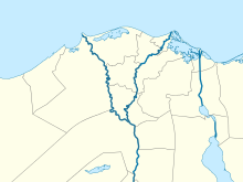
Area of Wadi Tumilat in Egypt |
Wadi Tumilat, now 5.5 to 6.5 m above sea level, was a semi- arid valley in ancient Egypt that was located in the eighth Harpunengau in Lower Egypt . The entire western part of the Wadi -Tumilat was filled with a lake during antiquity , which was fed by drainage canals and branching river arms.
On the eastern edge of this lake was the fortress town of Tell er-Retaba, 26 km east of the mouth of the Wadi Tumilat, and the surrounding ancient Egyptian temple area. After Tell er-Retaba on the occasion of the construction of the Bubastis Canal by Pharaoh Necho II around 600 BC. Was abandoned by the residents, the rebuilding of Tell el-Maschuta, 15 km away, took place .
History of the wadi
Wadi Tumilat was a large river bed in geological times. It seems to have got its present form after the last Ice Age and has been around since around 3000 BC. Not to have changed significantly any more. The flood of the Nile flooded Wadi Tumilat every year. During the New Kingdom period, the Shasu , among others, migrated into the wadi more often:
“The Shasu tribes from Edom (šʒśw n idwm) passed the Merenptah fort in Tjeku to graze their cattle near the ponds of the Atum temple. On the day of Seth's birthday, I took her to the place where the other Shasu tribes who passed the fortress of Merenptah days ago are already staying. "
The statement in the Old Testament (Gen 47.11) that is Joseph's family settled in the land of Rameses , is the handing down of the pull-motif influenced that a participation in the construction of the city of Pi-Rameses requires.
During the late period from around 600 BC. There were obviously high floods of the Nile again, which forced the inhabitants of the wadi to go to higher areas. Shortly after the Ptolemaic or Greco-Roman times , the wadi was probably abandoned. The Nile thus had a natural runoff through the Wadi Tumilat, at least during the Nile floods.
In 1800 AD there was still a flood of the Nile through the Wadi Tumilat to almost Lake Timsah, which Jacques-Marie Le Père reported. The name Wadi Tumilat (fr: Ouady Toumilat ) was used by the scientists participating in Napoleon's Egyptian expedition in the Description de l'Égypte and thus spread. After the Second World War there were camps with German prisoners of war in Wadi Tumilat. The writer Erhart Kästner processed his experiences there in the “Tent Book of Tumilat”. Today the valley is criss-crossed by the Ismailia Canal , irrigation canals and the road between Cairo and Ismailia and is mainly used for agriculture.
See also
literature
- Herbert Donner : History of the people of Israel and its neighbors in outline. Part 1. Vandenhoeck & Ruprecht, Göttingen 2007, ISBN 978-3-525-51679-9 , pp. 102-103.
- Ellen-Fowles Morris: The architecture of imperialism - Military bases and the evolution of foreign policy in Egypt's New Kingdom. Brill, Leiden 2005, ISBN 90-04-14036-0 .
- Alan Gardiner : The Delta Residence of the Ramessides, IV In: Journal of Egyptian Archeology. No. 5, 1918, pp. 242-271.
- Édouard Naville : The store-city of Pithom and The route of the Exodus. Trübner, London 1903.
- Jacques-Marie Le Père : Mémoire sur la communication de la mer des Indes à la Méditerranée par la mer Rouge et l'Isthme de Sueys. Imprimerie Impériale, Paris 1809, pp. 21-186 ( books.google.de ).
Web links
Individual evidence
- ^ Tassie Hassan, van Wetering: Kafr Hassan Dawood. (about the excavation near the village of Kafr Hassan Dawood, 2003) On: echo.org (ECHO = Egyptian Cultural Heritage Organization); last accessed on May 8, 2014.
- ^ Schörner: Artificial shipping canals in antiquity. In: Skyllis - Journal for Underwater Archeology (Skyllis) Volume 3, Issue 1, 2000, pp. 38–43.
Coordinates: 30 ° 32 ′ 58 ″ N , 31 ° 57 ′ 49 ″ E

