Watermill (Remscheid)
|
Watermill (Remscheid)
City of Remscheid
Coordinates: 51 ° 11 ′ 21 ″ N , 7 ° 17 ′ 23 ″ E
|
||
|---|---|---|
| Height : | 258 m above sea level NN | |
|
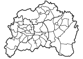
Location of Wassermühle (Remscheid) in Remscheid |
||
Watermill was a residential area in the southeast of the Bergisch city of Remscheid in North Rhine-Westphalia . The place name goes back to a water mill at the location. Today the area of the desert is used as a parking lot.
Location and description
Watermill was located in the statistical district of Engelsburg in the Lennep district in the valley of the Lenneper Bach near Kleebach . Other neighboring residential areas and farms are Jacobsmühle , Müllersberg , Lenneper Hof , Jammertal , Nagelsberg , Schneppendahl , Durchsholz and Auf der Hardt . Due to the construction of the Wuppertal dam, the Spaniermühle and Nagelsbergermühle have gone .
The new route of the federal road 229 , which also had to be relocated due to the construction of the dam, runs south of the desert . Until it was relocated, it was laid directly adjacent to the north of the residential area, as was the Lennep - Krebsöge section of the Wuppertal Railway .
history
The map Topographia Ducatus Montani from 1715 shows the mill as a mill . In addition to the Jacobsmühle upstream, also labeled as Mühl , another six unlabeled water engines on the Lenneper and Panzerbach are shown on the map. In the 18th century the place belonged to the Bergisches Amt Bornefeld-Hückeswagen .
The watermill on Nagelsberg was first mentioned in writing in 1770. It was the Lenneper Bannmühle , until the French occupation in 1804 lifted the mill. In 1815/16 three residents lived in the village.
On April 22nd, 1824, the town of Lennep sold the mill to Peter Johann Mühlinghaus , the owner of the Jacobsmühle, located 150 meters upstream. When it was sold, the city stipulated that the mill should be operated as a grinding mill " forever " . This " eternity " ended after a year, when a settlement on April 4, 1825 stipulated that the watermill could be used by Mühlinghaus and his heirs for any purpose he wanted and could also be demolished. For this, Mühlinghaus paid the city compensation of 200 Thalers.
Like the Jacobsmühle two years later, Johann Mühlinghaus and Johann Kotthaus zu Nagelsberg bought the watermill in 1828 and converted it into a cloth factory. An overshot waterwheel drove two cross- shearing machines and a gouging machine . Since the owners were the same, the watermill soon formed an operating unit with the Nagelsbergermühle downstream.
In 1832 the water mill belonged to the Lennep district, which was part of the Lennep mayor . The residential area, which was categorized as a factory building according to the statistics and topography of the Düsseldorf administrative district , had a manufacturing facility at that time. At that time, four people lived in the village, all of whom were Protestant.
On April 30, 1840, the two owners received a concession to operate a 16 HP steam engine ; in 1852, 34 workers are employed in the water mill. In 1879, after being sold to the Budde & Karsch company, it was converted into a carded yarn spinning mill.
In the municipality lexicon for the province of Rhineland , a house with six residents is given for 1885. At that time the place still belonged to the Lennep mayor's office within the Lennep district . In 1895 the place had a house, but no residents, in 1905 the watermill was no longer included in the list of Lennper places to live.
In 1886 the Lennep - Krebsöge section of the Wuppertal Railway was opened past the mill, and the watermill was given its own watermill stop on the railway line. In 1908 the factory burned down and was not rebuilt. In 1929 the town of Lennep was incorporated into Remscheid with the watermill. There was still a residential building in Wassermühle until the 1970s. Then this, as well as the now disused railway line, had to give way to the preparations for the construction of the Lenneper Bach pre-dam for the Wuppertal dam.
Individual evidence
- ^ A b c d e Günther Schmidt: Hammer and Kotten research in Remscheid ; Volume 5; From Blombach to Eschbach ; Remscheid; ISBN 3-9800077-6-6
- ↑ a b Johann Georg von Viebahn : Statistics and Topography of the Administrative District of Düsseldorf , 1836
- ↑ Königliches Statistisches Bureau (Prussia) (Ed.): Community encyclopedia for the Rhineland Province, based on the materials of the census of December 1, 1885 and other official sources, (Community encyclopedia for the Kingdom of Prussia, Volume XII), Berlin 1888.
- ↑ Königliches Statistisches Bureau (Prussia) (Ed.): Community encyclopedia for the Rhineland Province, based on the materials of the census of December 1, 1895 and other official sources, (Community encyclopedia for the Kingdom of Prussia, Volume XII), Berlin 1897.
- ↑ Königliches Statistisches Bureau (Prussia) (Ed.): Community encyclopedia for the Rhineland Province, based on the materials of the census of December 1, 1905 and other official sources, (Community encyclopedia for the Kingdom of Prussia, Volume XII), Berlin 1909.
