Graefensteinberg water tower
Coordinates: 49 ° 9 ′ 9 ″ N , 10 ° 49 ′ 52 ″ E
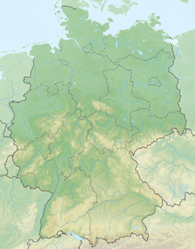
The water tower Graefensteinberg is a 45 meter (34 meters without antenna) high water tower at 512 m above sea level. NN high Geiselsberg in the municipality of Haundorf , Bavaria .
The tower is located between the districts of Gräfensteinberg and the Absberg district of Igelsbach in the Haundorf area. He stands near the summit directly to the county road WUG 1 and is a highly visible landmark .
It was built between March 10, 1976 and December 1976. It has two ring-shaped water tanks with a storage volume of 450 cubic meters each. The lower edge of the 2 meter high foundation of the tower with a diameter of 14.4 meters is 6 meters deep. The 16 meter high tower cage, whose diameter increases from 17.6 meters to 19.6 meters, rests on an 18 meter high concrete shaft with a diameter of 5.80 meters, which was erected in 5 ½ days using the climbing formwork method . The tower cage is clad with 24 concrete slabs, each weighing 9.5 tons.
The Gräfensteinberg water tower, which is also used to broadcast the radio program from " Radio 8 " on the VHF frequency 90.3 MHz with 100 W effective radiated power (ERP), can be visited during the summer months as part of regular tours, with the visitor gallery having a Staircase with 165 steps is accessible. From the viewing platform you have an overview of the Brombachsee in the east and the Altmühlsee in the west, as well as the former course of the Upper German-Raetian Limes , which reached its northernmost point in Middle Franconia about five kilometers south at Gunzenhausen .

