Weisshornweg
| Weisshornweg | |
|---|---|
| Data | |
| length | 22.54 km |
| location | Valais Alps , Mattertal |
| Supervised by | St. Niklaus parish |
| Starting point |
Boys 1960 m above sea level M. 46 ° 11 ′ 43.3 " N , 7 ° 47 ′ 56" E. |
| Target point |
Randa 1406 m above sea level M. 46 ° 6 '1 " N , 7 ° 47' 0.3" E |
| Type | Höhenweg |
| Height difference | 1708 m |
| The highest point | Wasulicke 3114 m above sea level M. |
| Lowest point | Randa 1406 m above sea level M. |
| Level of difficulty | T2 Junge- und Jungtalweg - Alpenblumenweg, T4 Jungtal - Topalihütte and Topalihütte - Randa |
| season | Spring autumn |
| Viewpoints | Weisshorn Group , Mischabel |
| particularities | Thanks to the Topalihütte , the Weisshornweg can be mastered in two daily stages. |
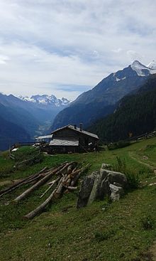
The Weisshornweg is a high-altitude trail in the Weisshorn group of the canton of Valais in Switzerland and leads from Jungs ( 1960 m above sea level ) via the Jungtal ( 2387 m ) and the Wasulicke ( 3114 m ) to the Topalihütte ( 2674 m above sea level ). and then over the Guggiberg ( 2222 m ) to Randa ( 1406 m above sea level ). It is 22.54 km long and offers wonderful viewpoints of the Mischabel . The highest point is the Wasulicke at 3114 m above sea level. M. , which connects the Jungtal with the Wasmutälli. The Höhenweg was opened on August 24, 2003. However, it has been closed since 2019 because it is at risk of falling rocks and the summer bridges that are supposed to lead over the ravine between Topalihütte and Randa are no longer being set up.
Topalihütte and distances

Thanks to the Topalihütte , the Weisshornweg can be done in two daily stages
- of 10.69 km from Jungs to Topalihütte and
- 11.85 km from the Topali Hut to Randa
be mastered.
From the terrace of the Topalihütte there is a view from the Mischabel with Täschhorn ( 4491 m ) and Dom ( 4545 m ) to the Aletsch Glacier .
Route
Junge can be reached from St. Niklaus Dorf ( 1120 m above sea level , Valaisian German Zaniglas ) both on foot via the Jungeweg and by means of a passenger cable car.

Jungeweg
The Jungeweg leads from the Kreuzweg station to the Kreuzweg station from St. Niklaus Dorf ( 1120 m above sea level ) to an altitude of 1940 m above sea level. M. to the boys chapel, which was built in 1762. The rosary chapels along the Jungeweg date back to 1735. The old mule track fits perfectly into the terrain and leads first through meadows and then through forest, which becomes lighter with increasing height. Through the underpass at St. Niklaus train station ( 1126.7 m above sea level ) on the Brig-Visp-Zermatt-Bahn line of the Matterhorn-Gotthard Railway , the Jungeweg goes 3.94 km up to the Junge chapel.
At the Balmulägni at an altitude of 1230 m above sea level. M. to 1233 u m. M. ( Balmu and Lägni Valais German for Holly or shelter and level ) follows the Jungerweg the "Wasserleita" Tumbalmuwasser ( irrigation channel ). After a total of 1.6 km at an altitude of 1390 m above sea level. M. past the junction to Teli and Sparren , he crosses the Jungbach after 1.74 km at an altitude of 1411 m above sea level. M. and then moves after 3.09 km at an altitude of 1719 m above sea level. M. past the junction both to the middle station of the Jungerbahn at Gafinu at 1795 m above sea level. M. as well as to Wintergadmen ( 1809 m above sea level ). The building groups Lerchji ( 1798 m above sea level ), Dili ( 1853 m above sea level ), Biel ( 1895 m above sea level ) and Egga ( 1934 m above sea level ) are located between the two settlements Wintergadmen and Junge . which can be reached via Wintergadmen.
Passenger cable car St. Niklaus Dorf - Junge
The valley station ( 1138.8 m above sea level ) of the Jungerbahn is not far above the St. Niklaus train station ( 1126.7 m above sea level ) on the Brig-Visp-Zermatt railway line of the Matterhorn-Gotthard railway. The two connected cabins of the two-lane aerial tramway with suspension and traction cables can each carry four people. The terminus of the cooperative railway, which is in operation all year round, is at an altitude of 1990.5 m above sea level. M.
Jungtalweg - Alpine Flower Path

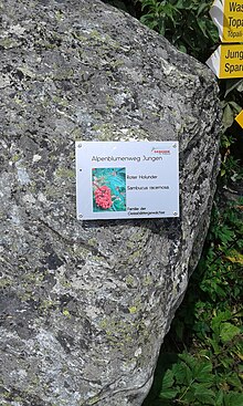
From the mountain hut of Jungeralp which is at an altitude of 1989 m above sea level. M. is located at the northern end of the Junge settlement, the trail leads through sparse larch forest and after 449 m along a high, beautiful dry stone wall over the tree line to the Jungtal at 2387 m above sea level. M. The mostly still well-preserved dry stone wall was built between 1926 and 1932 for afforestation so that the game and especially the goats could not reach the young trees. The ascent of the Jungtalweg remains moderate, so that after a total of 2.44 km you reach the stables of the Jungtalalp, where you can also get fresh milk and cheese. Junge is one of the Alps in the canton of Valais, whose natural cheese is “1A” quality and therefore has the “Raclette du Valais AOP” brand or the name “Junge” embossed or as a relief on the side of the cheese (the “cylinder wall”, so to speak) of the loaf can carry. Along the Jungtalweg there are over 80 boards that describe the diverse alpine flora with photos and text, so that the way from Junge to Jungtal is also known as the Alpine Flower Path.
Jungtal - Topalihütte
From the alpine hut and the stables of the Jungtal ( 2387 m ) the Weisshornweg first goes to an altitude of 2417 m and after 128 m it stretches along the left flank of the valley to the end of the Jungtal, from where it rises more strongly and aims towards the large moraine, which goes down from the Wasu ( 3343 m ) and Festihorn ( 3092 m ) massifs . After 3.03 km, the hiking trail crosses the Jungbach at an altitude of 2760 m , where there is a last major ascent to an altitude of 3114 m above sea level. M. zur Wasulicke must be mastered ( Wasu and Licke, Valais German for piece of lawn and gap ), before the descent to the Topalihütte to an altitude of 2674 m M. can be done. After a total of 4.8 km on the Wasulicke, there is a wonderful view of the Brunegghorn and the wild eastern slopes of the Barrhorn of the Weisshorn group as well as the Mischabel opposite . From the Wasulicke the path follows to the upper Wasmutälli at an altitude of 2970 m above sea level. M. ( Wasmu and Tälli Valais German for lawn and valley form ) and then to the Stelline at an altitude of 2765 m above sea level. M. , crosses the moraines under the Stelligletscher and then climbs slightly back to the Topalihütte. The distance from the stables of Jungtalalp to the Topalihütte is 8.08 km.
Topali Hut - Randa
Attention: This section of the route has been officially closed since 2019. The ascent from Herbriggen is possible, the ascent from Randa "remains closed".
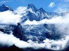
From the Topalihütte ( 2674 m above sea level ) in a southerly direction, the Weisshornweg first rises to an altitude of 2714 m above sea level. M. to the junction to Schöllijoch ( 3343 m ). After these 524 m it leads in constant up and down, tending to sloping, around the ridge-ridge corner Abberg and via the Mulde Tälli under the Schwarzhorn ( 2985 m ) to an altitude of 2222 m above sea level. M. to Guggiberg, from where the high path continues above the Randa mountain drop . After 5.51 km at an altitude of 2230 m above sea level. M. past the junction towards Guggini ( 2077 m ) and after a total of 7.64 km at Längenflueberg at an altitude of 2378 m above sea level. M. past the fork in the direction of Bodmen ( 2235 m ) and to the "Kastel" viewpoint ( 2830 m ), it finally only goes down to Randa at an altitude of 1406 m . The hiker will u. a. rewarded with a wonderful view of the Bis glacier in the Weisshorn group . Bridges help over the creeks of the trenches of the Tummigbach (after 2.87 km at 2634 m above sea level ) or Holzzüji (after a total of 4.41 km at 2319 m above sea level ) and Rossogeneji (after a total of 6.98 km at 2307 m above sea level ). The total distance from the Topalihütte to the Randa train station is 11.85 km.
Route planning
The sections under the Bis glacier to the Weisshornhüttenweg and Weisshornhütte and on to Zermatt have unfortunately not yet been implemented. The maintenance of the existing sections is also questionable, as the area to the east of Weisshorn, Bishorn and Brunegghorn is at high risk of landslides. In addition, the restoration of the Europaweg on the opposite side of the Mattertal initially caused high costs, so that the financing of the further expansion of the Weisshornweg is questionable.
conditions
Although the more delicate parts of the "Jungtal - Topalihütte" and "Topalihütte - Randa" sections of the Weisshornweg are secured with hand chains and fixed ropes, these two sections are only recommended for experienced and persevering hikers who are rated with difficulty T4 .
Refreshments
- Topali Hut ,
- Boys as well
- St. Niklaus Dorf and Randa .
literature
- Christian Imboden: Mountains: job, calling, fate. The St. Niklaus mountain guides as pioneers of international alpinism . Rotten Verlag , Visp 2013, ISBN 3-907624-48-3 . (Chapter First camps and accommodations in the Alps known in writing for mountaineers from the lowlands, as well as high alpine huts around the Nikolaital ).
Web links
Individual evidence
- ^ Website of the Topalihütte: Section blocked. Retrieved March 25, 2020 .
- ↑ Specifications of the Valais Raclette, Swiss Confederation, Federal Department of Economics, Education and Research. Federal Office for Agriculture FOAG, Quality and Sales Promotion Department, August 24, 2015.
- ^ Website of the Topalihütte, section "Approaches": route section closed. Retrieved March 25, 2020 .
- ↑ Video hike to the Kastel viewpoint (online)


