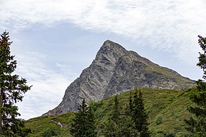
Wetterspitze (Aggls-Rosskopf-Kamm)
| Weather tip | ||
|---|---|---|
|
Wetterspitze photographed from the Kalcher Alm |
||
| height | 2709 m slm | |
| location | Aggls-Rosskopf-Kamm, between the Pflersch and Ridnaun valleys | |
| Mountains | Stubai Alps | |
| Dominance | 3 km → Winkeljochspitze | |
| Notch height | 195 m ↓ Maurerscharte | |
| Coordinates | 46 ° 55 '53 " N , 11 ° 19' 14" E | |
|
|
||
| First ascent | First tourist ascent: August 7, 1889 by Julius Pock | |
| Normal way | Over the northwest ridge of the Mauerscharte | |
The Wetterspitze ( Italian Cima del Tempo , 2706 m slm ) is a mountain in the Stubai Alps in South Tyrol . It is located in the Aggls-Rosskopf-Kamm, a mountain range between the Pflersch Valley in the north and the Ridanna Valley in the south. The summit is quite easy to reach from both valleys and is often climbed as part of a ski tour in winter . It is a good vantage point for the Tribulaun (such as the Pflerscher Tribulaun ) towering on the northern side of the Pflersch Valley .
Climbs
The usual ascent finally leads from the 2511 m high Maurerscharte (also Maurerspitzscharte ) to the summit in half an hour. This notch can be reached in 3½ hours from the Wiesen district in the Ridnaun Valley or in 4 hours from Innerpflersch. An alternative option is the somewhat more difficult climb from the Edelweißhütte over the eastern flank, for which three hours must be planned. All described climbs are marked .
Literature and map
- Walter Klier : Alpine Club Guide Stubai Alps. Bergverlag Rudolf Rother , Munich 2006, ISBN 3-7633-1271-4


