Pflerscher Tribulaun
| Pflerscher Tribulaun | ||
|---|---|---|
|
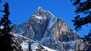
Pflerscher Tribulaun from the south |
||
| height | 3097 m above sea level A. | |
| location | Tyrol , Austria and South Tyrol , Italy | |
| Mountains | Stubai Alps | |
| Dominance | 6.3 km → Schneespitze | |
| Notch height | 498 m ↓ Pflerscher Scharte | |
| Coordinates | 46 ° 59 ′ 7 ″ N , 11 ° 20 ′ 20 ″ E | |
|
|
||
| Type | Rock peaks | |
| rock | Dolomite, lime | |
| First ascent | 1874 | |
| Normal way | South flank ( III- ) | |
|
Pflerscher Tribulaun from northwest ( Habicht ) |
||
|
From the southwest |
||

The Pflerscher Tribulaun is 3097 m above sea level. A. high mountain in the Stubai Alps . It is considered one of the most important climbing mountains in this mountain range.
topography
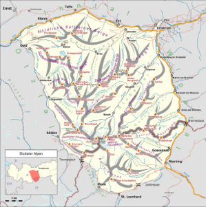
The mountain is the highest point of the Tribulaun ridge , a section of the main Alpine ridge . To its north lies the Gschnitztal in the Austrian State Tyrol , in the south the to South Tyrol associated Pflerschtal . In the northwest the ridge runs behind the Sandesjoch to Goldkappl ( 2793 m ), in the northeast the Tribulaunscharte is joined by the 2946 m high Gschnitzer Tribulaun . The Pflerscher Tribulaun is characterized on all sides by steep rock faces, which are among the highest in the Stubai Alps. To the east of the summit, the mountain is split by a deep chasm, on the other side of which lies the slightly lower eastern summit of the mountain. According to legend , this chasm was carved into the rock by a mighty mountain king to protect a persecuted miner. The king of the valley, who oppressed and persecuted the miner, was petrified as punishment. Due to its split appearance, the tribulaun in the Gschnitztal was also called "Die Schaar" (The Scissors).
geology


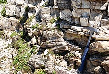
Like its neighboring mountains, the mountain is mainly made up of main dolomite from the Triassic . The carbonates form a sequence of layers several hundred meters thick, which rests on a crystalline bedrock made of gneisses , amphibolites and phyllitic mica schists . The rock dolomite was not discovered by Déodat de Dolomieu in the Dolomites named after him, but here in the Tribulaun group.
Paths to the summit
Starting points for an ascent are the villages of Gschnitz in Tyrol and Pflersch in South Tyrol. The bases are the Austrian Tribulaunhütte ( 2064 m above sea level ) in the northeast and the Italian Tribulaunhütte (also Rifugio Cesare Calciati al Tribulaun , 2368 m slm ) on the Sandessee in the west.
With a normal route in difficulty III (UIAA) of Pflerscher Tribulaun to reach the most difficult peaks of the Stubai Alps belongs. In addition, like most of the other climbs, this path, which is secured in places with steel ropes, is extremely brittle and prone to falling rocks . It leads from Gschnitz or Pflersch to the Sandesjoch and on through the southern flank and a south-east running gorge to the summit.
Of the other climbs, the west ridge with difficulty III + is a popular route because of its relatively good rock quality. Several other mostly extremely dangerous alpine climbing routes lead through both the north and south walls in the V and VI. Degree. The east summit can be reached from the west summit (IV +), the north-east ridge from the Tribulaunscharte (IV) and the south-west face (III +) as well as several other routes in the IV. To VI. Degree can be achieved. A steep icy gully (IV) on the north side also leads to the notch between the two peaks .
history
The first attempts at ascent by English mountaineers with the help of Swiss guides are documented in 1869. Thereupon the Tribulaun was considered to be impassable until on September 21, 1872 Heinrich Waitzenbauer and the guide G. Pittracher reached the east summit. In 1874, Johann Grill ( der Kederbacher ) and the Munich tourists G. Hofmann and N. Winhart finally managed to climb the main summit from Gschnitz via today's normal route, with Grill and Hofmann climbing barefoot. G. Pittracher, who originally set out with the group, stayed behind on the way. A year later, the mountain was climbed from Pflersch for the first time, opening up the most popular climb to date.
literature
- Heinrich and Walter Klier : Alpine Club Guide Stubai Alps . Rother Bergverlag, Munich 1980, ISBN 3-7633-1212-9 , p. 240-248 .
- Andreas Orgler : Climbing in the Stubai Alps and in the Valsertal valley . Panico Alpinverlag, 1992, ISBN 978-3-926807-21-2 , p. 150-179 .
- Egon Bernabè: Petrological and thermobarometric investigations on the Pflersch metabasite complex (Pflerschtal, South Tyrol - Italy) . Innsbruck, Univ., Diploma thesis, 2009, 125 pages
- Georg Hofmann: First ascent of the Great Tribulaun magazine of the German and Austrian Alpine Club, 1875
Web links
Individual evidence
- ↑ Clem Clements, Jonathan de Ferranti, Eberhard Jurgalski , Mark Trengove: The 3000 m SUMMITS of AUSTRIA - 242 peaks with at least 150 m of prominence , October 2011, p. 12.
- ↑ Federal Office for Metrology and Surveying Austria: Pflerscher Tribulaun on the Austrian Map online (Austrian map 1: 50,000) .
- ^ Günther Ennemoser: Gossensaß Brenner Pflersch . Athesia, Bozen 1984, ISBN 88-7014-344-9 , p. 143-144 .
- ^ A b Ludwig Purtscheller : The Stubai Group . In: Eduard Richter, German and Austrian Alpine Association (ed.): The development of the Eastern Alps . tape II . Publishing house of the German and Austrian Alpine Club, Berlin 1894, p. 410-414 .
- ↑ Tiroler Höhenweg Alta Via-Tiroler Höhenweg. (PDF; 1.7 MB) Compass Maps , accessed on April 4, 2009 .
- ↑ Recording report geological map. (PDF; 661 kB) (No longer available online.) Federal Geological Institute, formerly in the original ; Retrieved April 4, 2009 . ( Page no longer available , search in web archives ) Info: The link was automatically marked as defective. Please check the link according to the instructions and then remove this notice.
- ↑ Otto Meier: Studies on the tectonics of the Tauern window frame on the burner. (PDF; 4.4 MB) Retrieved April 4, 2009 .
- ^ Günther Ennemoser: Gossensaß Brenner Pflersch . Athesia, Bozen 1984, ISBN 88-7014-344-9 , p. 62-64 .


