Gold cap
| Gold cap | ||
|---|---|---|
|
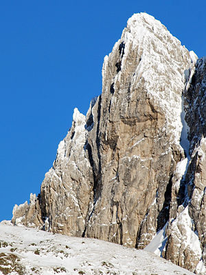
Goldkappl from the south |
||
| height | 2793 m above sea level A. | |
| location | Tyrol ( Austria ) / South Tyrol ( Italy ) | |
| Mountains | Stubai Alps | |
| Dominance | 0.72 km → Pflerscher Tribulaun | |
| Notch height | 103 m ↓ notch to the tribulaun | |
| Coordinates | 46 ° 59 '18 " N , 11 ° 19' 47" E | |
|
|
||
| Type | Rock peaks | |
| rock | Dolomite , carbonates | |
| First ascent | 1889 H. Unterwurzacher, Meynow, L. Treptow and J. Windisch | |
|
Goldkappl from the northeast |
||
The Goldkappl is a 2793 m above sea level. A. high mountain in the Stubai Alps on the border between Austria and Italy . It is considered an important climbing mountain .
Location and surroundings
The Goldkappl is part of the Tribulaunkamm, a section of the main Alpine ridge that separates the Tyrolean Gschnitztal in the north from the South Tyrolean Pflerschtal in the south. To the west the ridge continues to the Pflerscher Scharte ( 2599 m ), to the east lie the Sandesjoch , the Pflerscher Pinggl and in the further course of the ridge the Pflerscher Tribulaun .
Both to the south and to the north, the Goldkappl slopes down with steep rock faces up to 400 meters high. The east ridge to the Sandesjoch has three distinctive rock towers called (from west to east) Mühlsteiger , Jud and Fleckinger or Flöckinger towers .
Important tourist bases in the area are the Italian Tribulaunhütte (also Rifugio Cesare Calciati al Tribulaun ) ( 2368 m slm ) on the Sandessee in the southwest of the mountain and the Austrian Tribulaunhütte ( 2064 m above sea level ) in the northeast.
geology
Like its better-known neighbor, the Pflerscher Tribulaun , the Goldkappl consists mainly of main dolomite from the Triassic . The metamorphically shaped sediments lie discordantly on crystalline rock consisting of gneisses , amphibolites and phyllitic mica schists .
Alpinism
The Goldkappl was first climbed in 1889 by H. Unterwurzacher, Meynow, L. Treptow and J. Windisch from the south and further over the east ridge . This ascent is rated with difficulty III (UIAA) , as is the west ridge and the path from Sandesjoch over the east ridge, which Otto Ampferer and C. Berger first started in 1899 . Another ascent leads in difficulty IV-V through the north face.
The south face of the Goldkappl is considered to be particularly important, which was considered a major unsolved problem in the 1930s and where several well-known climbers such as Matthias Auckenthaler failed. In 1936 Matthias Rebitsch and Hans Frenademetz managed the first ascent after Rebitsch had survived an extremely long fall. The attempted by Rebitsch in his fall line could still not be increased, until 1963 succeeded Walter Spitzenstätter and Robert Trojer the first free ascent of the south face Gold Kappl (VI +). The Route Veitstanz (VII), opened in 1983 by Hans Kammerlander and Hanspeter Eisendle, is another significant ascent.
There are also several challenging routes up to the VII level of difficulty leading through the southern slopes of the Mühlsteiger, Jud and Fleckinger towers.
literature
- Heinrich and Walter Klier : Alpine Club Guide Stubai Alps . Bergverlag Rother , Munich 1980, ISBN 3-7633-1212-9 , p. 234-239 .
Web links
Individual evidence
- ^ Egon Bernabè: Petrological and thermobarometric investigations on the Pflersch metabasite complex (Pflerschtal, South Tyrol - Italy) . Innsbruck, Univ., Diploma thesis, 2009, 125 pages
- ↑ Andreas Orgler : Climbing in the Stubai Alps and in the Valsertal Basin . Panico Alpinverlag, 1992, ISBN 978-3-926807-21-2 , p. 171-175 .


