Wild Mannle
| Wild Mannle | ||
|---|---|---|
|
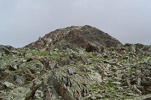
Wildes Mannle summit (southern ascent) |
||
| height | 3023 m above sea level A. | |
| location | Tyrol , Austria | |
| Mountains | Ötztal Alps | |
| Coordinates | 46 ° 52 '31 " N , 10 ° 53' 38" E | |
|
|
||
The Wilde Mannle is 3023 m above sea level. A. (according to other information 3019 m above sea level ) high mountain in the Ötztal Alps in Tyrol .
The summit is located southeast of the Wildspitze above Vent and delimits the basin of the Rofenkarferner from the east, which has since shrunk significantly. The rock head can be reached as an easy mountain tour from the Breslauer Hütte in 1½ hours. The ascent directly from the Stablein mountain station of the Vent cable car can be done in 2 hours. A circular route with start and finish point Stablein over the Wilde Mannle and the Breslauer Hütte can be done in 5½ hours.
In the meantime a second cable car (six-seater chairlift "Wildes Mannle"), which leads from Stablein to an altitude of about 2640 m, has been put into operation. This shortens the ascent from Stablein by an hour.
Literature / maps
- Alpine Club Map 1: 25,000, sheet 30/6, Ötztal Alps, Wildspitze
- Kompass hiking map 1: 25,000, sheet 042, Inneres Ötztal, Gurgler Tal, Venter Tal, Pitztal , ISBN 3-85491-600-0
- Henriette and Walter Klier : Rother hiking guide Ötztal , Bergverlag Rother , Munich 2007, ISBN 978-3-7633-4094-1
Individual evidence
- ^ Austrian Map online 1: 50,000 (ÖK 50) of the BEV
- ^ Walter Klier : Alpine Club Guide Ötztal Alps . Bergverlag Rother . Munich 1993. ISBN 3-7633-1116-5
- ^ Mountain railway in Vent - Ötztal, Tyrol, Austria. Retrieved July 1, 2019 .


