
Windischenbach (Pfedelbach)
| Windischenbach | ||
 View from Weißlensberg over the Windischenbach and the village. In the background the large district town of Öhringen. |
||
| Data | ||
| Water code | DE : 238678726 | |
| location |
Swabian-Franconian forest mountains
|
|
| River system | Rhine | |
| Drain over | Pfedelbach → Ohrn → Kocher → Neckar → Rhine → North Sea | |
| source | About 2.5 km southwest of the center of Pfedelbach in the Holzklinge . 49 ° 9 ′ 41 ″ N , 9 ° 28 ′ 48 ″ E |
|
| Source height | approx. 326 m above sea level NN | |
| muzzle | on the southern edge of the Öhringen development from the left in the Pfedelbach Coordinates: 49 ° 11 ′ 21 ″ N , 9 ° 29 ′ 50 ″ E 49 ° 11 ′ 21 ″ N , 9 ° 29 ′ 50 ″ E |
|
| Mouth height | approx. 224 m above sea level NN | |
| Height difference | approx. 102 m | |
| Bottom slope | approx. 28 ‰ | |
| length | 3.7 km | |
| Catchment area | approx. 5 km² | |
| Communities | Pfedelbach | |
The Windischenbach is a creek in northeastern Baden-Württemberg of 3.7 km in length, which flows into the Pfedelbach from the left on the southern edge of Öhringen .
geography
Source and history
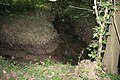
The Windischenbach arises on the northern slope of the Keuper Mountains of the Mainhardt Forest to the Hohenlohe level . In the municipality of Pfedelbach it rises about 2.5 km southwest of the center of the central town at 326 m above sea level. NN above in the wooded wooden blade .
The creek runs through this blade , deepening quickly, to the north and after half a kilometer it reaches the border with the open field. On the left is the Windischenbacher * Klingenhof , a farm in the district of Windischenbach in the municipality of Pfedelbach in Hohenlohekreis, next to which the stream runs through a pond over 0.1 hectare in size , over which fruit trees stretch up the flat slope in the west on the right bank the lower limit of the forest on the steeper castle hill follows the brook for another half a kilometer.
Then the Windischenbach breaks away from the forest and, accompanied by a dense gallery of trees along the banks, takes a curve to the northeast, briefly touching an isolated and marshy sloping forest below the Burghof residential area. The now less prominent right edge of the Wolfsbühl , northeast foothills of the Burgberg , follows the brook almost to the Windischenbacher Friedhof, the valley basin becomes noticeably wider on this section and the water at the end flows again in a northerly direction. A little after the cemetery, the brook reaches the southern outskirts of Windischenbach, where an inconsistently water-bearing ditch about 1.2 km long, except at the lowest course, flows from the left. In the village, the Windischenbach runs underground, piped under the Bachstrasse, here soon another, similarly long inlet flows to it from the west, which arises between Lindelberg in the south and Golberg in the north and flows along a dirt road through the Klingenfeld in a ditch.
Already in the industrial zone on the northern edge of Windischenbach, it turns again to the northeast, is again fed by an inconsistent inflow of about 0.8 km in length from the left, which reaches in the area of the Golberghöfe, and then leaves the village and community of Pfedelbach, soon accompanied by a row of trees in a narrow green strip between fields on the slope to the right and left. On the southern edge of Öhringen's development , it takes up two more unstable water-bearing field ditches from the left and right and then joins the industrial area around the Steinsfeldle from the left after a run of 3.7 km to about 224 m above sea level. NN in the Pfedelbach .
Catchment area
The Windischenbach has a catchment area of about 5.0 km², which borders on the central Brettach in the west and on that of the receiving Pfedelbach in the east . From the mouth in the northeast, the watershed runs south past the eastern end of Windischenbach, on a field path over the western slope of the Wolfsbühl , up to the spur of the Burgberg and then between Holzklinge and Lohklinge through the Buchenhau to the beginning of the corridor. Here it turns to the west and before the nearby drop in the Brettachtal to the northwest and runs across the wooded plain . Just east of the Rote Steige , it descends the Bergkanmm, passes Stöckig and the Eichelhalde to the east and then overcomes the Lindelberg to the east, transversely to its orientation.Then it changes over to the ridge line of the Golberg that extends northeast and reaches Verrenberg on the eastern Öhringer their northwesternmost point. From here it pulls back to the mouth in an easterly direction.
Only the Klingenhof, Windischenbach and part of the industrial area in the south of Öhringen, touched at the mouth, lie on the stream. In the further catchment area there are also Weißlensberg (left valley slope opposite the Burgberg ), the Burghof (right in under the Burgberg ridge in the transition to Wolfsbühl ), Lindelberg (on the eastern spur of the mountain of the same name) and the Golberghöfe (east of the Golberg foot); these are all in the Pfedelbacher district. On Öhringer there is also an emigrant farm in Scherersgrund .
geology
The course of the Windischenbach lies entirely in the Keuper . It arises in the lower colored marls ( Steigerwald Formation ) of the wooden blade , quickly cuts through a narrow band of sandstone reed ( Stuttgart Formation ) and then remains in the Gipskeuper ( Grabfeld Formation ) until its mouth .
The catchment area begins further south and higher in the silica sandstone ( Hassberge formation ) on the plateau around Buchhorn , which extends on both sides of the wooden blade to the spurs of the castle hill in the east and the left blade "cheek" south of Stöckig. This quite wide, the Burgberg less wide, is a leveling area in the reed sandstone in front of it, such areas also cover the Lindelberg and the Golberg . The larger remaining part of the catchment area lies in the gypsum keuper, which is overlaid by loess , especially on the lower slope in the lower half of the course .

The valley floodplain of the Windischenbach, below the industrial area. Seen from Öhringen

The floodplain of the Windischenbach, seen above Windischenbach in the direction of Klingenhof
The mouth of the Windischenbach in the Pfedelbach. On the southwestern outskirts of Öhringen


Individual evidence
- ↑ Estimated from the contour lines of the TK25.
- ↑ Interpolated according to the contour line image on the TK25.
- ↑ According to LUBW-FG10 (data record entry).
- ↑ Measured on the TK25.
- ^ Geology according to GK50-SFW.
literature
- "TK25": Topographic map 1: 25,000 Baden-Württemberg North, as single sheet no. 6823 Pfedelbach
- "GK50-SFW": Geological map of the Swabian-Franconian Forest Nature Park 1: 50,000, published by the State Office for Geology, Raw Materials and Mining Baden-Württemberg, Freiburg i. Br. 2001
Web links
Geoportal Baden-Württemberg ( information ), especially with the partial maps / layers
- the State Institute for the Environment, Measurements and Nature Conservation Baden-Württemberg (LUBW)
- "LUBW-FG10": River 1: 10,000
- "LUBW-SG10": Standing water 1: 10,000
- "LUBW-GEZG": water catchment areas
- of the State Office for Geology, Raw Materials and Mining of the State of Baden-Württemberg (LGRB)
- "LGRB-GÜK300": Geological overview map 1: 300,000