Wipe
Coordinates: 52 ° 49 ′ 0 ″ N , 11 ° 53 ′ 0 ″ E
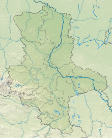
Wische (derived from Low German for 'meadow') is the name of a landscape in the northeast of the Altmark in Saxony-Anhalt . It is a former flood area of the Elbe .
geography
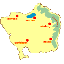
The Wische lies west of the Elbe and east of the river Milde-Biese-Aland . The towns of Seehausen and Osterburg are on the western edge, while the town of Werben is in the northeast . In the south, the Arneburger Höhe limits the area. The wipe is around 22 meters above sea level . The north of the Wisps is also known as the Sheaf .
Part of the Wische belongs to the Seehausen (Altmark) community . One of its member communities is called Altmärkische Wische . The area is flat and criss-crossed by numerous ditches. It is lower than the mean high water level of the Elbe. The Aland therefore flows backwards when the Elbe floods. Due to the floods, the land is very fertile, but the soil is also so heavy that farm implements often get stuck in the silt after fresh rain. Most of the Wische Villages are Marshhoof Villages .
history
Geographically, the Wische was created around 130,000 years ago in the final phase of the Saale complex . It has a special geological position in the Altmark: It is the remainder of an ice age, 275 square kilometers large meltwater lake of the Berlin-Hamburg glacial valley . Fine-grained clays were created by deposits of Elbe water, making the area very fertile.
From 1150 the Dutch built a dike between Altenzaun and Beuster , which separated the Elbe from the Wische and made agriculture possible there. Often it was not possible to use horses so that field work had to be stopped or done by humans. A “wiper sledge”, a mud slide made of planks, was often used to transport loads. Steam plows were used longer than in other German regions to prepare the deep soil for sugar beet cultivation . After the Second World War, there was a lack of labor to cultivate the land, so that the trenches silted up. 1958 to 1962 large parts of the trenches were cleared as a youth object of the FDJ . At the same time, livestock farming projects were started to reduce dependence on risky agriculture.
Flora and fauna
Numerous falcons and white storks live in the area .
literature
- Fritz Täger: The Altmark. Sachsenverlag, Dresden 1960, pp. 71–83.
Web links
Individual evidence
- ↑ The Altmärkische Wische at werben-elbe.de , accessed on July 1, 2014
- ^ Fritz Täger: The Altmark . Sachsenverlag, Dresden 1960, p. 73.
- ^ Fritz Täger: The Altmark . Sachsenverlag, Dresden 1960, p. 72.
- ^ Fritz Täger: The Altmark . Sachsenverlag, Dresden 1960, p. 74.
- ↑ Steam plows in the Wische ( Memento from January 22, 2012 in the Internet Archive )
- ^ Fritz Täger: The Altmark . Sachsenverlag, Dresden 1960, pp. 78–80.


