Zezere
| Zezere | ||
|
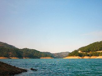
The Lago Azul , between Ferreira do Zêzere and Vila Rei, part of the Castelo de Bode dam system |
||
| Data | ||
| location | Central Portugal | |
| River system | Tagus river | |
| Drain over | Tejo → Atlantic | |
| Source height | 1900 m | |
| muzzle |
Tagus Coordinates: 39 ° 28 ′ 30 " N , 8 ° 20 ′ 27" W 39 ° 28 ′ 30 " N , 8 ° 20 ′ 27" W.
|
|
| length | 200 km | |
| Catchment area | 5043 km² | |
| Left tributaries | see below | |
| Right tributaries | see below | |
| Reservoirs flowed through |
Cabril dam Bouçã dam Castelo do Bode dam |
|
| Small towns | Constância | |
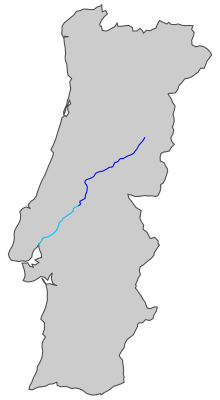
The Zêzere is an approximately 200 km long right tributary of the Tejo in central Portugal .
course
It rises at an altitude of around 1900 m in the Serra da Estrela , below the Cântaro Magro summit (near Manteigas ). On its approximately 200 km long way to the south it passes various foothills of the Iberian Scheidegebirge and wooded areas, feeds three reservoirs, and passes various, mostly smaller villages, including the well-known village of Dornes . At Constância it finally flows into the Tejo.
Tributaries
The most important tributary is the Rio Nabão , with its own catchment area of 1056 km².
|
|
Power plants and reservoirs
Looking downstream, the Zêzere is dammed by the following power plants:
| power plant | operator | Max. Power (MW) | Reservoir | Surface (km²) | Volume (million m³) |
|---|---|---|---|---|---|
| Cabril | EDP | 97 | Cabril | 20.23 | 720 |
| Bouçã | EDP | 50 | 5 | 48.4 | |
| Castelo do Bode | EDP | 139 | Castelo do Bode | 32.91 | 1,095 |
meaning
The Zêzere is the second largest river in Portugal after the Mondego . With its three dams and reservoirs Cabril , Bouçã and Castelo do Bode, it is important for both electricity and water supply. In particular, the Castelo do Bode dam, completed in 1951 , whose reservoir extends upwards from its dam at Martinchel for several kilometers, supplies part of the electricity and water requirements of the capital Lisbon.
The Zêzere offers numerous water sports, especially on its lakes. In addition, the wooded riverside areas are considered recreational areas. The Zêzere is one of the most popular Portuguese rivers for canoeing .
After the water quality of the Zêzere was found to be below average by the Portuguese national water institute INAG ( Instituto Nacional da Água ) until the mid-2000s , a large number of measures to increase the quality have been carried out since then. The moderately severe adverse effects from heavy metals originate from wastewater from ore mines in the upper reaches of the river. From around Dornelas do Zêzere , the loads in the water of the Zêzere decrease noticeably.
The river is the eponymous reference point for a large number of places and regional organizations, including the district town of Ferreira do Zêzere .
Web links
- Visitor website for the region around the river (multilingual)
- Pictures of the Rio Zêzere on Flickr
Individual evidence
- ^ Entry on Zêzere in the Infopédia , the online encyclopedia of the Porto Editora , accessed on December 15, 2013
- ↑ Centro Náutico do Zézere ( Memento from 20090622223704) (Portuguese and English), accessed on December 15, 2013
- ↑ Portuguese website for canoe tourism ( Memento of the original from July 23, 2013 in the Internet Archive ) Info: The archive link was inserted automatically and has not yet been checked. Please check the original and archive link according to the instructions and then remove this notice. , accessed December 15, 2013
- ↑ Dossier on the river ( Memento from December 15, 2013 in the Internet Archive ) as a pdf download at www.serrasonline.com (port.), Accessed December 15, 2013

