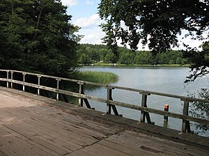
Zermützelsee
| Zermützelsee | ||
|---|---|---|

|
||
| Zermützelsee from the Stendenitzer Bridge | ||
| Geographical location | Brandenburg | |
| Tributaries | Rhin | |
| Drain | Rhin | |
| Places on the shore | Zermützel | |
| Location close to the shore | Neuruppin | |
| Data | ||
| Coordinates | 53 ° 0 '43 " N , 12 ° 49' 53" E | |
|
|
||
| Altitude above sea level | 38.3 m above sea level NHN | |
| surface | 1.2 km² | |
| length | 2.18 km | |
| width | 600 m | |
| Maximum depth | 7 m | |
| Middle deep | 4 m | |
The Zermützelsee is located in the Ostprignitz-Ruppin district in the north of Brandenburg in the middle of Ruppin Switzerland and is north of the core area of Neuruppin between the Tornowsee and the Tetzensee .
The Stendenitz Forest Museum is located on the west side of the lake . On the east side is Zermützel , a district of Neuruppin. The Rhin , a right tributary of the Havel , flows through the lake .
The Zermützelsee has a water surface of about 1.2 km². It is about four meters deep on average, at its deepest point it is seven meters deep. Various types of fish such as eels , pike , pikeperch , catfish , perch , carp , tench and white fish can be found in the lake .
See also
Web links
Commons : Zermützelsee - Collection of images, videos and audio files
- Zermützelsee on mein-badesee.de
Individual evidence
- ↑ Neuruppiner Gewässer / Berliner Gewässer in brief information on hobby-angeln.com
Panorama from the campsite

