
Zugerberg
| Zugerberg | ||
|---|---|---|
 Zugerberg and the city of Zug |
||
| height | 1039 m above sea level M. | |
| location | Canton of Zug , Switzerland | |
| Dominance | 2.74 km → Brandflue | |
| Notch height | 81 m ↓ Eigenried | |
| Coordinates | 683 626 / 221836 | |
|
||
| rock | Subalpine molasses | |

The Zugerberg is a mountain ridge in the Swiss canton of Zug with a maximum height of 1039 m above sea level. M. , the highest point is called Hünggigütsch .
mountain
The Zugerberg lies on the east bank of the Zugersee , west of the Lorzen and Hürital . It consists of folded subalpine molasses that are pushed up in the southernmost part . South includes, without significant saddle already to the municipality Walchwil belonging Grossmatt Tolle ( 1165 m above sea level. M. , location ) on. The city train , one of which is also the Zugerberg, situated at the foot of the mountain - the mountain is considered mountain town.
The Zugerberg is a popular destination, accessible by road or by funicular the Zugerbergbahn (ZBB) from the valley station Schönegg (train), which can be reached directly using the number 11 bus from the railway train. The mountain railway takes you to 926 m above sea level in around 6 minutes . M. and transports around 300,000 people per year.
A road connection leads over the Zugerberg from Zug to Unterägeri over a pass called Sätteli ( Lage ) at 975 m above sea level. M. This street is closed to private motorized traffic on weekends.
Zugerberg is a popular place for paragliders, especially in summer when the wind is good from the west . Good thermal updrafts form on the slopes and often allow flying until late in the evening.
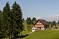
The boarding school Institut Montana is located on the Zugerberg .
history
In 1916, during the First World War , Switzerland took in over 12,000 prisoners of war of various nationalities. As war wounded, they were housed in various climatic health resorts in Switzerland until the end of the war in November 1918, including on the Zugerberg.
During the Second World War , the Zugerberg formed the reduit border . The Zugerberg barrier was built to defend this entrance to the Reduit.
From 1943 to 1988, there was a military penal institution on the Zugerberg in Frühebüel ( Lage ).
During the Soviet-Afghan war (1979–1988), Switzerland took eleven of the Soviet citizens captured by Afghan resistance fighters as prisoners of war because the resistance fighters were unable to treat the prisoners in accordance with the Geneva Conventions . This was done with the consent of both warring parties, and the accommodation was on the Zugerberg for two years.
In 1989, Frühebüel was converted into an ETH research station, the agricultural test farm Frühebüel.
Zugerberg moorland
The Zugerberg is inventory object No. 6 in the federal inventory of moor landscapes . Several moors lie on the high plateau of the Zugerberg, modeled by ice age glaciers, which is also shaped by the common land that dates back to the 16th century . The moors have been used for local peat extraction for centuries ; in the First World War, peat mining began in Eigenried on an industrial scale. This mining continued into the early 1980s. Today wooden sheds, called "turbenhouses", are a reminder of the peat mining. The turbenhouses were used to store the dried turben , as the cut peat portions were called.
photos

Institute Montana
Rear Geissboden

Moorland
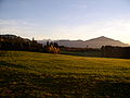
Moorland


Web links
- Renato Morosoli: Zugerberg. In: Historical Lexicon of Switzerland .
Individual evidence
- ↑ Zugerberg with Roman Koch ( Memento from April 20, 2008 in the Internet Archive )
- ↑ a b Hervé de Weck: Internments. In: Historical Lexicon of Switzerland .
- ^ A b Renato Morosoli: Walchwil. In: Historical Lexicon of Switzerland .
- ↑ Show in itself
- ↑ Agricultural trial operation Früebüel. Archived from the original on July 9, 2007 ; Retrieved December 29, 2009 .
- ↑ Katja Hürlimann: "Lack of wood" and "Lack of gravel"? - Resource management in the canton of Zug from the Middle Ages to today. (pdf, not searchable; 768 kB) p. 13 , accessed on December 30, 2009 .
- ↑ Peat extraction and peat utilization in the Sihlsee area - the craft of turpning. Retrieved December 30, 2009 .