Cyclones in Mauritius
Mauritius has been hit many times by devastating cyclones .
Important cyclones in the island's history
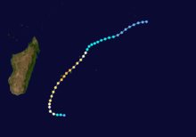
Every year around twelve cyclones occur in the Indian Ocean and last an average of three weeks. However, not all of them come to the island. The cyclones that affect Mauritius typically arise north or northeast of Mauritius between the 8th and 12th parallel . From there they move south and west on a parabolic curve before losing their destructive power between the 18th and 25th parallel. Mauritius itself is around the 20th parallel. Correspondingly, the wind direction in cyclones in Mauritius is east, south-east.
This section describes the cyclones that caused the greatest damage in Mauritius.
Before 1882
Since the island was uninhabited until the arrival of the Dutch, there are no reports of hurricanes from earlier times. In the Dutch colonial times, Mauritius was very sparsely populated. At the top 250 Europeans lived on the island. Accordingly, the coverage of the cyclones at that time is anecdotal. On February 4 and 5, 1644, what was described as a terrible storm swept over the island. The cyclone on February 9, 1695 was reported to have wave heights of 9 feet. The storm devastated the Flacq district in particular . Even after the French took over the colony in 1710, the island was still sparsely populated. Most of the storm damage now occurred in the capital Port Louis . In 1748 many houses in Port Louis, the hospital and Mon Plaisir in Pamplemousses and many bridges were destroyed. Three sailing ships that sank off Port Louis (the Le Brillant, La Renommée and Le Mars). The cyclones on February 27 and 28, 1760, February 23, 1768, January 14, 1787 and February 28, 1818 also caused severe damage to the entire colony.
1892
The cyclone that devastated the island on April 29, 1892 was unusually strong and caused enormous damage. 1200 people died and 50,000 were left homeless. The west of the island around the capital Port Louis was particularly hard hit by the devastation. Even massive stone buildings could not withstand the wind pressure. At its peak, wind speeds of over 120 miles / hour (192 km / h) were measured.
1945
In 1945 two cyclones reached the island. The first, from January 27-29, 1945, was the strongest since the great cyclone of 1892. In Port Louis, the barometer fell to 716.5 and the wind speed reached 124 mph. The north of the island in particular was devastated. In Rivière du Rempart , almost all the roofs were covered and the school was destroyed. In Poudre d'Or , the hospital was in Goodlands badly damaged the cinema. Grand Baie reported major damage to almost all buildings, especially the police station. But the damage in Flacq and Grand Port was also considerable.
Carol (1960)
As in 1945, the island was the scene of two cyclones. While Cyclone Alix (the hurricanes were named since 1960) was relatively light, Carol was far more destructive. 60% of the sugar cane harvest was destroyed. The government organized an emergency program and then a reconstruction program. As a result, for example, 200 houses were built in Grand Baie (the neighborhood is popularly known as Camp Carol).
Gervaise (1975)
Gervaise was the first major cyclone after independence. It also led to political disputes, as it became clear that the island could only repair the damage with help from abroad, especially from France and the USA. The storm with wind speeds of 174 miles / hour caused 10 deaths, hundreds of houses destroyed and dozens of ships sunk.
Hollanda (1994)
Cyclone Hollanda was the worst storm in Mauritius in 19 years. It formed on February 6, 1994 and reached Mauritius on February 10. Wind speeds of 155 km / h were measured. The storm destroyed 450 houses and left 1,500 people homeless. There were 2 deaths and losses of US $ 135 million.
Protective measures
In 1774 the first scientific weather recordings were made by N. de Céré, director of the botanical garden in Pamplemousses. Systematic weather observation in Mauritius began with the opening of a military observatory in Port Louis in 1832. In 1851 the Société de Météorologie was founded in Mauritius. In 1858 it was decided to replace this with a civil observatory. In 1874 the Royal Alfred Observatory in Pamplemousses officially opened. The observatory under its first director Ch. Meldrum was organizationally set up as a department of the governor's office. It was in service until 1961. In 1902 a weather station was opened on Rodrigues. In 1925 the central weather station in Vacoas was opened.
After 1945, a cyclone insurance than was natural hazard insurance (Cyclon Insurance Scheme) mandatory. Other weather observation stations have also been set up in the country.
A few years before Cyclone Carol, the government's Meteorological Department reorganized the warning system. Since then, there have been four warning levels for impending cyclones. The radio warnings are given to the population in four languages (English, French, Creole and Hindi) in order to reach all citizens.
Satellite images have been used in Vacous for the early detection of storms since 1968, and in 1977 an altitude radar was set up in Trou-aux-Cerfs.
literature
- Emmanuel Richon: Cyclones à Maurice, 2011, ISBN 9789994930081
Web links
Individual evidence
- ^ Jacob Haafner : Journey to Bengal and return journey to Europe . Mainz 2004. Chap. 19 and 20, pp. 188-201. - Detailed description of the signs, the course and the consequences in Port Louis. The original Dutch edition was published in Amsterdam in 1822.
- ↑ Allister Macmillan (Ed.): Mauritius Illustrated: Historical and Descriptive, Commercial and Industrial Facts, Figures, & Resources, 2000, ISBN 9788120615083 , p. 61, online


