gvSIG
| gvSIG
|
|
|---|---|

|
|
 gvSIG 1.0 |
|
| Basic data
|
|
| developer | gvSIG Association |
| Current version | 2.5 (November 6, 2019) |
| operating system | Windows , Linux , macOS |
| programming language | Java |
| category | Geographic information system |
| License | GPL ( Free Software ) |
| German speaking | Yes |
| gvsig.com | |
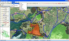
gvSIG (short for Spanish Generalitat Valencia Sistema de Información Geográfica ) is a free geographic information system . The program provides a variety of tools for the management of spatial data. Developers and users communicate via user lists and can thus actively participate in further development.
history
The Regional Office for Infrastructure and Transport (CIT), based in the Spanish province of Valencia , published a call for tenders in 2003 for the development of software for processing geographic data. The private company Iver won the tender and developed the prototype of gvSIG, in collaboration with the city government and the Jaume I University in Castellón de la Plana .
properties
gvSIG was developed in the Java programming language and is distributed under the GNU General Public License . The software is used as a desktop client, but is also often used as a client for GDIs . The following are the characteristics of the software:
- Platform-independent : The software is compatible with different operating systems: Windows , Linux and Mac .
- Modularity: New functions and extensions can be easily integrated, the program will continue to develop.
- Interoperable: gvSIG is able to read and write the common data formats, both free and proprietary data formats, such as ArcView , Microstation or AutoCAD . The data formats do not have to be changed during the work process. Data storage in a geographic database ( PostGIS , MySQL , Oracle , ArcSDE , HSQLDB ) is possible.
- The current version supports the following formats, among others:
- Standard-compliant: The current and future standards of the most important organizations are adhered to, as is done, for example, by the European Commission ( INSPIRE -RL) or the Open Geospatial Consortium (OGC).
gvSIG is able to process data from external servers, for example Web Map Service , Web Coverage Service , Web Feature Service , Web Catalog Service , Gazetter and ECWP Service. The free software gvSIG-Sextante and an interface to GRASS GIS expand the functionality of gvSIG by over 500 modules for raster and vector data analysis. In 2008 the first prototype of gvSIG Mobile was published.
A variant based on gvSIG is gvSIG Oxford Archeology Edition 2010, which has a slightly modified surface and has already integrated several extensions, including SEXTANTE.
Web links
Individual evidence
- ↑ Downloads. In: gvsig.com. Retrieved March 19, 2020 .
