Pörböly: Difference between revisions
Article expanded, stub (hopefully) removed, vikification. |
|||
| (5 intermediate revisions by 5 users not shown) | |||
| Line 1: | Line 1: | ||
{{unreferenced|date=March 2020}} |
|||
{{Infobox settlement |
{{Infobox settlement |
||
|image_skyline = |
|image_skyline = |
||
| Line 27: | Line 28: | ||
|website = {{URL|www.porboly.hu}} |
|website = {{URL|www.porboly.hu}} |
||
}} |
}} |
||
'''Pörböly''' is a village in [[Tolna |
'''Pörböly''' is a village in [[Tolna County]], southern [[Hungary]]. |
||
==Geography== |
==Geography== |
||
The village lies in an agricultural flatland some 90 m above the sea level, 9 kilometres in the eastern direction is the river [[Danube]] and the town of [[Baja]]. Some 66 |
The village lies in an agricultural flatland some 90 m above the sea level, 9 kilometres in the eastern direction is the river [[Danube]] and the town of [[Baja, Hungary|Baja]]. Some 66 km ESE is Serbian town of [[Subotica]]. |
||
The floodplain forest belt along the Danube river, the [[Gemenc]] nature reserve, starts beyond the village with many [[oxbow lake]]s, canals and distributaries. Bird observation places can be reached from here. |
The floodplain forest belt along the Danube river, the [[Gemenc]] nature reserve, starts beyond the village with many [[oxbow lake]]s, canals and distributaries. Bird observation places can be reached from here. |
||
==Transport== |
==Transport== |
||
Hungarian highway M6 passes the town Bátaszék 9 |
Hungarian highway M6 passes the town Bátaszék 9 km westwards. State road Nr. 55 goes through the village as well as a railway connecting [[Bátaszék]] and [[Kiskunhalas]], both tracks cross the Danube eastwards to the town of Baja via the [[Türr István]] Híd what is the Hungarian southernmost Danube bridge. |
||
At the Pörböly railway station a narrow-gauge [[Bosnian-gauge railways|Bosnian gauge]] railway starts directing through the Danube forests northwards, the [[Gemenc State Forest Railway]]. |
At the Pörböly railway station a narrow-gauge [[Bosnian-gauge railways|Bosnian gauge]] railway starts directing through the Danube forests northwards, the [[Gemenc State Forest Railway]]. |
||
{{Tolna County}} |
|||
{{authority control}} |
|||
{{DEFAULTSORT:Porboly}} |
{{DEFAULTSORT:Porboly}} |
||
Latest revision as of 12:40, 12 December 2021
Pörböly | |
|---|---|
| Coordinates: 46°12′21″N 18°48′48″E / 46.20583°N 18.81333°E | |
| Country | |
| County | Tolna |
| Area | |
| • Total | 11.1 km2 (4.3 sq mi) |
| Population (2011) | |
| • Total | 541 |
| • Density | 49/km2 (130/sq mi) |
| Time zone | UTC+1 (CET) |
| • Summer (DST) | UTC+2 (CEST) |
| Postal code | 7142 |
| Area code | 74 |
| Website | www |
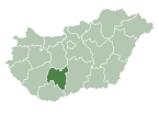
Pörböly is a village in Tolna County, southern Hungary.
Geography[edit]
The village lies in an agricultural flatland some 90 m above the sea level, 9 kilometres in the eastern direction is the river Danube and the town of Baja. Some 66 km ESE is Serbian town of Subotica.
The floodplain forest belt along the Danube river, the Gemenc nature reserve, starts beyond the village with many oxbow lakes, canals and distributaries. Bird observation places can be reached from here.
Transport[edit]
Hungarian highway M6 passes the town Bátaszék 9 km westwards. State road Nr. 55 goes through the village as well as a railway connecting Bátaszék and Kiskunhalas, both tracks cross the Danube eastwards to the town of Baja via the Türr István Híd what is the Hungarian southernmost Danube bridge.
At the Pörböly railway station a narrow-gauge Bosnian gauge railway starts directing through the Danube forests northwards, the Gemenc State Forest Railway.


