
Yeppoon: Difference between revisions
No edit summary |
added demographics section |
||
| (433 intermediate revisions by more than 100 users not shown) | |||
| Line 1: | Line 1: | ||
{{ |
{{Use Australian English|date=August 2019}} |
||
{{Use dmy dates|date=August 2022}} |
|||
| name = Yeppoon |
|||
{{GeoGroup}} |
|||
| state = qld |
|||
{{Infobox Australian place |
|||
| image = Yeppoon.JPG |
|||
| type = town |
|||
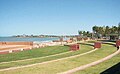
| caption = Yeppoon's Main Beach. |
|||
| |
| name = Yeppoon |
||
| state = qld |
|||
| postcode = 4703 |
|||
| |
| image = Yeppoon2011-15.JPG |
||
| caption = Looking across Keppel Bay from Wreck Point |
|||
| pop = 15,235<ref name="ABS"/> |
|||
| coordinates = {{coord|-23.1288|150.7444|type:city_region:AU-QLD|display=inline,title|name=Yeppoon (town centre)}} |
|||
| elevation= 6 |
|||
| |
| pop = 7037 |
||
| pop_year = {{CensusAU|2021}} |
|||
| mintemp = 18.5 |
|||
| pop_footnotes = <ref name=Census2021/> |
|||
| rainfall = 824.9 |
|||
| established = |
|||
| stategov = [[Electoral district of Keppel|Keppel]] |
|||
| postcode = 4703 |
|||
| fedgov = [[Division of Capricornia|Capricornia]] |
|||
| |
| area = 27.6 |
||
| |
| timezone = [[AEST]] |
||
| utc = +10:00 |
|||
| location1= [[Brisbane]] |
|||
| dist1 = 21.2 <!-- road distances as per template instructions --> |
|||
| dist2 = 42 |
|||
| |
| dir1 = NNW |
||
| location1 = [[Emu Park]] |
|||
| location2= [[Rockhampton, Queensland|Rockhampton]] |
|||
| |
| dist2 = 40.9 |
||
| |
| dir2 = NW |
||
| location2 = [[Rockhampton]] |
|||
| location3= [[Emu Park, Queensland|Emu Park]] |
|||
| dist3 = 672 |
|||
| dir3 = NNW |
|||
| location3 = [[Brisbane]] |
|||
| dist4 = |
|||
| dir4 = |
|||
| location4 = |
|||
| lga = [[Shire of Livingstone]] |
|||
| stategov = [[Electoral district of Keppel|Keppel]] |
|||
| fedgov = [[Division of Capricornia|Capricornia]] |
|||
| elevation = 6 |
|||
| maxtemp = 25.9 |
|||
| mintemp = 18.5 |
|||
| rainfall = 824.9 |
|||
| near-n = [[Barlows Hill, Queensland|Barlows Hill]]<br />[[Meikleville Hill, Queensland|Meikleville Hill]] |
|||
| near-ne = [[Farnborough, Queensland|Farnborough]] |
|||
| near-e = ''[[Coral Sea]]'' |
|||
| near-se = [[Cooee Bay, Queensland|Cooee Bay]] |
|||
| near-s = [[Taroomball, Queensland|Taroom Ball]]<br />[[Taranganba, Queensland|Taranganba]] |
|||
| near-sw = [[Hidden Valley, Queensland|Hidden Valley]] |
|||
| near-w = [[Barmaryee, Queensland|Barmaryee]] |
|||
| near-nw = [[Pacific Heights, Queensland|Pacific Heights]]<br />[[Inverness, Queensland|Inverness]] |
|||
}} |
}} |
||
'''Yeppoon''' ({{IPAc-en|j|ə|ˈ|p|uː|n}}) is a coastal town and [[Suburbs and localities (Australia)|locality]] in the [[Shire of Livingstone]], [[Queensland]], Australia.<ref>{{cite QPN|38658|Yeppoon|town|access-date=28 December 2015}}</ref><ref>{{cite QPN|48955|Yeppoon|locality|access-date=28 December 2015}}</ref> Yeppoon is renowned for its beaches, tropical climate, and the islands out on the bay. Located {{Convert|41|km}} from the city of [[Rockhampton]], Yeppoon is the [[Seat of government|seat]] of the Shire of Livingstone and the principal town on the [[Capricorn Coast]], a string of seaside communities stretching more than {{convert|150|km|mi}} from north to south. The beaches and shallow coves provide a destination both for tourists and retirees settling down in Central Queensland. Offshore, there are 27 islands including [[Great Keppel Island]] which is {{convert|20|km|mi}} from Yeppoon. In the {{CensusAU|2021}}, the locality of Yeppoon had a population of 7,037 people; this does not include any neighbouring suburbs.<ref name=Census2021/> |
|||
'''Yeppoon''' is a [[coast]]al [[resort]] town situated in [[Central Queensland]], [[Australia]]. The town is the [[Local government|administrative]] centre for the [[Livingstone Shire]]. Located on [[Keppel Bay]], at the 2006 [[Census in Australia|census]], Yeppoon had a population of 13,284.<ref name="ABS">{{Census 2006 AUS|id=UCL363000|name=Yeppoon (Urban Centre/Locality)|accessdate=2008-03-07|quick=on}}</ref> |
|||
== |
==Geography== |
||
{{further|Capricorn Coast}} |
|||
Yeppoon is located on [[Keppel Bay]] which opens to the [[Coral Sea]], around {{convert|700|km|mi}} north of the state capital, [[Brisbane]], and {{convert|40|km|mi}} from Rockhampton City. It is located within the local government area of [[Shire of Livingstone]] in [[Central Queensland]]. Between 2008 and 2013, it was within the [[Rockhampton Region]]). |
|||
The [[Rockhampton-Yeppoon Road]] (as Yeppoon Road) runs along part of the southern boundary.<ref>{{Google maps |url=https://goo.gl/maps/bsnKf1TSqpqHfyXs9 |accessdate=23 April 2022 |title=Yeppoon, Queensland}}</ref> |
|||
Yeppoon is the major town along the tourist strip of the [[Capricorn Coast]], and is around 700 [[Kilometre|km]] north of the state capital, [[Brisbane]], and 40 km from its nearest regional centre, the city of [[Rockhampton, Queensland|Rockhampton]]. Long stretches of [[beach]]es are the main [[tourist]] attraction, while the islands of the Keppel Group, in particular [[Great Keppel Island]], are another drawcard. The Rosslyn Bay boat harbour caters for professional and privately owned vessels and is a very popular place to raise a young family as well as those seeking a sea change. Yeppoons rapid population growth is a reflection of its very popular conditions |
|||
==History== |
|||
North of the town is the [[Byfield, Queensland|Byfield]] [[State Forest]] and [[Byfield National Park|National Park]]. The State Forest consists largely of [[pine]] plantations. The National Park is largely coastal and sand dune based geographical areas. It is popular with [[Four Wheel Drive]] enthusiasts. |
|||
The Capricorn Coast is part of the traditional lands of the [[Darumbal]] Aboriginal people. Yeppoon was first settled by the Ross family in 1865 who took up large landholding along the length of the Capricorn Coast. {{Citation needed|date=November 2021}} Fruit crops, cattle, and wool were the major industries of the early town. A short-lived period of [[sugar]] cane growing followed from 1883 to 1903, which failed due to unseasonal rains and lack of financial backing. Along with other sugar growing areas of Australia, [[South Sea Islander]]s were used as labourers on the sugar plantations, often without their consent (see [[blackbirding]]).<ref>{{cite news|title=The History of Joskeleigh|url=http://www.abc.net.au/local/stories/2007/09/14/2032838.htm|access-date=25 December 2011|newspaper=ABC Capricornia|date=17 September 2007|url-status=live|archive-url=https://web.archive.org/web/20150403203355/http://www.abc.net.au/local/stories/2007/09/14/2032838.htm|archive-date=3 April 2015}}</ref> [[Pineapple]]s, [[mango]]es, and other tropical fruit became the mainstay of local agriculture in the new century, with cattle grazing and fishing also contributing to the local economy. {{citation needed|date=May 2014}} |
|||
Yeppoon Provisional School opened on 4 May 1885 and became Yeppoon State School on 1 October 1889. Originally in Queen Street, it was relocated in 1957 to Tucker Street.<ref name=":0">{{Citation|title=Queensland schools past and present|publication-date=2010|author1=Queensland Family History Society|edition=Version 1.01|publisher=[[Queensland Family History Society]]|isbn=978-1-921171-26-0}}</ref><ref>{{Cite web |date=2019-11-06 |title=History |url=https://yeppoonss.eq.edu.au/our-school/history |access-date=2022-12-16 |website=Yeppoon State School |language=en |archive-date=27 May 2024 |archive-url=https://web.archive.org/web/20240527005823/https://yeppoonss.eq.edu.au/our-school/history |url-status=live }}</ref> |
|||
== History == |
|||
St Ursula's College, a Catholic day and boarding school for girls, was established on 12 March 1918 by the [[Presentation Sisters]].<ref name=":0" /> |
|||
[[Image:Lamermoor.jpg|thumb|left|Pineapple farming at Lamermoor Beach south of Yeppoon in the early 1970s.]][[Pineapple]]s and [[sugar]] were the major industries of the early town. The first [[Europe]]an residents arrived in [[1865]]. Along with other sugar growing areas of Australia, [[South Sea Islander]]s were used as labourers on the sugar plantations, often without their consent (see [[blackbirding]]){{Fact|date=February 2007}}. No sugar is grown in the area today, and pineapple production has declined significatly in recent years. |
|||
St Brendan's College, a Catholic day and boarding school for boys, was established on 8 October 1939 by the [[Congregation of Christian Brothers|Christian Brothers]].<ref name=":0" /> |
|||
Yeppoon Infants State School opened on 24 January 1955, but closed in 1968.<ref name=":0" /> |
|||
Yeppoon State High School opened on 28 January 1969.<ref name=":0" /> |
|||
The Bay View Tower motel and restaurant become Yeppoon first [[high-rise building]] in 1986.<ref>{{Cite web|url=http://www.atrealestateyeppoon.com.au/buying/suburb-profiles-yeppoon-4703.php|title=Yeppoon, Queensland|website=@ Real Estate|archive-url=https://web.archive.org/web/20170225203810/http://www.atrealestateyeppoon.com.au/buying/suburb-profiles-yeppoon-4703.php|archive-date=25 February 2017|url-status=live|access-date=30 May 2015}}</ref> |
|||
On 20 February 2015, severe tropical [[cyclone Marcia]] crossed the Capricorn Coast near [[Shoalwater Bay]] as a category 5 Cyclone. The storm destroyed more than 150 houses in Yeppoon and left more than 13,500 residents without power. |
|||
The Yeppoon Public Library was opened in 1990 and went through a major refurbishment in 2017.<ref>{{Cite web|url=http://www.plconnect.slq.qld.gov.au/__data/assets/pdf_file/0012/388497/SLQ_StatsBulletin1617_20171109.pdf|title=Public Libraries Statistical Bulletin 2016-17|date=November 2017|website=Public Libraries Connect|archive-url=https://web.archive.org/web/20180130022546/http://www.plconnect.slq.qld.gov.au/__data/assets/pdf_file/0012/388497/SLQ_StatsBulletin1617_20171109.pdf|archive-date=30 January 2018|url-status=live|access-date=31 January 2018}}</ref> |
|||
Yeppoon is within the [[local government in Australia|local government area]] of [[Shire of Livingstone]] (between 2008 and 2013, it was within the [[Rockhampton Region]] following a local government amalgamation that was reversed in 2014). |
|||
== Demographics == |
|||
In the {{CensusAU|2016}}, the locality of Yeppoon had a population of 6,334 people.<ref name="Census2016">{{Census 2016 AUS|id=SSC33248|name=Yeppoon (SSC)|access-date=20 October 2018|quick=on}}</ref> |
|||
In the {{CensusAU|2021}}, the locality of Yeppoon had a population of 7,037 people; this does not include any neighbouring suburbs.<ref name=Census2021>{{Census 2021 AUS|id=SAL33219|name=Yeppoon (SAL)|access-date=6 August 2022|quick=on}}</ref> |
|||
==Heritage listings== |
|||
Yeppoon has a number of [[heritage-listed]] sites, including: |
|||
* [[Yeppoon railway station]], James Street ({{coord|-23.1283|150.7429|region:AU-QLD_type:railwaystation|name=Yeppoon railway station}})<ref>{{cite QHR|2632|Yeppoon Station Building|602563|access-date=12 July 2013}}</ref> |
|||
* [[Yeppoon War Memorial]], Normanby Street ({{coord|-23.1299|150.7464|region:AU-QLD_type:landmark|name=Yeppoon War Memorial}})<ref>{{cite QHR|16862|Yeppoon War Memorial|602126|access-date=12 July 2013}}</ref> |
|||
* former [[Yeppoon State School building]], 29 Queen Street ({{coord|-23.1298|150.7461|region:AU-QLD_type:edu|name=former Yeppoon State School building}})<ref>{{cite QHR|19524|Yeppoon State School (former)|602404|access-date=12 July 2013}}</ref> |
|||
* current [[Yeppoon State School]], Tucker Street ({{coord|-23.1259|150.7371|region:AU-QLD_type:edu|display=inline|name=Yeppoon State School}})<ref>{{cite QHR||Yeppoon State School|650231|access-date=16 December 2022}}</ref> |
|||
==Governance== |
|||
[[File:Cad-map-40chain-parish-yeppoon-1974.jpg|thumb|Cadastral map of the Parish of Yeppoon displaying real property information and Administrative Areas including Parish; County and Land Agents District]] |
|||
In 1879, the [[Gogango Division]] was established as one of 74 divisions in Queensland under the ''Divisional Boards Act 1879''. The Gogango Divisional Board's scope of authority comprised a large area north and east of Rockhampton. While the Division was administered in Rockhampton, a locally appointed body, the Yeppoon Progress Association, met once a month to look after the minor requirements of the town. |
|||
The discovery of gold brought a huge influx of people to the region, and the various boards broke up into smaller administrative bodies to better service the growing population. In 1903, the Gogango Divisional Board was renamed [[Shire of Livingstone]].<ref>{{cite web|title=Gogango Shire Council|url=http://www.archivessearch.qld.gov.au/search/AgencyDetails.aspx?AgencyId=897|publisher=Queensland State Archives|access-date=27 December 2011|url-status=live|archive-url=https://web.archive.org/web/20120327103354/http://www.archivessearch.qld.gov.au/Search/AgencyDetails.aspx?AgencyId=897|archive-date=27 March 2012}}</ref> |
|||
The boundaries of the new shire remained largely unchanged until 1984, when outlying districts including the suburbs of [[Nerimbera, Queensland|Nerimbera]] and [[Parkhurst, Queensland|Parkhurst]] were ceded to Livingstone's larger neighbour, [[City of Rockhampton]]. Continued growth in both ''Local Government Authorities'' became a contentious subject from then on, which caused much political tension, until finally in 2007, local conflicts came to a head with the tabling before the [[Parliament of Queensland]] of the proposed ''Local Government (Reform Implementation) Act 2007''. |
|||
The Act passed, and on 15 March 2008, Livingstone Shire merged with [[Shire of Fitzroy|Fitzroy Shire]], [[Shire of Mount Morgan|Mount Morgan Shire]], and [[Rockhampton|Rockhampton City]] to form the new local government area, [[Rockhampton Region]].<ref>{{cite QHR|16133|North Rockhampton Borough Chambers|601370|access-date=20 April 2008}}</ref> This forced amalgamation caused political tension.<ref>{{cite news|title=Rocky Council Motion to Muzzle Ludwig|url=http://www.themorningbulletin.com.au/story/2011/05/24/rocky-council-motion-muzzle-ludwig/|newspaper=The Morning Bulletin|access-date=25 December 2011|date=24 May 2011|url-status=live|archive-url=https://web.archive.org/web/20120614155539/http://www.themorningbulletin.com.au/story/2011/05/24/rocky-council-motion-muzzle-ludwig/|archive-date=14 June 2012}}</ref><ref>{{cite news|last=Taylor|first=Adrian|title=Council Ousts Bill Ludwig|url=http://www.themorningbulletin.com.au/story/2011/08/24/council-ousts-bill-ludwig-after-filing-complaint/|newspaper=The Morning Bulletin|access-date=25 December 2011|date=24 August 2011|url-status=live|archive-url=https://web.archive.org/web/20120614155634/http://www.themorningbulletin.com.au/story/2011/08/24/council-ousts-bill-ludwig-after-filing-complaint/|archive-date=14 June 2012}}</ref> Following a majority vote by residents to restore the Shire of Livingstone,<ref>{{Cite web |title=Elections – Livingstone Area De-amalgamation Poll – Livingstone – Poll Area Summary |url=https://results.ecq.qld.gov.au/elections/local/LIVINGSTONE/results/district97.html |access-date=2022-08-06 |website=[[Electoral Commission of Queensland]] |archive-date=18 October 2022 |archive-url=https://web.archive.org/web/20221018114850/https://results.ecq.qld.gov.au/elections/local/LIVINGSTONE/results/district97.html |url-status=live }}</ref> on 1 January 2014, the Shire of Livingstone was re-established with its 2008 boundaries with its seat at Yeppoon.<ref>{{cite web |title=De-amalgamation |url=http://www.dsdip.qld.gov.au/bc/ |publisher=Queensland Government |access-date=14 August 2013 |url-status=dead |archive-url=https://web.archive.org/web/20130826155025/http://www.dsdip.qld.gov.au/bc |archive-date=26 August 2013 }}</ref> |
|||
== Education == |
== Education == |
||
Yeppoon State School is a government primary (Early Childhood to Year 6) school for boys and girls in 14–16 Tucker Street ({{coord|-23.1253|150.7379|type:edu_region:AU-QLD|name=Yeppoon State School}}).<ref name="SchoolList2018">{{cite web |date=9 July 2018 |title=State and non-state school details |url=https://data.qld.gov.au/dataset/state-and-non-state-school-details/resource/5b39065c-df32-415c-994c-5ff12f8de997 |url-status=live |archive-url=https://web.archive.org/web/20181121065959/https://data.qld.gov.au/dataset/state-and-non-state-school-details/resource/5b39065c-df32-415c-994c-5ff12f8de997 |archive-date=21 November 2018 |access-date=21 November 2018 |publisher=[[Queensland Government]]}}</ref><ref>{{Cite web |date=2020-11-29 |title=Yeppoon State School |url=https://yeppoonss.eq.edu.au/ |access-date=2023-09-24 |website=Yeppoon State School |language=en |archive-date=19 March 2020 |archive-url=https://web.archive.org/web/20200319221145/https://yeppoonss.eq.edu.au/ |url-status=live }}</ref> In 2015, the school had an enrolment of 320 students with 30 teachers (24 full-time equivalent) and 23 non-teaching staff (14 full-time equivalent).<ref>{{Cite web |title=2015 School Annual Report |url=https://yeppoonss.eq.edu.au/Supportandresources/Formsanddocuments/Annual%20reports/Yeppoon%20State%20School%20Annual%20Report%202015.pdf |url-status=live |archive-url=https://web.archive.org/web/20170530043034/https://yeppoonss.eq.edu.au/Supportandresources/Formsanddocuments/Annual%20reports/Yeppoon%20State%20School%20Annual%20Report%202015.pdf |archive-date=30 May 2017 |access-date=30 May 2017 |website=Yeppoon State School}}</ref> In 2018, the school had an enrolment of 320 students with 28 teachers (24 full-time equivalent) and 16 non-teaching staff (12 full-time equivalent).<ref name="ACARA2018">{{cite web |title=ACARA School Profile 2018 |url=https://www.acara.edu.au/docs/default-source/default-document-library/school-profile-2018.xlsx |access-date=28 January 2020 |publisher=[[Australian Curriculum, Assessment and Reporting Authority]] |archive-date=27 August 2020 |archive-url=https://web.archive.org/web/20200827085246/https://www.acara.edu.au/docs/default-source/default-document-library/school-profile-2018.xlsx |url-status=dead }}</ref> It includes a [[special education]] program.<ref name="SchoolList2018" /> |
|||
Yeppoon State High School is a government secondary (7–12) school for boys and girls at 30 Rawlings Street ({{coord|-23.1349|150.7355|type:edu_region:AU-QLD|name=Yeppoon State High School}}).<ref name="SchoolList2018" /><ref>{{Cite web |date=2022-02-18 |title=Yeppoon State High School |url=https://yeppoonshs.eq.edu.au/ |access-date=2023-09-24 |website=Yeppoon State High School |language=en |archive-date=3 October 2023 |archive-url=https://web.archive.org/web/20231003115048/https://yeppoonshs.eq.edu.au/ |url-status=live }}</ref> In 2015, the school had an enrolment of 1,006 students with 84 teachers (81 full-time equivalent) and 44 non-teaching staff (32 full-time equivalent).<ref>{{Cite web |title=2015 School Annual Report |url=https://yeppoonshs.eq.edu.au/Supportandresources/Formsanddocuments/Annual%20reports/annual-report-2015.pdf |url-status=live |archive-url=https://web.archive.org/web/20170530043554/https://yeppoonshs.eq.edu.au/Supportandresources/Formsanddocuments/Annual%20reports/annual-report-2015.pdf |archive-date=30 May 2017 |access-date=30 May 2017 |website=Yeppoon State High School}}</ref> In 2018, the school had an enrolment of 1,033 students with 88 teachers (86 full-time equivalent) and 41 non-teaching staff (31 full-time equivalent).<ref name="ACARA2018" /> |
|||
Yeppoon is home to prominent high schools such as [[St. Brendan's College]], [[St Ursula's College, Yeppoon|St Ursula's College]] and [[Yeppoon State High School]]. [[Rugby league]] players [[Julian O'Neill]], [[Shane Martenee]], [[PJ Marsh]] and [[David Taylor (rugby league)|Dave Taylor]] are all St. Brendan's alumni. |
|||
[[St Ursula's College, Yeppoon|St Ursula's College]] is a Catholic secondary (7–12) school for girls at 42–62 Queen Street ({{coord|-23.1300|150.7434|type:edu_region:AU-QLD|name=St Ursula's College}}).<ref name="SchoolList2018" /><ref>{{cite web |title=St Ursula's College |url=https://www.stursulas.qld.edu.au/ |access-date=21 November 2018 |archive-date=28 November 2018 |archive-url=https://web.archive.org/web/20181128211002/http://stursulas.qld.edu.au/ |url-status=live }}</ref> In 2018, the school had an enrolment of 393 students with 36 teachers (32 full-time equivalent) and 30 non-teaching staff (18 full-time equivalent).<ref name="ACARA2018" /> |
|||
==Growth == |
|||
[[Image:Mt Barmoya.jpg|thumb|right|Mt Barmoya viewed from Saint Brendan's College.]] |
|||
Yeppoon has the 3rd highest population expansion rate in Australia, and has undergone a very large expansion in recent years including many new residential estates and various shopping center's either under construction or recently completed. During the last population count Yeppoon was recorded as having just over 10 thousand people but now figures are showing that Yeppoon's population is now well over the 15,000 mark.{{fact}} |
|||
[[St. Brendan's College, Yeppoon|St Brendan's College]] is a Catholic secondary (7–12) school for boys at 139 Adelaide Park Road ({{coord|-23.1162|150.7300|type:edu_region:AU-QLD|name=St Brendan's College}}).<ref name="SchoolList2018" /><ref>{{cite web |title=St Brendan's College |url=https://www.stbrendans.qld.edu.au/ |access-date=21 November 2018 |archive-date=6 February 2019 |archive-url=https://web.archive.org/web/20190206064659/https://www.stbrendans.qld.edu.au/ |url-status=live }}</ref> In 2018, the school had an enrolment of 614 students with 53 teachers (52 full-time equivalent) and 44 non-teaching staff (34 full-time equivalent).<ref name="ACARA2018" /> |
|||
== Amenities == |
|||
The [[Shire of Livingstone|Livingstone Shire Council]] operates the Yeppoon Library on 84 John Street, Yeppoon.<ref>{{Cite web |title=Yeppoon Library |url=http://www.plconnect.slq.qld.gov.au/networking/directory-of-public-libraries/branches/livingstone/yeppoon_library |url-status=live |archive-url=https://web.archive.org/web/20180131142356/http://www.plconnect.slq.qld.gov.au/networking/directory-of-public-libraries/branches/livingstone/yeppoon_library |archive-date=31 January 2018 |access-date=31 January 2018 |website=Public Libraries Connect}}</ref> |
|||
The Yeppoon branch of the [[Queensland Country Women's Association]] meets at the RSL Hall at 5 Normanby Street.<ref>{{Cite web |title=Branch Locations |url=http://www.qcwa.org.au/branch-locations/ |url-status=dead |archive-url=https://web.archive.org/web/20181226010724/http://www.qcwa.org.au/branch-locations/ |archive-date=26 December 2018 |access-date=26 December 2018 |publisher=[[Queensland Country Women's Association]]}}</ref> |
|||
The Livingstone Shire council has also installed a waterpark on the foreshore called the Keppel Kraken, which features interactive water features and play areas for children.<ref>{{Cite web |title=The Keppel Kraken |url=https://www.livingstone.qld.gov.au/993/The-Keppel-Kraken |access-date=2019-10-28 |website=[[Livingstone Shire Council]] |archive-date=28 October 2019 |archive-url=https://web.archive.org/web/20191028130042/https://www.livingstone.qld.gov.au/993/The-Keppel-Kraken |url-status=live }}</ref> The shire also operates The Yeppoon Lagoon, a {{Convert|2500|m2||abbr=}} resort style lagoon pool located in the old council building site, right on the water front. The lagoon includes a shallow children's play area, and informal lap pool and an infinity edge with views over the Keppel islands.<ref>livingstone.qld.gov.au</ref> |
|||
Yeppoon Wesleyan Methodist Church is at 1 Fred Lawn Drive ({{Coord|-23.1416|150.7337|type:landmark_region:AU-QLD|name=Yeppoon Wesleyan Methodist Church}}).<ref>{{Cite web |title=Yeppoon Wesleyan Methodist Church |url=https://yeppoon.wesleyan.org.au/ |url-status=live |archive-url=https://web.archive.org/web/20210820225101/https://yeppoon.wesleyan.org.au/ |archive-date=20 August 2021 |access-date=2021-08-19 |website=Wesleyan Methodist Church Australia |language=en-AU}}</ref> It is part of the [[Wesleyan Methodist Church of Australia|Wesleyan Methodist Church]].<ref>{{Cite web |title=North Queensland |url=https://wesleyan.org.au/north-queensland/ |url-status=live |archive-url=https://web.archive.org/web/20210818124955/https://wesleyan.org.au/north-queensland/ |archive-date=18 August 2021 |access-date=2021-08-18 |website=Wesleyan Methodist Church Australia |language=en-AU}}</ref> |
|||
=== Shopping === |
|||
Yeppoon has a number of shopping centres. |
|||
*Yeppoon Central |
|||
*Keppel Bay Plaza |
|||
*Yeppoon CBD |
|||
*Tanby Road District |
|||
=== Healthcare === |
|||
* [[Capricorn Coast Hospital]] |
|||
==Media== |
|||
Although mainly served by media from nearby Rockhampton, there is a small selection of local media based on the Capricorn Coast. |
|||
Until 2020, Yeppoon had its own weekly newspaper called ''The Capricorn Coast Mirror'',<ref>[http://apnarm.com.au/print/community/4612 Capricorn Coast Mirror] {{webarchive|url=https://web.archive.org/web/20161116230431/http://apnarm.com.au/print/community/4612|date=16 November 2016}}, Community Newspapers, [[APN News & Media]] (Australian Regional Media). Retrieved 16 November 2016.</ref> which was started by locals John and Suzy Watson in 1983. ''The Capricorn Coast Mirror'' was an offshoot to the region's daily newspaper ''[[The Morning Bulletin]]'', focusing on news and issues directly relevant to communities throughout [[Shire of Livingstone|Livingstone Shire]] and the [[Capricorn Coast]]. However, in 2020, ''The Mirror'' was one of 36 small newspapers in Australia which were closed entirely by [[News Corp Australia]].<ref>{{cite news |last=Meade |first=Amanda |date=28 May 2020 |title=News Corp announces end of more than 100 Australian print newspapers in huge shift to digital |work=The Guardian |url=https://www.theguardian.com/media/2020/may/28/news-corp-announces-end-of-nearly-100-australian-print-newspapers-in-huge-shift-to-digital |access-date=18 July 2022 |quote=36 small papers will disappear entirely, including Queensland’s Buderim Chronicle, Caloundra Weekly, Capricorn Coast Mirror... |archive-date=27 May 2024 |archive-url=https://web.archive.org/web/20240527005721/https://www.theguardian.com/media/2020/may/28/news-corp-announces-end-of-nearly-100-australian-print-newspapers-in-huge-shift-to-digital |url-status=live }}</ref> |
|||
An independent news magazine called ''The Spectator'' is published locally on the Capricorn Coast and issued fortnightly. It was also established by Suzy and John Watson as an independent alternative for news in the Livingstone Shire.<ref>[http://www.emuparkonline.com.au/_gold-listings/spectator-news-magazine Gold Listing: The Spectator] {{webarchive|url=https://web.archive.org/web/20161116231551/http://www.emuparkonline.com.au/_gold-listings/spectator-news-magazine|date=16 November 2016}}, ''Emu Park Online''. Retrieved 16 November 2016.</ref> |
|||
[[Keppel FM]] (formerly 4NAG) is Yeppoon's local community radio station which has locally based on-air presenters hosting a variety of special interest programming each day from a studio in Yeppoon. The station was founded in 1998 and broadcasts to the Livingstone Shire on 91.3 FM.<ref>[https://www.cbaa.org.au/station/4NAG Station Profile: 4NAG] {{webarchive|url=https://web.archive.org/web/20161116225901/https://www.cbaa.org.au/station/4NAG|date=16 November 2016}}, [[Community Broadcasting Association of Australia]] website. Retrieved 16 November 2016</ref> |
|||
==Sport== |
|||
The local [[rugby league]] team is the Yeppoon Seagulls. The club competes in the [[Rockhampton District Rugby League]] competition. |
|||
Yeppoon is home to prominent [[Rugby league]] breeding ground [[St. Brendan's College, Yeppoon|St. Brendan's College]]. Professional players [[Paul Bowman (rugby league)|Paul Bowman]], [[Casey Conway]], [[Tom Hewitt (rugby league)|Tom Hewitt]], [[PJ Marsh]], [[Shane Marteene]], [[Julian O'Neill]], [[Matthew Scott (rugby league)|Matthew Scott]], [[Jake Granville]], [[Corey Oates]], [[David Taylor (rugby league)|Dave Taylor]], [[Ben Hunt (rugby league)|Ben Hunt]] and [[Harry Grant (rugby league)|Harry Grant]] are all St. Brendan's alumni. |
|||
== Climate == |
|||
Yeppoon experiences a [[humid subtropical climate]] ([[Köppen climate classification|Köppen:]] ''Cfa,'' [[Trewartha climate classification|Trewartha:]] ''Cfal''), with long, hot, wet summers and short, mild, dry winters.<ref>{{Cite web |title=Yeppoon climate: Average Temperature, weather by month, Yeppoon water temperature – Climate-Data.org |url=https://en.climate-data.org/oceania/australia/queensland/yeppoon-32235/ |access-date=2022-05-21 |website=en.climate-data.org |archive-date=22 April 2023 |archive-url=https://web.archive.org/web/20230422123412/https://en.climate-data.org/oceania/australia/queensland/yeppoon-32235/ |url-status=live }}</ref> Owing to its location in the southern [[tropics]], on the Capricorn coast, it has lower [[humidity]] than [[Far North Queensland]], resulting in less oppressive summer conditions. |
|||
{{Weather box |
|||
| location = Yeppoon The Esplanade, Queensland, Australia (1993–present normals and extremes): 6 m AMSL |
|||
| metric first = Yes |
|||
| single line = Yes |
|||
| collapsed = Yes |
|||
| Jan record high C = 38.6 |
|||
| Feb record high C = 38.4 |
|||
| Mar record high C = 39.1 |
|||
| Apr record high C = 31.9 |
|||
| May record high C = 33.0 |
|||
| Jun record high C = 29.2 |
|||
| Jul record high C = 29.4 |
|||
| Aug record high C = 31.5 |
|||
| Sep record high C = 34.4 |
|||
| Oct record high C = 36.5 |
|||
| Nov record high C = 42.2 |
|||
| Dec record high C = 40.5 |
|||
| Jan avg record high C = 31.1 |
|||
| Feb avg record high C = 31.1 |
|||
| Mar avg record high C = 30.1 |
|||
| Apr avg record high C = 28.3 |
|||
| May avg record high C = 26.1 |
|||
| Jun avg record high C = 24.0 |
|||
| Jul avg record high C = 23.3 |
|||
| Aug avg record high C = 24.4 |
|||
| Sep avg record high C = 26.3 |
|||
| Oct avg record high C = 28.1 |
|||
| Nov avg record high C = 29.2 |
|||
| Dec avg record high C = 30.6 |
|||
| Jan high C = 29.4 |
|||
| Feb high C = 29.3 |
|||
| Mar high C = 28.5 |
|||
| Apr high C = 26.6 |
|||
| May high C = 24.2 |
|||
| Jun high C = 22.0 |
|||
| Jul high C = 21.5 |
|||
| Aug high C = 22.3 |
|||
| Sep high C = 24.4 |
|||
| Oct high C = 26.1 |
|||
| Nov high C = 27.6 |
|||
| Dec high C = 28.8 |
|||
| Jan mean C = 26.7 |
|||
| Feb mean C = 26.5 |
|||
| Mar mean C = 25.6 |
|||
| Apr mean C = 23.3 |
|||
| May mean C = 20.1 |
|||
| Jun mean C = 17.8 |
|||
| Jul mean C = 16.8 |
|||
| Aug mean C = 17.6 |
|||
| Sep mean C = 20.1 |
|||
| Oct mean C = 22.7 |
|||
| Nov mean C = 24.6 |
|||
| Dec mean C = 25.9 |
|||
| Jan low C = 24.0 |
|||
| Feb low C = 23.7 |
|||
| Mar low C = 22.7 |
|||
| Apr low C = 19.9 |
|||
| May low C = 15.9 |
|||
| Jun low C = 13.6 |
|||
| Jul low C = 12.1 |
|||
| Aug low C = 12.8 |
|||
| Sep low C = 15.8 |
|||
| Oct low C = 19.3 |
|||
| Nov low C = 21.5 |
|||
| Dec low C = 23.0 |
|||
| Jan avg record low C = 21.6 |
|||
| Feb avg record low C = 21.5 |
|||
| Mar avg record low C = 20.2 |
|||
| Apr avg record low C = 17.2 |
|||
| May avg record low C = 10.8 |
|||
| Jun avg record low C = 8.1 |
|||
| Jul avg record low C = 6.6 |
|||
| Aug avg record low C = 7.6 |
|||
| Sep avg record low C = 11.4 |
|||
| Oct avg record low C = 15.5 |
|||
| Nov avg record low C = 18.6 |
|||
| Dec avg record low C = 20.3 |
|||
| Jan record low C = 16.9 |
|||
| Feb record low C = 16.8 |
|||
| Mar record low C = 14.5 |
|||
| Apr record low C = 10.2 |
|||
| May record low C = 4.9 |
|||
| Jun record low C = 2.7 |
|||
| Jul record low C = -0.1 |
|||
| Aug record low C = 2.7 |
|||
| Sep record low C = 5.3 |
|||
| Oct record low C = 8.8 |
|||
| Nov record low C = 12.0 |
|||
| Dec record low C = 16.0 |
|||
| precipitation colour = green |
|||
| Jan precipitation mm = 112.9 |
|||
| Feb precipitation mm = 173.4 |
|||
| Mar precipitation mm = 143.9 |
|||
| Apr precipitation mm = 71.7 |
|||
| May precipitation mm = 65.8 |
|||
| Jun precipitation mm = 52.8 |
|||
| Jul precipitation mm = 43.2 |
|||
| Aug precipitation mm = 32.8 |
|||
| Sep precipitation mm = 33.0 |
|||
| Oct precipitation mm = 51.4 |
|||
| Nov precipitation mm = 70.5 |
|||
| Dec precipitation mm = 114.8 |
|||
| unit precipitation days = 1.0 mm |
|||
| Jan precipitation days = 9.5 |
|||
| Feb precipitation days = 9.8 |
|||
| Mar precipitation days = 9.7 |
|||
| Apr precipitation days = 7.6 |
|||
| May precipitation days = 6.1 |
|||
| Jun precipitation days = 6.0 |
|||
| Jul precipitation days = 3.6 |
|||
| Aug precipitation days = 3.5 |
|||
| Sep precipitation days = 3.4 |
|||
| Oct precipitation days = 4.3 |
|||
| Nov precipitation days = 4.9 |
|||
| Dec precipitation days = 7.3 |
|||
| Jan humidity = 72.0 |
|||
| Feb humidity = 73.0 |
|||
| Mar humidity = 70.5 |
|||
| Apr humidity = 70.0 |
|||
| May humidity = 68.0 |
|||
| Jun humidity = 69.5 |
|||
| Jul humidity = 66.5 |
|||
| Aug humidity = 68.0 |
|||
| Sep humidity = 69.0 |
|||
| Oct humidity = 68.0 |
|||
| Nov humidity = 68.0 |
|||
| Dec humidity = 71.0 |
|||
| Jan dew point C = 22.3 |
|||
| Feb dew point C = 22.3 |
|||
| Mar dew point C = 20.7 |
|||
| Apr dew point C = 18.7 |
|||
| May dew point C = 15.5 |
|||
| Jun dew point C = 13.2 |
|||
| Jul dew point C = 11.8 |
|||
| Aug dew point C = 13.2 |
|||
| Sep dew point C = 16.2 |
|||
| Oct dew point C = 17.9 |
|||
| Nov dew point C = 19.2 |
|||
| Dec dew point C = 21.2 |
|||
| source 1 = [[Australian Bureau of Meteorology]] (1993–present normals and extremes)<ref>{{cite web |url=http://www.bom.gov.au/climate/averages/tables/cw_033294_All.shtml |title=Yeppoon The Esplanade, QLD Climate (1993–present normals and extremes) |publisher=[[Australian Bureau of Meteorology]] |access-date=21 May 2022 |archive-date=21 May 2022 |archive-url=https://web.archive.org/web/20220521033907/http://www.bom.gov.au/climate/averages/tables/cw_033294_All.shtml |url-status=live }}</ref> |
|||
| source = |
|||
}} |
|||
== Gallery == |
|||
<gallery> |
|||
File:Yeppoon QLD Panorama.jpg|Panorama over the CBD |
|||
File:Yeppoon2011-05.JPG|Beak Bridge over [[Ross Creek (Queensland)|Ross Creek]] |
|||
File:Cooee-Bay1.jpg|Cooee Bay |
|||
File:Yeppoon-railway1.jpg|Yeppoon Railway Station (defunct) 2011 |
|||
File:Yeppoon.JPG|Yeppoon Main Beach |
|||
File:Yeppoon (1).JPG|Yeppoon Main Beach amphitheatre |
|||
File:StateLibQld 1 297815 View of Yeppoon, ca. 1953.jpg|Yeppoon town, 1953 |
|||
File:StateLibQld 1 297851 Yeppoon Beach near Rockhampton, ca. 1948.jpg|Yeppoon Main Beach, 1948 |
|||
File:StateLibQld 1 291019 View of a beach at Yeppoon, ca. 1936.jpg|Yeppoon Main Beach, 1936 |
|||
|Wreck Point lookout viewing platform. Top level.<ref>{{Cite news|url=https://yeppooncapricorncoast.com.au/wreck-point-scenic-lookout/|title=Wreck Point Scenic Lookout – Yeppoon, Capricorn Coast|work=Yeppoon, Capricorn Coast|access-date=2018-07-18|language=en-US|archive-date=28 February 2020|archive-url=https://web.archive.org/web/20200228082359/https://yeppooncapricorncoast.com.au/wreck-point-scenic-lookout/|url-status=live}}</ref> |
|||
</gallery> |
|||
==See also== |
|||
{{Portal|Queensland}} |
|||
* [[Cooee Bay]] |
|||
* [[Taranganba]] |
|||
* [[Ross Creek (Yeppoon)|Ross Creek]] |
|||
* [[Lammermoor, Queensland|Lammermoor]] |
|||
* [[Emu Park]] |
|||
==References== |
==References== |
||
{{reflist}} |
{{reflist}} |
||
==External links== |
|||
{{coor title dm|23|08|S|150|44|E|region:AU_type:city}} |
|||
{{commons category-inline|Yeppoon}} |
|||
* [http://queenslandplaces.com.au/yeppoon University of Queensland: Queensland Places: Yeppoon] |
|||
* [https://www.thishappyplanet.com/history/central-queensland/capricorn-coast-early-settlement/ Capricorn Coast History & Geography] |
|||
* [https://www.livingstone.qld.gov.au/ Livingstone Shire] |
|||
{{Shire of Livingstone}} |
|||
[[Category:Coastal towns in Queensland]] |
|||
{{Central Queensland}} |
|||
{{authority control}} |
|||
[[fr:Yeppoon]] |
|||
[[nl:Yeppoon]] |
|||
[[Category:Yeppoon| ]] |
|||
[[Category:Coastal towns in Queensland]] |
|||
[[Category:Shire of Livingstone]] |
|||
[[Category:Capricorn Coast]] |
|||
[[Category:Localities in Queensland]] |
|||
Latest revision as of 04:10, 29 May 2024
| Yeppoon Queensland | |||||||||||||||
|---|---|---|---|---|---|---|---|---|---|---|---|---|---|---|---|
 Looking across Keppel Bay from Wreck Point | |||||||||||||||
 Yeppoon | |||||||||||||||
| Coordinates | 23°07′44″S 150°44′40″E / 23.1288°S 150.7444°E | ||||||||||||||
| Population | 7,037 (2021 census)[1] | ||||||||||||||
| • Density | 255.0/km2 (660.4/sq mi) | ||||||||||||||
| Postcode(s) | 4703 | ||||||||||||||
| Elevation | 6 m (20 ft) | ||||||||||||||
| Area | 27.6 km2 (10.7 sq mi) | ||||||||||||||
| Time zone | AEST (UTC+10:00) | ||||||||||||||
| Location |
| ||||||||||||||
| LGA(s) | Shire of Livingstone | ||||||||||||||
| State electorate(s) | Keppel | ||||||||||||||
| Federal division(s) | Capricornia | ||||||||||||||
| |||||||||||||||
| |||||||||||||||
Yeppoon (/jəˈpuːn/) is a coastal town and locality in the Shire of Livingstone, Queensland, Australia.[2][3] Yeppoon is renowned for its beaches, tropical climate, and the islands out on the bay. Located 41 kilometres (25 mi) from the city of Rockhampton, Yeppoon is the seat of the Shire of Livingstone and the principal town on the Capricorn Coast, a string of seaside communities stretching more than 150 kilometres (93 mi) from north to south. The beaches and shallow coves provide a destination both for tourists and retirees settling down in Central Queensland. Offshore, there are 27 islands including Great Keppel Island which is 20 kilometres (12 mi) from Yeppoon. In the 2021 census, the locality of Yeppoon had a population of 7,037 people; this does not include any neighbouring suburbs.[1]
Geography[edit]
Yeppoon is located on Keppel Bay which opens to the Coral Sea, around 700 kilometres (430 mi) north of the state capital, Brisbane, and 40 kilometres (25 mi) from Rockhampton City. It is located within the local government area of Shire of Livingstone in Central Queensland. Between 2008 and 2013, it was within the Rockhampton Region).
The Rockhampton-Yeppoon Road (as Yeppoon Road) runs along part of the southern boundary.[4]
History[edit]
The Capricorn Coast is part of the traditional lands of the Darumbal Aboriginal people. Yeppoon was first settled by the Ross family in 1865 who took up large landholding along the length of the Capricorn Coast. [citation needed] Fruit crops, cattle, and wool were the major industries of the early town. A short-lived period of sugar cane growing followed from 1883 to 1903, which failed due to unseasonal rains and lack of financial backing. Along with other sugar growing areas of Australia, South Sea Islanders were used as labourers on the sugar plantations, often without their consent (see blackbirding).[5] Pineapples, mangoes, and other tropical fruit became the mainstay of local agriculture in the new century, with cattle grazing and fishing also contributing to the local economy. [citation needed]
Yeppoon Provisional School opened on 4 May 1885 and became Yeppoon State School on 1 October 1889. Originally in Queen Street, it was relocated in 1957 to Tucker Street.[6][7]
St Ursula's College, a Catholic day and boarding school for girls, was established on 12 March 1918 by the Presentation Sisters.[6]
St Brendan's College, a Catholic day and boarding school for boys, was established on 8 October 1939 by the Christian Brothers.[6]
Yeppoon Infants State School opened on 24 January 1955, but closed in 1968.[6]
Yeppoon State High School opened on 28 January 1969.[6]
The Bay View Tower motel and restaurant become Yeppoon first high-rise building in 1986.[8]
On 20 February 2015, severe tropical cyclone Marcia crossed the Capricorn Coast near Shoalwater Bay as a category 5 Cyclone. The storm destroyed more than 150 houses in Yeppoon and left more than 13,500 residents without power.
The Yeppoon Public Library was opened in 1990 and went through a major refurbishment in 2017.[9]
Yeppoon is within the local government area of Shire of Livingstone (between 2008 and 2013, it was within the Rockhampton Region following a local government amalgamation that was reversed in 2014).
Demographics[edit]
In the 2016 census, the locality of Yeppoon had a population of 6,334 people.[10]
In the 2021 census, the locality of Yeppoon had a population of 7,037 people; this does not include any neighbouring suburbs.[1]
Heritage listings[edit]
Yeppoon has a number of heritage-listed sites, including:
- Yeppoon railway station, James Street (23°07′42″S 150°44′34″E / 23.1283°S 150.7429°E)[11]
- Yeppoon War Memorial, Normanby Street (23°07′48″S 150°44′47″E / 23.1299°S 150.7464°E)[12]
- former Yeppoon State School building, 29 Queen Street (23°07′47″S 150°44′46″E / 23.1298°S 150.7461°E)[13]
- current Yeppoon State School, Tucker Street (23°07′33″S 150°44′14″E / 23.1259°S 150.7371°E)[14]
Governance[edit]

In 1879, the Gogango Division was established as one of 74 divisions in Queensland under the Divisional Boards Act 1879. The Gogango Divisional Board's scope of authority comprised a large area north and east of Rockhampton. While the Division was administered in Rockhampton, a locally appointed body, the Yeppoon Progress Association, met once a month to look after the minor requirements of the town.
The discovery of gold brought a huge influx of people to the region, and the various boards broke up into smaller administrative bodies to better service the growing population. In 1903, the Gogango Divisional Board was renamed Shire of Livingstone.[15]
The boundaries of the new shire remained largely unchanged until 1984, when outlying districts including the suburbs of Nerimbera and Parkhurst were ceded to Livingstone's larger neighbour, City of Rockhampton. Continued growth in both Local Government Authorities became a contentious subject from then on, which caused much political tension, until finally in 2007, local conflicts came to a head with the tabling before the Parliament of Queensland of the proposed Local Government (Reform Implementation) Act 2007.
The Act passed, and on 15 March 2008, Livingstone Shire merged with Fitzroy Shire, Mount Morgan Shire, and Rockhampton City to form the new local government area, Rockhampton Region.[16] This forced amalgamation caused political tension.[17][18] Following a majority vote by residents to restore the Shire of Livingstone,[19] on 1 January 2014, the Shire of Livingstone was re-established with its 2008 boundaries with its seat at Yeppoon.[20]
Education[edit]
Yeppoon State School is a government primary (Early Childhood to Year 6) school for boys and girls in 14–16 Tucker Street (23°07′31″S 150°44′16″E / 23.1253°S 150.7379°E).[21][22] In 2015, the school had an enrolment of 320 students with 30 teachers (24 full-time equivalent) and 23 non-teaching staff (14 full-time equivalent).[23] In 2018, the school had an enrolment of 320 students with 28 teachers (24 full-time equivalent) and 16 non-teaching staff (12 full-time equivalent).[24] It includes a special education program.[21]
Yeppoon State High School is a government secondary (7–12) school for boys and girls at 30 Rawlings Street (23°08′06″S 150°44′08″E / 23.1349°S 150.7355°E).[21][25] In 2015, the school had an enrolment of 1,006 students with 84 teachers (81 full-time equivalent) and 44 non-teaching staff (32 full-time equivalent).[26] In 2018, the school had an enrolment of 1,033 students with 88 teachers (86 full-time equivalent) and 41 non-teaching staff (31 full-time equivalent).[24]
St Ursula's College is a Catholic secondary (7–12) school for girls at 42–62 Queen Street (23°07′48″S 150°44′36″E / 23.1300°S 150.7434°E).[21][27] In 2018, the school had an enrolment of 393 students with 36 teachers (32 full-time equivalent) and 30 non-teaching staff (18 full-time equivalent).[24]
St Brendan's College is a Catholic secondary (7–12) school for boys at 139 Adelaide Park Road (23°06′58″S 150°43′48″E / 23.1162°S 150.7300°E).[21][28] In 2018, the school had an enrolment of 614 students with 53 teachers (52 full-time equivalent) and 44 non-teaching staff (34 full-time equivalent).[24]
Amenities[edit]
The Livingstone Shire Council operates the Yeppoon Library on 84 John Street, Yeppoon.[29]
The Yeppoon branch of the Queensland Country Women's Association meets at the RSL Hall at 5 Normanby Street.[30]
The Livingstone Shire council has also installed a waterpark on the foreshore called the Keppel Kraken, which features interactive water features and play areas for children.[31] The shire also operates The Yeppoon Lagoon, a 2,500 square metres (27,000 sq ft) resort style lagoon pool located in the old council building site, right on the water front. The lagoon includes a shallow children's play area, and informal lap pool and an infinity edge with views over the Keppel islands.[32]
Yeppoon Wesleyan Methodist Church is at 1 Fred Lawn Drive (23°08′30″S 150°44′01″E / 23.1416°S 150.7337°E).[33] It is part of the Wesleyan Methodist Church.[34]
Shopping[edit]
Yeppoon has a number of shopping centres.
- Yeppoon Central
- Keppel Bay Plaza
- Yeppoon CBD
- Tanby Road District
Healthcare[edit]
Media[edit]
Although mainly served by media from nearby Rockhampton, there is a small selection of local media based on the Capricorn Coast.
Until 2020, Yeppoon had its own weekly newspaper called The Capricorn Coast Mirror,[35] which was started by locals John and Suzy Watson in 1983. The Capricorn Coast Mirror was an offshoot to the region's daily newspaper The Morning Bulletin, focusing on news and issues directly relevant to communities throughout Livingstone Shire and the Capricorn Coast. However, in 2020, The Mirror was one of 36 small newspapers in Australia which were closed entirely by News Corp Australia.[36]
An independent news magazine called The Spectator is published locally on the Capricorn Coast and issued fortnightly. It was also established by Suzy and John Watson as an independent alternative for news in the Livingstone Shire.[37]
Keppel FM (formerly 4NAG) is Yeppoon's local community radio station which has locally based on-air presenters hosting a variety of special interest programming each day from a studio in Yeppoon. The station was founded in 1998 and broadcasts to the Livingstone Shire on 91.3 FM.[38]
Sport[edit]
The local rugby league team is the Yeppoon Seagulls. The club competes in the Rockhampton District Rugby League competition.
Yeppoon is home to prominent Rugby league breeding ground St. Brendan's College. Professional players Paul Bowman, Casey Conway, Tom Hewitt, PJ Marsh, Shane Marteene, Julian O'Neill, Matthew Scott, Jake Granville, Corey Oates, Dave Taylor, Ben Hunt and Harry Grant are all St. Brendan's alumni.
Climate[edit]
Yeppoon experiences a humid subtropical climate (Köppen: Cfa, Trewartha: Cfal), with long, hot, wet summers and short, mild, dry winters.[39] Owing to its location in the southern tropics, on the Capricorn coast, it has lower humidity than Far North Queensland, resulting in less oppressive summer conditions.
| Climate data for Yeppoon The Esplanade, Queensland, Australia (1993–present normals and extremes): 6 m AMSL | |||||||||||||
|---|---|---|---|---|---|---|---|---|---|---|---|---|---|
| Month | Jan | Feb | Mar | Apr | May | Jun | Jul | Aug | Sep | Oct | Nov | Dec | Year |
| Record high °C (°F) | 38.6 (101.5) |
38.4 (101.1) |
39.1 (102.4) |
31.9 (89.4) |
33.0 (91.4) |
29.2 (84.6) |
29.4 (84.9) |
31.5 (88.7) |
34.4 (93.9) |
36.5 (97.7) |
42.2 (108.0) |
40.5 (104.9) |
42.2 (108.0) |
| Mean maximum °C (°F) | 31.1 (88.0) |
31.1 (88.0) |
30.1 (86.2) |
28.3 (82.9) |
26.1 (79.0) |
24.0 (75.2) |
23.3 (73.9) |
24.4 (75.9) |
26.3 (79.3) |
28.1 (82.6) |
29.2 (84.6) |
30.6 (87.1) |
31.1 (88.0) |
| Mean daily maximum °C (°F) | 29.4 (84.9) |
29.3 (84.7) |
28.5 (83.3) |
26.6 (79.9) |
24.2 (75.6) |
22.0 (71.6) |
21.5 (70.7) |
22.3 (72.1) |
24.4 (75.9) |
26.1 (79.0) |
27.6 (81.7) |
28.8 (83.8) |
25.9 (78.6) |
| Daily mean °C (°F) | 26.7 (80.1) |
26.5 (79.7) |
25.6 (78.1) |
23.3 (73.9) |
20.1 (68.2) |
17.8 (64.0) |
16.8 (62.2) |
17.6 (63.7) |
20.1 (68.2) |
22.7 (72.9) |
24.6 (76.3) |
25.9 (78.6) |
22.3 (72.2) |
| Mean daily minimum °C (°F) | 24.0 (75.2) |
23.7 (74.7) |
22.7 (72.9) |
19.9 (67.8) |
15.9 (60.6) |
13.6 (56.5) |
12.1 (53.8) |
12.8 (55.0) |
15.8 (60.4) |
19.3 (66.7) |
21.5 (70.7) |
23.0 (73.4) |
18.7 (65.6) |
| Mean minimum °C (°F) | 21.6 (70.9) |
21.5 (70.7) |
20.2 (68.4) |
17.2 (63.0) |
10.8 (51.4) |
8.1 (46.6) |
6.6 (43.9) |
7.6 (45.7) |
11.4 (52.5) |
15.5 (59.9) |
18.6 (65.5) |
20.3 (68.5) |
6.6 (43.9) |
| Record low °C (°F) | 16.9 (62.4) |
16.8 (62.2) |
14.5 (58.1) |
10.2 (50.4) |
4.9 (40.8) |
2.7 (36.9) |
−0.1 (31.8) |
2.7 (36.9) |
5.3 (41.5) |
8.8 (47.8) |
12.0 (53.6) |
16.0 (60.8) |
−0.1 (31.8) |
| Average precipitation mm (inches) | 112.9 (4.44) |
173.4 (6.83) |
143.9 (5.67) |
71.7 (2.82) |
65.8 (2.59) |
52.8 (2.08) |
43.2 (1.70) |
32.8 (1.29) |
33.0 (1.30) |
51.4 (2.02) |
70.5 (2.78) |
114.8 (4.52) |
966.2 (38.04) |
| Average precipitation days (≥ 1.0 mm) | 9.5 | 9.8 | 9.7 | 7.6 | 6.1 | 6.0 | 3.6 | 3.5 | 3.4 | 4.3 | 4.9 | 7.3 | 75.7 |
| Average relative humidity (%) | 72.0 | 73.0 | 70.5 | 70.0 | 68.0 | 69.5 | 66.5 | 68.0 | 69.0 | 68.0 | 68.0 | 71.0 | 69.5 |
| Average dew point °C (°F) | 22.3 (72.1) |
22.3 (72.1) |
20.7 (69.3) |
18.7 (65.7) |
15.5 (59.9) |
13.2 (55.8) |
11.8 (53.2) |
13.2 (55.8) |
16.2 (61.2) |
17.9 (64.2) |
19.2 (66.6) |
21.2 (70.2) |
17.7 (63.8) |
| Source: Australian Bureau of Meteorology (1993–present normals and extremes)[40] | |||||||||||||
Gallery[edit]
-
 Panorama over the CBD
 -
 Beak Bridge over Ross Creek
 -
 Cooee Bay
 -
 Yeppoon Railway Station (defunct) 2011
 -
 Yeppoon Main Beach
 -
 Yeppoon Main Beach amphitheatre
 -
 Yeppoon town, 1953
 -
 Yeppoon Main Beach, 1948
 -
 Yeppoon Main Beach, 1936


.JPG)


See also[edit]
References[edit]
- ^ a b c Australian Bureau of Statistics (28 June 2022). "Yeppoon (SAL)". 2021 Census QuickStats. Retrieved 6 August 2022.
- ^ "Yeppoon – town (entry 38658)". Queensland Place Names. Queensland Government. Retrieved 28 December 2015.
- ^ "Yeppoon – locality (entry 48955)". Queensland Place Names. Queensland Government. Retrieved 28 December 2015.
- ^ Google (23 April 2022). "Yeppoon, Queensland" (Map). Google Maps. Google. Retrieved 23 April 2022.
- ^ "The History of Joskeleigh". ABC Capricornia. 17 September 2007. Archived from the original on 3 April 2015. Retrieved 25 December 2011.
- ^ a b c d e Queensland Family History Society (2010), Queensland schools past and present (Version 1.01 ed.), Queensland Family History Society, ISBN 978-1-921171-26-0
- ^ "History". Yeppoon State School. 6 November 2019. Archived from the original on 27 May 2024. Retrieved 16 December 2022.
- ^ "Yeppoon, Queensland". @ Real Estate. Archived from the original on 25 February 2017. Retrieved 30 May 2015.
- ^ "Public Libraries Statistical Bulletin 2016-17" (PDF). Public Libraries Connect. November 2017. Archived (PDF) from the original on 30 January 2018. Retrieved 31 January 2018.
- ^ Australian Bureau of Statistics (27 June 2017). "Yeppoon (SSC)". 2016 Census QuickStats. Retrieved 20 October 2018.
- ^ "Yeppoon Station Building (entry 602563)". Queensland Heritage Register. Queensland Heritage Council. Retrieved 12 July 2013.
- ^ "Yeppoon War Memorial (entry 602126)". Queensland Heritage Register. Queensland Heritage Council. Retrieved 12 July 2013.
- ^ "Yeppoon State School (former) (entry 602404)". Queensland Heritage Register. Queensland Heritage Council. Retrieved 12 July 2013.
- ^ "Yeppoon State School (entry 650231)". Queensland Heritage Register. Queensland Heritage Council. Retrieved 16 December 2022.
- ^ "Gogango Shire Council". Queensland State Archives. Archived from the original on 27 March 2012. Retrieved 27 December 2011.
- ^ "North Rockhampton Borough Chambers (entry 601370)". Queensland Heritage Register. Queensland Heritage Council. Retrieved 20 April 2008.
- ^ "Rocky Council Motion to Muzzle Ludwig". The Morning Bulletin. 24 May 2011. Archived from the original on 14 June 2012. Retrieved 25 December 2011.
- ^ Taylor, Adrian (24 August 2011). "Council Ousts Bill Ludwig". The Morning Bulletin. Archived from the original on 14 June 2012. Retrieved 25 December 2011.
- ^ "Elections – Livingstone Area De-amalgamation Poll – Livingstone – Poll Area Summary". Electoral Commission of Queensland. Archived from the original on 18 October 2022. Retrieved 6 August 2022.
- ^ "De-amalgamation". Queensland Government. Archived from the original on 26 August 2013. Retrieved 14 August 2013.
- ^ a b c d e "State and non-state school details". Queensland Government. 9 July 2018. Archived from the original on 21 November 2018. Retrieved 21 November 2018.
- ^ "Yeppoon State School". Yeppoon State School. 29 November 2020. Archived from the original on 19 March 2020. Retrieved 24 September 2023.
- ^ "2015 School Annual Report" (PDF). Yeppoon State School. Archived (PDF) from the original on 30 May 2017. Retrieved 30 May 2017.
- ^ a b c d "ACARA School Profile 2018". Australian Curriculum, Assessment and Reporting Authority. Archived from the original on 27 August 2020. Retrieved 28 January 2020.
- ^ "Yeppoon State High School". Yeppoon State High School. 18 February 2022. Archived from the original on 3 October 2023. Retrieved 24 September 2023.
- ^ "2015 School Annual Report" (PDF). Yeppoon State High School. Archived (PDF) from the original on 30 May 2017. Retrieved 30 May 2017.
- ^ "St Ursula's College". Archived from the original on 28 November 2018. Retrieved 21 November 2018.
- ^ "St Brendan's College". Archived from the original on 6 February 2019. Retrieved 21 November 2018.
- ^ "Yeppoon Library". Public Libraries Connect. Archived from the original on 31 January 2018. Retrieved 31 January 2018.
- ^ "Branch Locations". Queensland Country Women's Association. Archived from the original on 26 December 2018. Retrieved 26 December 2018.
- ^ "The Keppel Kraken". Livingstone Shire Council. Archived from the original on 28 October 2019. Retrieved 28 October 2019.
- ^ livingstone.qld.gov.au
- ^ "Yeppoon Wesleyan Methodist Church". Wesleyan Methodist Church Australia. Archived from the original on 20 August 2021. Retrieved 19 August 2021.
- ^ "North Queensland". Wesleyan Methodist Church Australia. Archived from the original on 18 August 2021. Retrieved 18 August 2021.
- ^ Capricorn Coast Mirror Archived 16 November 2016 at the Wayback Machine, Community Newspapers, APN News & Media (Australian Regional Media). Retrieved 16 November 2016.
- ^ Meade, Amanda (28 May 2020). "News Corp announces end of more than 100 Australian print newspapers in huge shift to digital". The Guardian. Archived from the original on 27 May 2024. Retrieved 18 July 2022.
36 small papers will disappear entirely, including Queensland's Buderim Chronicle, Caloundra Weekly, Capricorn Coast Mirror...
- ^ Gold Listing: The Spectator Archived 16 November 2016 at the Wayback Machine, Emu Park Online. Retrieved 16 November 2016.
- ^ Station Profile: 4NAG Archived 16 November 2016 at the Wayback Machine, Community Broadcasting Association of Australia website. Retrieved 16 November 2016
- ^ "Yeppoon climate: Average Temperature, weather by month, Yeppoon water temperature – Climate-Data.org". en.climate-data.org. Archived from the original on 22 April 2023. Retrieved 21 May 2022.
- ^ "Yeppoon The Esplanade, QLD Climate (1993–present normals and extremes)". Australian Bureau of Meteorology. Archived from the original on 21 May 2022. Retrieved 21 May 2022.
External links[edit]
![]() Media related to Yeppoon at Wikimedia Commons
Media related to Yeppoon at Wikimedia Commons
- University of Queensland: Queensland Places: Yeppoon
- Capricorn Coast History & Geography
- Livingstone Shire
| International | |
|---|---|
| National | |