Inverin
Indreabhán | |
|---|---|
Village | |
| Coordinates: 53°14′00″N 9°26′00″W / 53.2333°N 9.4333°W | |
| Country | Ireland |
| Province | Connacht |
| County | County Galway |
| Elevation | 0 m (0 ft) |
| Irish Grid Reference | M043212 |

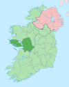
Indreabhán (Irish: Indreabhán, its official name)[1][2] is a Gaeltacht village between Spiddal and Casla in County Galway, Ireland. Indreabhán is more strongly Irish-speaking than Spiddal, partly due to fewer commuters from Galway living there.[citation needed] There are a number of Irish-language summer colleges in the area, most notably Coláiste Lurgan and Coláiste Uí Chadhain. The actual village of Indreabhán is the area between Baile na hAbhann and Na Minna.
Inverin is reached from the city of Galway on the R336 road. It is served by Bus Éireann route 424 from Galway.
There is a Gaelic Athletic Association club, CLG Mhícheál Breathnach, which holds a football tournament every year on St. Stephen's Day.
Aer Arann Islands is headquartered in Indreabhán.[3]
People
See also
References
- ^ Indreabhán. Irish Placenames database. Retrieved: 2011-01-04.
- ^ A. D. Mills, 2003, A Dictionary of British Place-Names, Oxford University Press
- ^ "Contact." Aer Arann Islands. Retrieved on May 15, 2016. "Address: Aer Arann Islands, An Caislean, Inverin, Co. Galway, Ireland."


