Solano County, California
Solano County | |
|---|---|
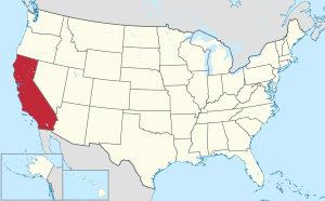
 Location within the U.S. state of California | |
 California's location within the U.S. | |
| Coordinates: 38°16′N 121°56′W / 38.27°N 121.94°W | |
| Country | |
| State | |
| Founded | 1850 |
| Seat | Fairfield |
| Population (2000) | |
| • Total | 394,542 |
| Website | www |
Solano County is a county located in central part of the U.S. state of California, about halfway between San Francisco and Sacramento and is one of the nine San Francisco Bay Area counties. As of 2000 its population was 394,542. The county seat is Fairfield.
History
Solano County was one of the original counties of California, created in 1850 at the time of statehood. Prior to statehood, it had been referred to as Benicia County.[citation needed]
At the request of General Mariano Vallejo, the county derives its name directly from an Indian Chief, Chief Solano of the Suisunes, a Native American tribe of the region and Vallejo's close ally. Chief Solano at one time led the tribes between the Petaluma River and the Sacramento River. The chief was also called Sem-Yeto, which signifies "brave or fierce hand." The Chief was given the Spanish name Francisco Solano during baptism at the Catholic Mission, and is named after the Spanish Franciscan missionary, Father Francisco Solano. "Solano" is a common surname in the north of Spain, specially in Navarra, Zaragoza and La Rioja.
Geography
According to the U.S. Census Bureau, the county has a total area of 2,348 km² (907 mi²). 2,148 km² (829 mi²) of it is land and 201 km² (77 mi²) of it (8.55%) is water.
Cities and towns
Unincorporated communities
- Birds Landing
- Collinsville
- Cordelia - located within the city limits of Fairfield.
- Elmira
- Green Valley
- Bucktown - within or just outside of NW Vacaville.
Adjacent Counties
- Contra Costa County, California - south
- Sonoma County, California - west
- Napa County, California - west
- Yolo County, California - north
- Sacramento County, California - east
Environmental factors
Solano county has a number of rare and endangered species including the wildflower Lasthenia conjugens, commonly known as Contra Costa goldfields and the annual plant Legenere limosa or False Venus' looking glass.
Solano County has several inactive cinnabar mines including the Hastings Mine and St. John's Mine,[1] both of which are subject to ongoing environmental monitoring; these mines were worked in the first half of the twentieth century.
Transportation Infrastructure
Major Highways
- File:Interstate 80 (California).svg Interstate 80
- File:Interstate 505 (California).svg Interstate 505
- File:Interstate 680 (California).svg Interstate 680
- File:Interstate 780 (California).svg Interstate 780
 California State Route 12
 California State Route 37
 California State Route 84
 California State Route 113
Demographics
As of the census² of 2000, there were 394,542 people, 130,403 households, and 97,411 families residing in the county. The population density was 184/km² (476/mi²). There were 134,513 housing units at an average density of 63/km² (162/mi²). The racial makeup of the county was 56.37% White, 14.91% Black or African American, 0.79% Native American, 12.75% Asian, 0.78% Pacific Islander, 8.01% from other races, and 6.39% from two or more races. 17.64% of the population were Hispanic or Latino of any race.
There were 130,403 households out of which 39.90% had children under the age of 18 living with them, 55.70% were married couples living together, 13.80% had a female householder with no husband present, and 25.30% were non-families. 19.60% of all households were made up of individuals and 6.50% had someone living alone who was 65 years of age or older. The average household size was 2.90 and the average family size was 3.33.
In the county the population was spread out with 28.30% under the age of 18, 9.20% from 18 to 24, 31.30% from 25 to 44, 21.70% from 45 to 64, and 9.50% who were 65 years of age or older. The median age was 34 years. For every 100 females there were 101.50 males. For every 100 females age 18 and over, there were 100.20 males.
The median income for a household in the county was $54,099, and the median income for a family was $60,597. Males had a median income of $41,787 versus $31,916 for females. The per capita income for the county was $21,731. About 6.10% of families and 8.30% of the population were below the poverty line, including 10.30% of those under age 18 and 6.30% of those age 65 or over.
Politics
| Year | GOP | Dems |
|---|---|---|
| 2004 | 41.9% 62,301 | 57.2% 85,096 |
| 2000 | 39.2% 51,604 | 57.0% 75,116 |
| 1996 | 34.7% 40,742 | 55.1% 64,644 |
| 1992 | 29.4% 38,883 | 48.7% 64,320 |
| 1988 | 47.4% 50,314 | 51.2% 54,344 |
| 1984 | 54.5% 51,678 | 44.3% 41,982 |
| 1980 | 50.7% 40,919 | 38.4% 30,952 |
| 1976 | 42.4% 26,136 | 54.6% 33,682 |
| 1972 | 54.0% 31,314 | 42.7% 24,766 |
| 1968 | 34.7% 17,683 | 53.5% 27,271 |
| 1964 | 30.4% 15,263 | 69.5% 34,930 |
| 1960 | 40.9% 18,751 | 58.8% 26,977 |
Trivia
In 1985 Humphrey the Humpback whale strayed off his migration route and ended up in Rio Vista at which point rescuers from The Marine Mammal Center and other volunteers were able to turn him around in the narrow river channel.
See also
References
- ^ C.Michael Hogan, Marc Papineau et al., Environmental Assessment of the columbus Parkway Widening between Ascot Parkway and the Northgate Development, Vallejo, Earth Metrics Inc. Report 7853, California State Clearinghouse, Sept, 1989

