Mogente/Moixent: Difference between revisions
Content deleted Content added
Physchim62 (talk | contribs) category |
m Disambiguating links to Costera (link changed to La Costera; link changed to La Costera) using DisamAssist. |
||
| (36 intermediate revisions by 30 users not shown) | |||
| Line 1: | Line 1: | ||
{{unreferenced|date=December 2016}} |
|||
{{Infobox |
{{Infobox settlement |
||
|official_name=Mogente/Moixent |
|||
| name = Moixent/Mogente |
|||
| settlement_type = [[Municipalities of Spain|Municipality]] |
|||
|spanish_name=Mogente |
|||
| official_name = <!-- if different from name --> |
|||
| ⚫ | |||
| native_name = <!-- if different from name --> |
|||
|time_zone=[[Central European Time|CET]] ([[Greenwich Mean Time|GMT]] +1) |
|||
| image_skyline =File:Vista de Moixent.JPG |
|||
|time_zone_summer=[[Central European Summer Time|CEST]] ([[Greenwich Mean Time|GMT]] +2) |
|||
| image_alt = |
|||
|native_language=Valencian |
|||
| image_caption = |
|||
|community=Valencian Community |
|||
| image_flag = Bandera de Moixent.svg |
|||
|community_link=Valencia (autonomous community) |
|||
| image_shield = Escut de Moixent.svg |
|||
|province=Valencia |
|||
| nickname = |
|||
|province_link=Valencia (province) |
|||
| motto = |
|||
|comarca=Costera |
|||
| image_map = |
|||
|comarca_link=Costera |
|||
| map_caption = |
|||
|area=150.23 |
|||
| pushpin_map = Spain Province of Valencia#Spain Valencia#Spain |
|||
|altitude=284 |
|||
| pushpin_label_position = |
|||
|population=4,559 |
|||
| pushpin_map_caption = Location in Spain |
|||
|date-population=2006 |
|||
| subdivision_type = [[List of sovereign states|Country]] |
|||
|density=30.3 |
|||
| subdivision_name = {{ESP}} |
|||
|date-density=2006 |
|||
| subdivision_type1 = [[Autonomous communities of Spain|Autonomous community]] |
|||
| subdivision_name1 = {{flag|Valencian Community}} |
|||
| subdivision_type2 = [[Provinces of Spain|Province]] |
|||
| subdivision_name2 = [[province of Valencia|Valencia]] |
|||
| subdivision_type3 = [[Comarcas of Spain|Comarca]] |
|||
| subdivision_name3 = [[La Costera|Costera]] |
|||
| subdivision_type4 = [[Judicial districts of Spain|Judicial district]] |
|||
| subdivision_name4 = Xàtiva |
|||
| seat_type = <!-- [[Capital (political)|Capital]] --> |
|||
| seat = |
|||
| ⚫ | |||
| coordinates_footnotes = |
|||
| elevation_m = 284 |
|||
| elevation_min_m = |
|||
| elevation_max_m = |
|||
| area_footnotes = |
|||
| area_total_km2 = 150.23 |
|||
| established_title = <!-- Founded --> |
|||
| established_date = |
|||
| population_footnotes = <!-- for references: use <ref> tags --> |
|||
| population_total = 4724 |
|||
| population_as_of = 2008 |
|||
| population_demonym = ''mogentino/a''<br>''moixentí/ína'' |
|||
| population_note = |
|||
| population_density_km2 = auto |
|||
| blank_name_sec1 = [[Languages of Spain|Official language(s)]] |
|||
| blank_info_sec1 = [[Valencian language|Valencian]] |
|||
| timezone = [[Central European Time|CET]] |
|||
| utc_offset = +1 |
|||
| timezone_DST = [[Central European Summer Time|CEST]] |
|||
| utc_offset_DST = +2 |
|||
| postal_code_type = [[List of postal codes in Spain|Postal code]] |
|||
| postal_code = 46640 |
|||
| area_code_type = [[Telephone numbers in Spain|Dialing code]] |
|||
| area_code = |
|||
| leader_title = [[Alcalde]] |
|||
| leader_name = Teófilo Fito (2015) |
|||
| leader_party = [[Citizens|C's]] |
|||
| website = {{official website|http://www.moixent.es}} |
|||
| footnotes = |
|||
}} |
}} |
||
'''Mogente |
'''Mogente''' ({{IPA-es|moˈxente|lang}}) or '''Moixent''' ({{IPA-va|mojˈʃent|lang}}) is a [[Municipalities of Spain|municipality]] in the [[Comarques of the Valencian community|''comarca'']] of [[La Costera|Costera]] in the [[Valencian Community]], Spain. |
||
The municipal area contains the ruins of [[la Bastida de les Alcusses]], one of the most important Iberian archaeological sites in the Valencian Community. |
|||
| ⚫ | |||
==References== |
|||
{{reflist}} |
|||
{{Costera}} |
{{Costera}} |
||
| ⚫ | |||
{{authority control}} |
|||
| ⚫ | |||
| ⚫ | |||
{{DEFAULTSORT:Mogente Moixent}} |
|||
[[Category:Municipalities in the Province of Valencia]] |
|||
| ⚫ | |||
| ⚫ | |||
Latest revision as of 07:06, 8 February 2023
Moixent/Mogente | |
|---|---|
 | |
| Coordinates: 38°52′32″N 0°45′11″W / 38.87556°N 0.75306°W | |
| Country | |
| Autonomous community | |
| Province | Valencia |
| Comarca | Costera |
| Judicial district | Xàtiva |
| Government | |
| • Alcalde | Teófilo Fito (2015) (C's) |
| Area | |
| • Total | 150.23 km2 (58.00 sq mi) |
| Elevation | 284 m (932 ft) |
| Population (2008) | |
| • Total | 4,724 |
| • Density | 31/km2 (81/sq mi) |
| Demonym(s) | mogentino/a moixentí/ína |
| Time zone | UTC+1 (CET) |
| • Summer (DST) | UTC+2 (CEST) |
| Postal code | 46640 |
| Official language(s) | Valencian |
| Website | Official website |
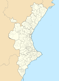
Mogente (Spanish: [moˈxente]) or Moixent (Valencian: [mojˈʃent]) is a municipality in the comarca of Costera in the Valencian Community, Spain.
The municipal area contains the ruins of la Bastida de les Alcusses, one of the most important Iberian archaeological sites in the Valencian Community.


