Ädelfors
| Ädelfors | ||||
|
||||
| State : | Sweden | |||
| Province (län): | Jönköpings län | |||
| Historical Province (landskap): | Småland | |||
| Municipality : | Vetlanda | |||
| Coordinates : | 57 ° 25 ′ N , 15 ° 19 ′ E | |||
| Residents : | 54 (December 31, 2000) | |||
| Area : | 0.12 km² | |||
| Population density : | 450 inhabitants / km² | |||
| Height : | 135 m above sea level | |||
| Telephone code : | + 46-383 | |||
| Postal code : | 57015 | |||
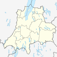
Ädelfors is an industrial settlement in the middle of Småland . Today it consists of only a few houses and almost 50 inhabitants, but in the past it was an important place for gold mining in Sweden, so not only were Sweden's first gold mine there, but also stamping works and smelting works.
Ädelfors consists of a cluster of houses, all of which are located near the Emån river and a reservoir. The older houses are on the north bank of the river near the former works. Until 2005, Ädelfors was classified as Småort in the municipality of Vetlanda .
geology
Ädelfors is located in a special zone within the TIB (Trans-Scandinavian Magmatite Belt) called Oskarshamn-Jönköping Belt (OJB), which extends from Jönköping in the west to Oskarshamn in the east. It is also discussed that this belt extends even further to the east and forms the base of Gotland. According to Lahtinen (2010) this belt should even extend as far as western Lithuania , which would result in an extension of approx. 500 km. This is supported by similar lithologies (metasediments), which were metamorphically overprinted at a similar point in time (1.83 Ga). What is certain, however, is that the currently known OJB has a length of approx. 150 km. Whatever the extent to which it extends to the east, the remaining borders can be defined quite clearly.
However, the contact between OJB and TIB cannot be ascertained in the field, since between them it is either covered by the granites and volcanic rocks of the TIB or separated by shear zones. The latter run mainly NW-SE. The OJB stands out from the surrounding granites and porphyries due to the composition of metasedimentites and metavolcanites. These consist mainly of meta-arkoses and meta-conglomerates; tonalitic magmatites also occur to a lesser extent.
The rocks belong to the so-called Vetlanda super group. Mafites with a MORB character can be found on the southwestern edge. This could indicate either a back-arc or magmatism in a fore-arc basin. Measurements of the crustal depth, which increases from 45 km to 55 km in the vicinity of the OJB, also indicate this different belt. Nironen (1997) proposes a tectonic model in which the OJB migrated to what is now the north in tow of a terran in central Sweden by subduction. According to this model, a subduction zone formed in front of 1.88 Ga, where the northern part was subducted under the southern part. This zone formed an arc, which continues from the north of Stockholm eastwards to Malmö, where it continues southwards.
The subduction zone became smaller by up to 1.85 Ga and there may have been shear movements in the south. At the same time, there were extension movements in the north of the subduction zone, as well as the formation of another subduction zone in the west of this. Furthermore, the terran was deformed into a stronger arch. Today this forms the regions Bergslagen and Sörmland, in which a lot of mining was also carried out.
In the tectonic model of Nironen, the OJB appears for the first time at 1.82 Ga. Nironen also describes the OJB as an area with island arc magmatism above the subduction zone that descends to the southeast.
According to Andersson et al. (2004) this belt was created by the collision of island arcs and the subduction of oceanic crust between the arcs. This happened between 1.84 and 1.82 Ga, with the accretion occurring from the continental margin towards the ocean.
At this point in time the Svekofennische orogenesis was largely complete, shortly afterwards island arc volcanism took place in the OJB. In addition, the TIB0 magmatites intruded at this time, as well as magmatites caused by continental marginal magmatism. This belt was deformed before the TIB's magmatites intruded 1.81-1.77 Ga. Following the OJB magmatism, the magmatism took place in TIB1, which together with TIB2 and TIB3 partially covers the OJB. The exact boundary between the OJB and the TIB was destroyed by several ductile shear zones, which both units traverse in the direction of WNW-ESE.
After the formation of the OJB and the TIB, doleritic dykes intruded. Some of these are more than 15 km long. Sometimes it was claimed in older literature that the OJB was not formed until the Gothic orogeny. However, this is an outdated opinion. On the basis of unspecified radiometric measurements it could be determined that the rocks of the OJB correlate with the Svekofennic rocks.
As already mentioned, the OJB consists mainly of metasediments and acidic metavolcanites. In the west the metasediments dominate, while from 15 ° 10 'latitude towards the east the metavolcanites increase strongly and are located as elongated lenses within the metasediments.
Around Ädelfors there are mainly dark metavolcanites in which metasedimentites such as B. node and mica slate can be found. The unmetamorphic magmatites found in the outermost SE are striking in the area. There the river Emån makes a bend, whereby the bank rises very steeply, in places with a 68% gradient.
The area has been severely folded. The trace of the fold axis plane runs roughly WSW-ENE, whereby it bends partially to NE in the eastern half of the working area. Five synclines and four anticlines could be found and this over 1.5 km.
Individual evidence
- ↑ Småorternas land area, folkmängd och invånare
- ↑ Sundblad, Krister, et al., 1998, The precambrian crust beneath the Baltic Sea, Geophysical Journal, Vol. 20, pp. 121-124
- ↑ a b Korja, Annakaisa, Pekka Heikkinen, 2005, The accretionary Svecofennian orogen-insight from the BABEL profiles, Precambrian Research, Vol. 136, pages 241-268
- ↑ a b Makowsky, Felix, 2013, Tryck- och temperaturbestämning av metamorfosen hos metasediment i Vetlandagruppen, Småland, Department of Geological Sciences, Stockholm University
- ↑ Nironen, Mikko, 1997, The Svecofennian Orogen: a tectonic model, Precambrian Research, Vol 86, pages 21-44.
- ↑ a b Andersson, Ulf, et al., 2004, THE TRANSSCANDINAVIAN IGNEOUS BELT, EVOLUTIONARY MODELS, Geological Survey of Finland, Special Paper 37
- ↑ Lahtinen, R, M Nironen, 2010, Paleoproterozoic lateric paleosol-ultra-mature / mature quarzite-meta-arkose succsessions in southern Fennoscandia-intra-orogenig stage during he Svecofennian orogeny, Precambrian Research, Vol. 183, pages 770-790
- ↑ Mansfeld Joakim, et al., 2005, 1.83-1.82 Ga formation of a juvenile volcanic arc — implications from U — Pb and Sm — Nd analyzes of the Oskarshamn-Jönköping Belt, southeastern Sweden, GFF, Volume 127, Issue 2, p 149-157
- ^ Mansfeld, Joakim, 1996, Geological, geochemical and geochronological evidence for a new Palaeoproterozoic terrane in southeastern Sweden, Precambrian Research, Vol. 77
- ^ A b c Jonas Börje Lundin: Investigation of bismuth-bound gold mineralization near Vetlanda, southern Sweden . 2015, doi : 10.13140 / RG.2.1.4330.2483 ( researchgate.net [PDF; 9.6 MB ; accessed on September 14, 2017]).


