Ķekava
| Ķekava ( German : Kekau) | ||
|---|---|---|
 Help on coat of arms |
|
|
| Basic data | ||
| State : |
|
|
| Landscape: | Semgallia ( Latvian : Zemgale ) | |
| Administrative district : | Ķekavas novads | |
| Coordinates : | 56 ° 50 ' N , 24 ° 13' E | |
| Residents : | 5,747 (Jun 3, 2015) | |
| Area : | ||
| Population density : | ||
| Height : | 9 m | |
| Website: | www.kekava.lv | |
| Post Code: | ||
| ISO code: | ||
| Keckau Church | ||
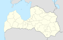
Ķekava ( German Keckau ) is a place in the Latvian region of Zemgale 17 km south of the capital Riga . The place is to the left of the Daugava in the immediate vicinity of the Riga reservoir.
history
The watermills of a Keckau estate were first mentioned in writing in 1435. After the partition of Livonia in 1561, the estate was part of the Duchy of Courland and from 1793 of the Russian Governorate of Courland . The Lutheran Church, which today forms the center of the village, also dates from this time.
The growth of the place began when the local kolkhoz was founded in 1969. Regardless of the large number of inhabitants (compared to most other cities), Ķekava was not granted city rights.
Bordesholm (Germany) has a community partnership with Ķekava.
Ķekavas novads
After an administrative reform, the place forms an administrative community together with the town of Baloži and two rural communities. The district (Ķekavas novads) covers an area of 270.2 km² and is home to 21,673 inhabitants (as of July 1, 2010).
There are in the area some agricultural large farms, as well as a well-known throughout Latvia brand for poultry and poultry products.
The Via Baltica (European route 67) runs through the territory from Riga to Bauska .
literature
- Hans Feldmann , Heinz von zur Mühlen (Hrsg.): Baltic historical local dictionary, part 2: Latvia (southern Livland and Courland). Böhlau, Cologne 1990, ISBN 3-412-06889-6 , pp. 277-278.
- Astrīda Iltnere (ed.): Latvijas Pagasti, Enciklopēdija. Preses Nams, Riga 2002, ISBN 9984-00-436-8 .

