Žagubica
|
Жагубица Zagubica |
|||
|
|||
| Basic data | |||
|---|---|---|---|
| State : | Serbia | ||
| Okrug : | Braničevo | ||
| Opština : | Opština Žagubica | ||
| Coordinates : | 44 ° 11 ' N , 21 ° 47' E | ||
| Height : | 499 m. i. J. | ||
| Area : | 760 km² | ||
| Residents : | 12,737 (2011) | ||
| Population density : | 17 inhabitants per km² | ||
| Telephone code : | (+381) 012 | ||
| Postal code : | 12320 | ||
| License plate : | PO | ||
| Structure and administration | |||
| Community type: | settlement | ||
| Website : | |||
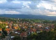
Žagubica ( Serbian - Cyrillic Жагубица , Romanian Jăgobiţa or Iaguba ) is a village and municipality in the Braničevo district in Serbia .
geography
Žagubica lies between Kučevo and Majdanpek in the north, Bor in the east, Despotovac in the south and Petrovac in the west. The village had 2,823 inhabitants in 2002, the municipality 14,823. It is a total of 760 km².
The karst spring from which the Mlava rises is located near Žagubica .
local community
The municipality of Zagubica includes the place of the same name and the following other places:
The area of the village in km², the population and the population density are in brackets
- Bliznak (20.41 km², 412, 20)
- Bresnica (22.37 km², 244, 11)
- Izvarica (18.93 km², 396, 21)
- Jošanica (36.10 km², 708, 20)
- Krepoljin (47.80 km², 1,958, 41)
- Krupaja (25.52 km², 766, 30)
- Laznica (74.81 km², 2,440, 33)
- Medvedjica (4.76 km², 46, 10)
- Milanovac (Magudica) (16.74 km², 595, 36)
- Milatovac (22 km², 913, 41)
- Osanica (66.52 km², 1,281, 19)
- Ribare (19.08 km², 542, 28)
- Selište (61.00 km², 567, 9)
- Sige (19.84 km², 935, 47)
- Suvi Do (91.33 km², 1,365, 15)
- Vukovac (22.95 km², 519, 23)
- Žagubica (189.84 km², 2,440, 33)
Population groups
The largest ethnic groups in the Žagubica municipality are (2002):
- Serbs = 10,985
- Wallachians = 3,268
Web links
- Homepage of the Žagubica municipality


