Abitibi lake
|
Lake Abitibi Lac Abitibi |
||
|---|---|---|

|
||
| Geographical location | Ontario , Quebec ( Canada ) | |
| Tributaries | Ghost River , Rivière La Sarre , Rivière Duparquet , Low Bush River , Aylen River | |
| Drain | Abitibi River → Moose River | |
| Islands | over 900 | |
| Location close to the shore | La Sarre | |
| Data | ||
| Coordinates | 48 ° 40 ′ N , 79 ° 45 ′ W | |
|
|
||
| Altitude above sea level | 265 m | |
| surface | 931 km² | |
| length | 90 km | |
| width | 22 km | |
| Maximum depth | 15 m | |
| Middle deep | 3.5 m | |

|
||
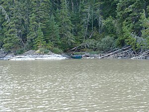
The Abitibisee ( English Lake Abitibi ; French Lac Abitibi ) is a lake on the border between the Canadian provinces of Ontario and Québec .
There are over 900 islands in the lake. It covers an area of 931 km² and consists of two parts that are only connected by a narrow area (see map), so that one could actually speak of two lakes. The only outflow is the Abitibi River . This flows over the Moose River into James Bay . Geographically, the lake lies between James Bay and the Ottawa River . On the south shore of the lake is Abitibi 70 , a reserve of wahgoshig first nation to which 280 members are expected.
history
Excavations on the lake that have been carried out since the 1950s extend into the epoch from 4000 BC. BC back. The so-called Shield Archaic People , i.e. people who are assigned to the archaic Indians of the Canadian shield , lived since about 6000 BC. In the region. At the lake they are first tangible in the Abitibi Narrows phase , after the glacier melted there around 6000 years ago. The area was warmer than it is today and therefore dense forests settled there. This warm period lasted until around 1000 BC. Chr.
In particular, artefacts from the Ontario Iroquois tradition were found at six sites around the lake. The oldest site is the Jordan Site , but it fell victim to the rising water level. Nevertheless, in 1985, in a year with particularly low water levels, numerous hand axes, scratches and other artifacts were recovered. The oldest pottery shards can be dated between 500 and 900, which belonged to a culture that processed the material into vessels. A distinction is made between Blackduck , Selkirk and Ontario Iroquois . They are believed to be the ancestors of today's Ojibway , Cree, and northern Algonquin. The inhabitants of the period around 1400 to 1500 were believed to be related to the Temiskaming Algonquin. In any case, the expansion of the Iroquois to the north caused them to flee, so that their cultural continuity on Lake Abitibi was broken.
With the conclusion of contract no. 9, one of the so-called numbered contracts in 1908, the Apitipiwinnik , who had hunted and collected in the border area between Ontario and Québec, were supposed to move to a reservation on Lake Abitibi, but only some of them did. The Abitibi, who lived in an area of around 230 by 260 km until 1939, were pushed into reservations. In 1958 the current Pikogan reserve was created.
The lake was first mentioned in a Jesuit report in 1640 and first appeared on a map in 1685. In the 1650s and 1660s the area was almost depopulated due to the Iroquois pressure, the name of the nearby town of Iroquois Falls recalls the presence of the Iroquois. The Abitibi were first mentioned in a Jesuit relation in the 1650s .
At the end of the 17th century, the lake was the focus of disputes between the British Hudson's Bay Company and French fur trading companies. The first surviving fur trader was Charles Joseph d'Ailleboust, who reached the lake in 1683. The Compagnie du Nord , privileged by the French king , planned to set up two trading centers in the area of Lake Abitibi. On June 2, 1686, Pierre, Chevalier Detroyes (or De Troyes) came to the lake with his 100 men. His people built a fort, an expedition headed west and five days later reached what is now the Abitibi-DeTroyes Provincial Park . On the way there, a second post was built at the narrow point between the two halves of the lake. In 1686 the English were briefly driven from James Bay when Detroyes captured the forts of Moose, Rupert and Albany. But the French returned to Montréal in autumn . The trading posts continued to exist for ten years, but were abandoned in 1696. The routes to the French trading posts were now too long for the Indians, so they moved back to the English posts in the Hudson Bay area to sell their skins and furs there.
In 1720 Paul Guillet moved to the lake to find allies against the British. He also set up a new trading post on the lake, which was so successful that Montréal traders complained that it was taking away their profits. His license was briefly revoked, but his strategic importance in the fight against the British was too great. The British were forced to reopen the post in Moose Fort in 1730 and offer better conditions. But not only British-French conflicts and the wars in Europe often cut off the posts from world trade, but also local conflicts between Cree, Inuit and Europeans. Around the forts there were regularly trading and encamping groups from which the later tribes emerged, such as the York Factory First Nation .
French colonial rule collapsed around 1760, and finally in 1763. From 1760 to 1786 free fur traders dominated the trade with the Indians of the region accordingly. They also supplied arms, much like the big trading companies, using any means to increase profits. When Long John offered rifles in 1778, his trading partners carefully examined the weapons to assess their value. The dealers then ordered counterfeit British weapons in New England and Belgium , which themselves plagiarized the trademarks. From 1787, the North West Company took over the area from Fort Temiskaming , but other traders continued their stations; the Hudson's Bay Company also created a post in 1793. The first missionaries appeared in 1837, and around 1881 Father Nedelec lived in a house by the lake.
The Hudson's Bay Company built a fort on the Abitibi River in 1867 , which was called Newpost. In 1905, when Fort Temiskaming was closed, a new fort was built at Abitibi Narrows. It was maintained until 1922. Competition arose from the Revillion Frères, based in Paris , with trading posts in Moosonee on the Albany River . They also had a camp right on the lake. A free trader also had a warehouse at the mouth of the Ghost River .
However, a series of gold discoveries west of the lake had a much stronger impact than this trade competition. English, French, Ukrainian and Italian replaced the Indian languages that were predominant until around 1905. But in contrast to the Klondike gold rush , the Canadian state kept public order firmly in hand and deployed police troops at an early stage. Land was given to veterans of the Boer Wars and Irish Fenians from 1904 . Camps arose; the Black River, over which the Abitibi River was reached, was used by steam and motor boats, forests were cut down. The railroad brought more and more prospectors, settlers and workers to the region, and after a few years the Indians had to move to a reservation. Sawmills and, from 1912, pulp mills in Iroquois Falls west of the lake offered 250 jobs, but the river that flowed into the lake was heavily polluted with sewage. The original inhabitants were less and less able to pursue their traditional way of life. In addition, the railway no longer brought the furs from the region to Hudson Bay , but from La Sarre on Lake Abitibi to Montréal.
In order to gain more precise knowledge of the extent to which boreal forests influence the global carbon dioxide balance on earth, the Lake Abitibi Model Forest was delineated, which has been investigated since then.
literature
- Kerry Margaret Abel: Changing Places. History, Community, and Identity in Northeastern Ontario , McGill-Queen's University Press 2006.
- François Guindon: Iroquoian Pottery at Lake Abitibi: A Case Study of the Relationship Between Hurons and Algonkians on the Canadian Shield , in: Canadian Journal of Archeology / Journal Canadien d'Archéologie , Volume 33.1 (2009) 65-91.
- Frank Ridley: Archeology of Lake Abitibi , 1966.
Web links
Individual evidence
- ^ Natural Resources Canada
- ↑ Handbook of North American Indians , Vol. 4: History of Indian-White relations , Washington 1988, pp. 400f.
- ↑ Lorene DiCorpo (Ed.): Worth traveling miles to see: diary of a survey trip to Lake Temiskaming, 1886. Alexander Herkes Telfer , Toronto 2004, p. 127.
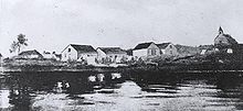
- ↑ A picture can be found here: Lake Abitibi Post ( Memento from July 6, 2011 in the Internet Archive ).
- ↑ Xiaolu Zhou, Changhui Peng, Qing-Lai Dang, Jiaxin Chen and Sue Parton: A Simulation of Temporal and Spatial Variations in Carbon at Landscape Level: A Case Study for Lake Abitibi Model Forest in Ontario, Canada , in: Mitigation and Adaptation Strategies for Global Change 12.4 (2007) 525-543.

